
4 Bus Route Map
View the 4 route map and see all 4 stops along the route. The map of 4 shows where the bus travels and the location of each stop, making it easy to understand the entire route at a glance.
Explore Asp Asti routes on the map and see where Asp Asti bus services operate. Use the 4 map to find bus stops and see how the 4 connects different areas along its trip.
All 4 stops on the map are displayed in route order, helping you follow the 4 bus from the first stop to the last.
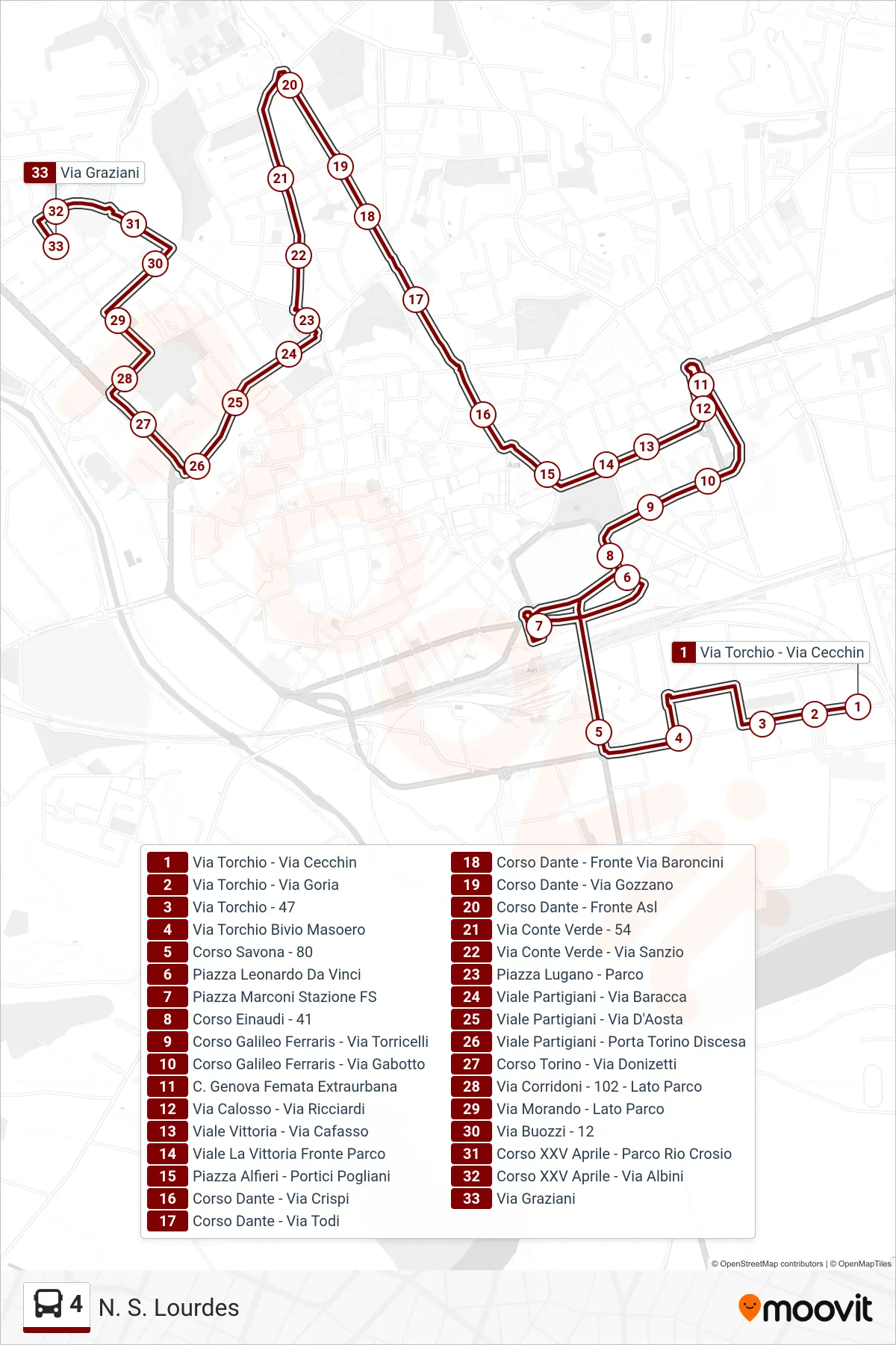
Stops list (4 - Our Lady of Lourdes)
- Via Torchio - Via Cecchin
- Torchio Street - Goria Street
- Via Torchio - 47
- Via Torchio Masoero Junction
- Savona Avenue - 80
- Leonardo Da Vinci Square
- Marconi Square FS Station
- Einaudi Avenue - 41
- Galileo Ferraris Course - Torricelli Street
- Corso Galileo Ferraris - Via Gabotto
- Genova Station - Regional Stop
- Via Calosso - Via Ricciardi
- Victory Avenue - Cafasso Street
- Viale La Vittoria Opposite Park
- Alfieri Square - Pogliani Arcade
- Dante Avenue - Crispi Street
- Dante Avenue - Todi Street
- Dante Avenue - Opposite Baroncini Street
- Dante Avenue - Via Gozzano
- Corso Dante - Across from Health Center
- Verde Count Street - 54
- Via Conte Verde - Via Sanzio
- Lugano Square - Park
- Partisans Avenue - Baracca Street
- Partigiani Avenue - D'Aosta Street
- Partigiani Avenue - Porta Torino Descent
- Corso Torino - Via Donizetti
- Corridoni Street - 102 - Park Side
- Morando Street - Park Side
- Via Buozzi - 12
- XXV April Avenue - Rio Crosio Park
- Corso XXV April - Via Albini
- Graziani Street