
4 Bus Route Map
View the 4 route map and see all 4 stops along the route. The map of 4 shows where the bus travels and the location of each stop, making it easy to understand the entire route at a glance.
Explore Danville Transit routes on the map and see where Danville Transit bus services operate. Use the 4 map to find bus stops and see how the 4 connects different areas along its trip.
All 4 stops on the map are displayed in route order, helping you follow the 4 bus from the first stop to the last.
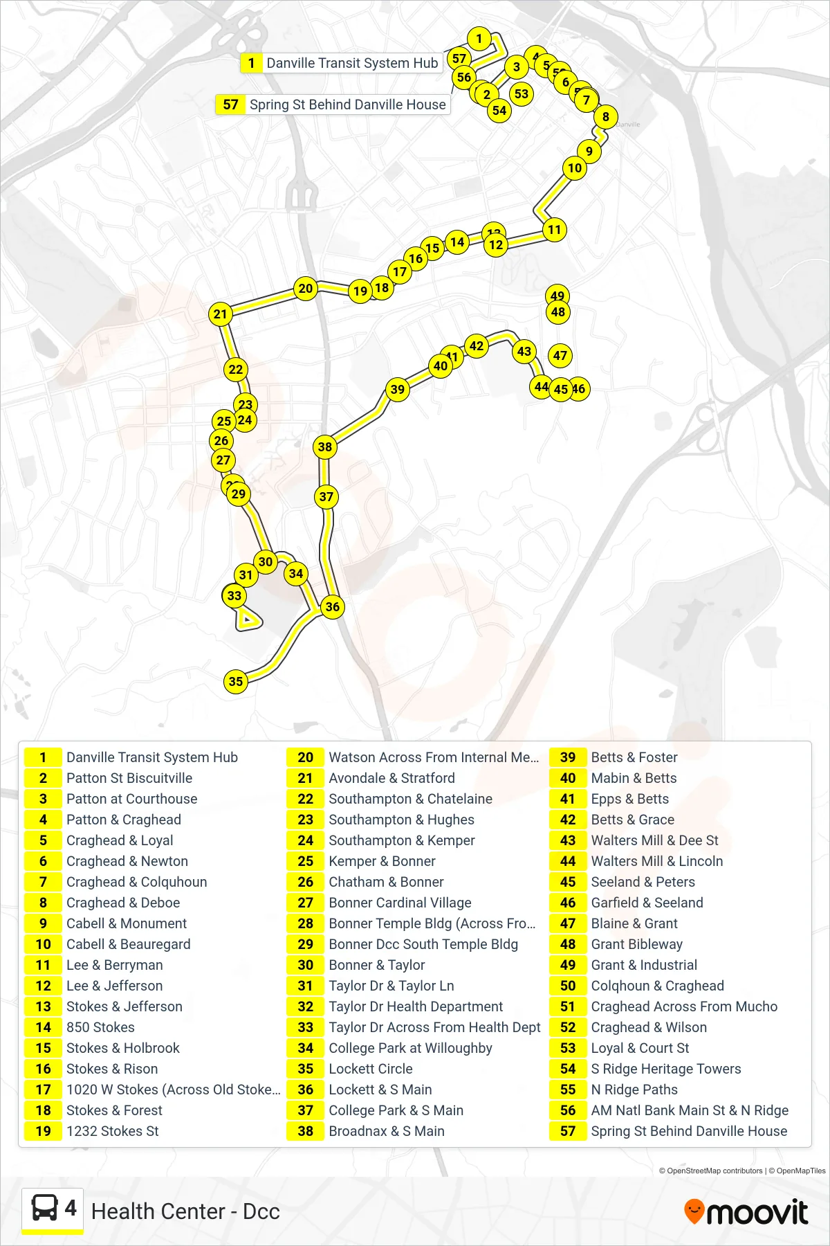
Stops list (4 - Health Center - Dcc)
- Danville Transit System Hub
- Patton St Biscuitville
- Patton at Courthouse
- Patton & Craghead
- Craghead & Loyal
- Craghead & Newton
- Craghead & Colquhoun
- Craghead & Deboe
- Cabell & Monument
- Cabell & Beauregard
- Lee & Berryman
- Lee & Jefferson
- Stokes & Jefferson
- 850 Stokes
- Stokes & Holbrook
- Stokes & Rison
- 1020 W Stokes (Across Old Stokes Conv Mkt)
- Stokes & Forest
- 1232 Stokes St
- Watson Across From Internal Medicine
- Avondale & Stratford
- Southampton & Chatelaine
- Southampton & Hughes
- Southampton & Kemper
- Kemper & Bonner
- Chatham & Bonner
- Bonner Cardinal Village
- Bonner Temple Bldg (Across From Shelter)
- Bonner Dcc South Temple Bldg
- Bonner & Taylor
- Taylor Dr & Taylor Ln
- Taylor Dr Health Department
- Taylor Dr Across From Health Dept
- College Park at Willoughby
- Lockett Circle
- Lockett & S Main
- College Park & S Main
- Broadnax & S Main
- Betts & Foster
- Mabin & Betts
- Epps & Betts
- Betts & Grace
- Walters Mill & Dee St
- Walters Mill & Lincoln
- Seeland & Peters
- Garfield & Seeland
- Blaine & Grant
- Grant Bibleway
- Grant & Industrial
- Colqhoun & Craghead
- Craghead Across From Mucho
- Craghead & Wilson
- Loyal & Court St
- S Ridge Heritage Towers
- N Ridge Paths
- AM Natl Bank Main St & N Ridge
- Spring St Behind Danville House