
4 Bus Route Map
View the 4 route map and see all 4 stops along the route. The map of 4 shows where the bus travels and the location of each stop, making it easy to understand the entire route at a glance.
Explore Salzburg AG (OBus) routes on the map and see where Salzburg AG (OBus) bus services operate. Use the 4 map to find bus stops and see how the 4 connects different areas along its trip.
All 4 stops on the map are displayed in route order, helping you follow the 4 bus from the first stop to the last.
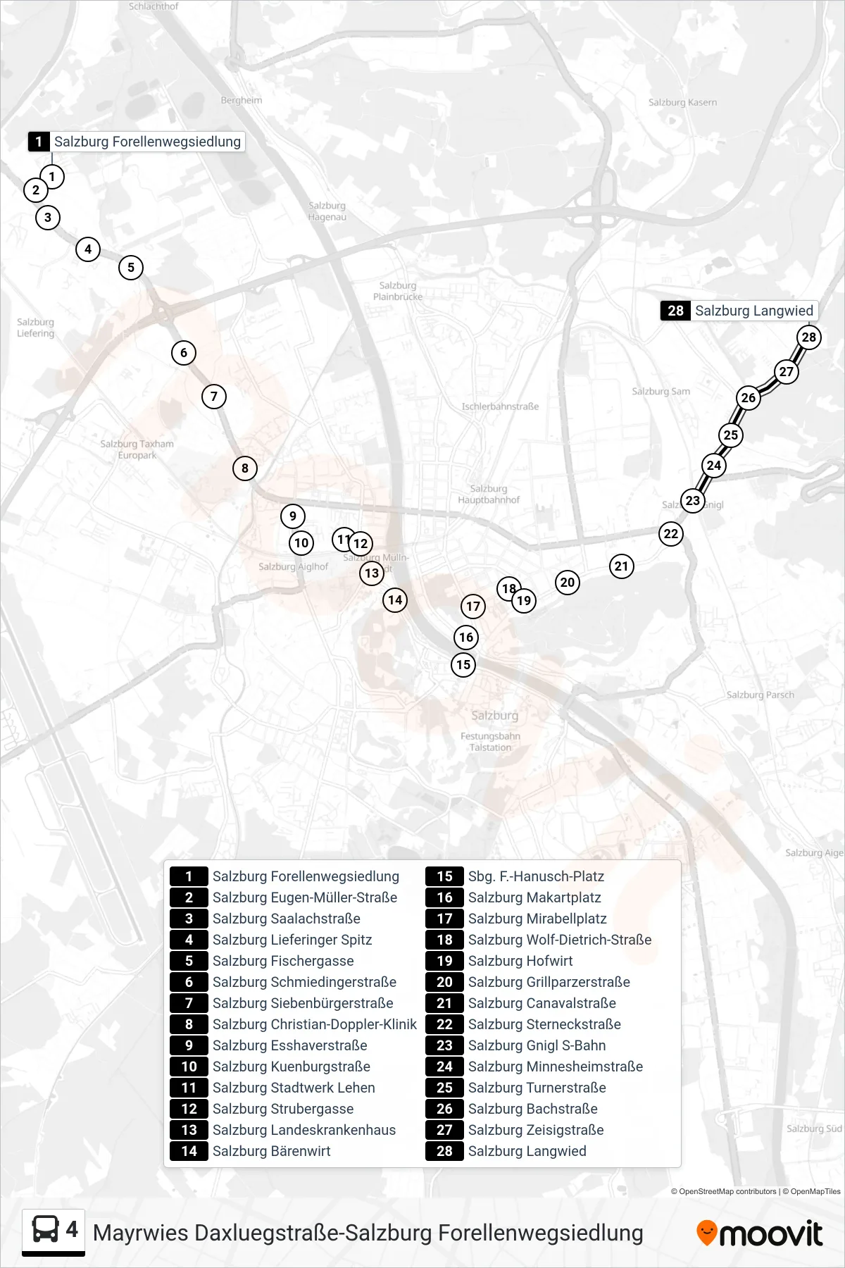
Stops list (4 - Langwied)
- Salzburg Forellenwegsiedlung
- Salzburg Eugen-Müller-Straße
- Salzburg Saalachstraße
- Salzburg Lieferinger Spitz
- Salzburg Fischergasse
- Salzburg Schmiedingerstraße
- Salzburg Siebenbürgerstraße
- Salzburg Christian-Doppler-Klinik
- Salzburg Esshaverstraße
- Salzburg Kuenburgstraße
- Salzburg Stadtwerk Lehen
- Salzburg Strubergasse
- Salzburg Landeskrankenhaus
- Salzburg Bärenwirt
- Sbg. F.-Hanusch-Platz
- Salzburg Makartplatz
- Salzburg Mirabellplatz
- Salzburg Wolf-Dietrich-Straße
- Salzburg Hofwirt
- Salzburg Grillparzerstraße
- Salzburg Canavalstraße
- Salzburg Sterneckstraße
- Salzburg Gnigl S-Bahn
- Salzburg Minnesheimstraße
- Salzburg Turnerstraße
- Salzburg Bachstraße
- Salzburg Zeisigstraße
- Salzburg Langwied