
40 Bus Route Map
View the 40 route map and see all 40 stops along the route. The map of 40 shows where the bus travels and the location of each stop, making it easy to understand the entire route at a glance.
Explore Rhode Island Public Transit Authority routes on the map and see where Rhode Island Public Transit Authority bus services operate. Use the 40 map to find bus stops and see how the 40 connects different areas along its trip.
All 40 stops on the map are displayed in route order, helping you follow the 40 bus from the first stop to the last.
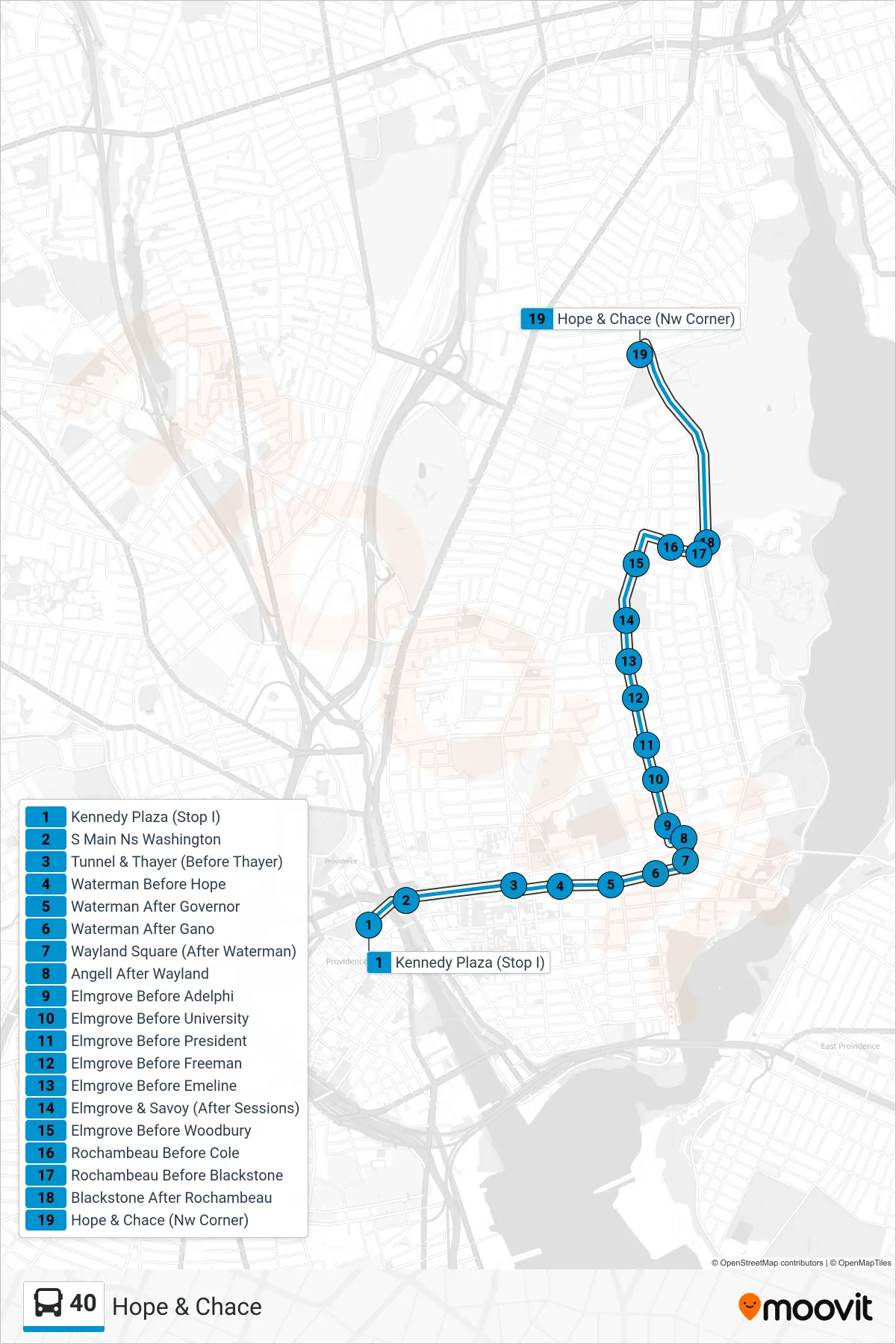
Stops list (40 - Hope & Chace)
- Kennedy Plaza (Stop I)
- S Main Ns Washington
- Tunnel & Thayer (Before Thayer)
- Waterman Before Hope
- Waterman After Governor
- Waterman After Gano
- Wayland Square (After Waterman)
- Angell After Wayland
- Elmgrove Before Adelphi
- Elmgrove Before University
- Elmgrove Before President
- Elmgrove Before Freeman
- Elmgrove Before Emeline
- Elmgrove & Savoy (After Sessions)
- Elmgrove Before Woodbury
- Rochambeau Before Cole
- Rochambeau Before Blackstone
- Blackstone After Rochambeau
- Hope & Chace (Nw Corner)