
40 Bus Route Map
View the 40 route map and see all 40 stops along the route. The map of 40 shows where the bus travels and the location of each stop, making it easy to understand the entire route at a glance.
Explore Portage Area Regional Transit Authority (PARTA) routes on the map and see where Portage Area Regional Transit Authority (PARTA) bus services operate. Use the 40 map to find bus stops and see how the 40 connects different areas along its trip.
All 40 stops on the map are displayed in route order, helping you follow the 40 bus from the first stop to the last.
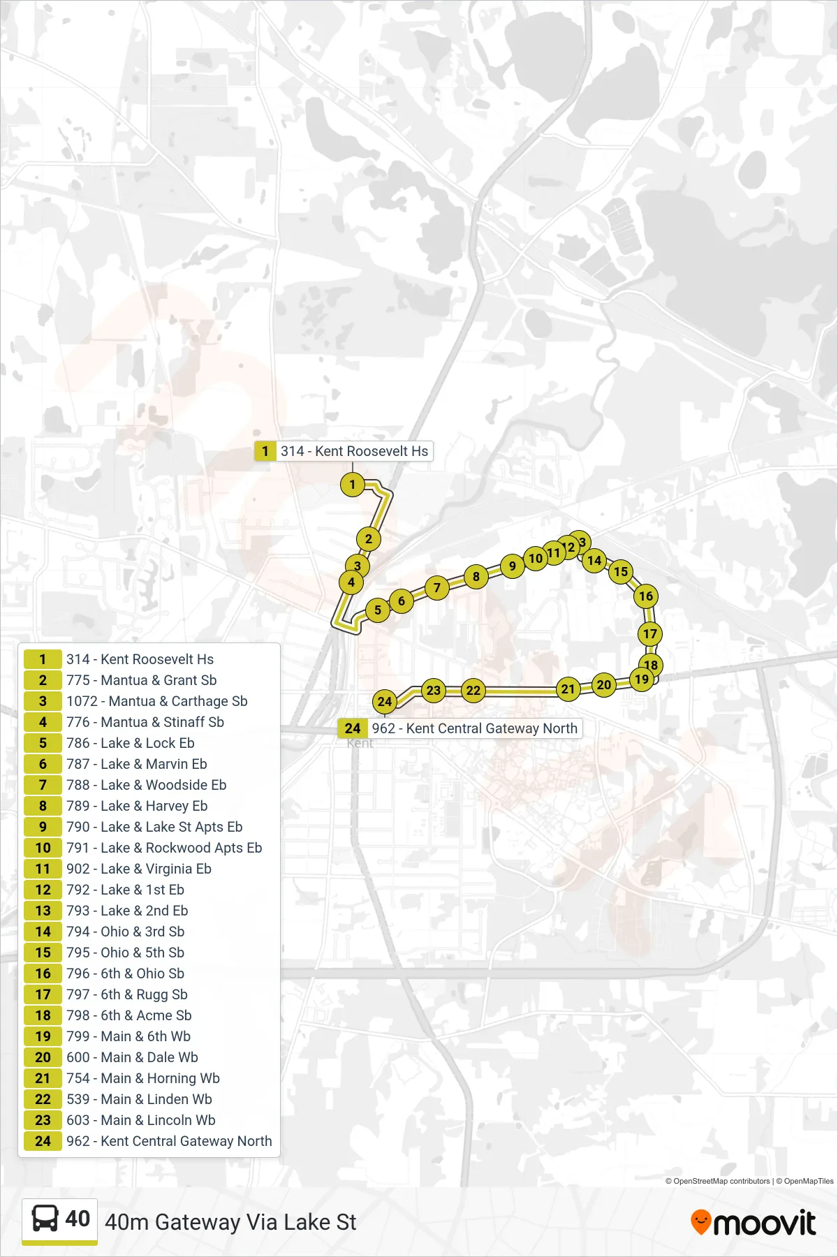
Stops list (40 - 40m Gateway Via Lake St)
- 314 - Kent Roosevelt Hs
- 775 - Mantua & Grant Sb
- 1072 - Mantua & Carthage Sb
- 776 - Mantua & Stinaff Sb
- 786 - Lake & Lock Eb
- 787 - Lake & Marvin Eb
- 788 - Lake & Woodside Eb
- 789 - Lake & Harvey Eb
- 790 - Lake & Lake St Apts Eb
- 791 - Lake & Rockwood Apts Eb
- 902 - Lake & Virginia Eb
- 792 - Lake & 1st Eb
- 793 - Lake & 2nd Eb
- 794 - Ohio & 3rd Sb
- 795 - Ohio & 5th Sb
- 796 - 6th & Ohio Sb
- 797 - 6th & Rugg Sb
- 798 - 6th & Acme Sb
- 799 - Main & 6th Wb
- 600 - Main & Dale Wb
- 754 - Main & Horning Wb
- 539 - Main & Linden Wb
- 603 - Main & Lincoln Wb
- 962 - Kent Central Gateway North