
40 Cable Car Route Map
View the 40 route map and see all 40 stops along the route. The map of 40 shows where the cable car travels and the location of each stop, making it easy to understand the entire route at a glance.
Explore KP Kyivpastrans routes on the map and see where KP Kyivpastrans cable car services operate. Use the 40 map to find cable car stations and see how the 40 connects different areas along its trip.
All 40 stops on the map are displayed in route order, helping you follow the 40 cable car from the first station to the last.
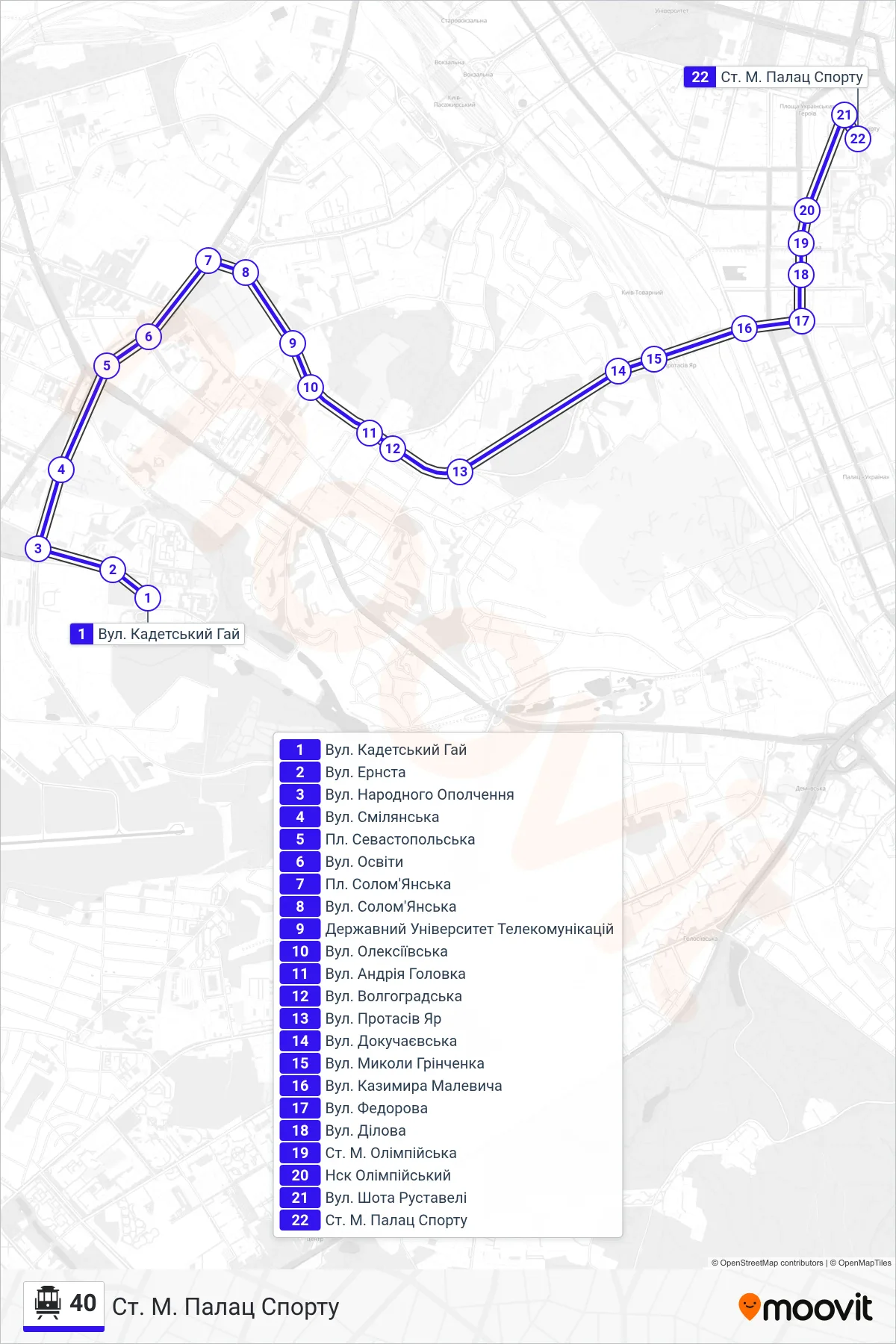
Stops list (40 - Palace of Sports Metro Station)
- Kadetskyi Hai Street
- Ernst Street
- Narodnoho Opolchennia Street
- Smilianska St
- Sevastopolska Square
- Osvity Street
- Solomyanska Square
- Solomyanska Street
- State University of Telecommunications
- Oleksiivska Street
- Andriia Holovka St
- Volhohradska Street
- Protasiv Yar Street
- Dokuchaievska St
- Mykola Hrinchenko Street
- Kazimir Malevich Street
- Fedorova St
- Dilova Street
- Olimpiiska Metro Station
- NSC Olympic
- Shota Rustaveli Street
- Palace of Sports Metro Station