
40 Bus Route Map
View the 40 route map and see all 40 stops along the route. The map of 40 shows where the bus travels and the location of each stop, making it easy to understand the entire route at a glance.
Explore NJ Transit routes on the map and see where NJ Transit bus services operate. Use the 40 map to find bus stops and see how the 40 connects different areas along its trip.
All 40 stops on the map are displayed in route order, helping you follow the 40 bus from the first stop to the last.
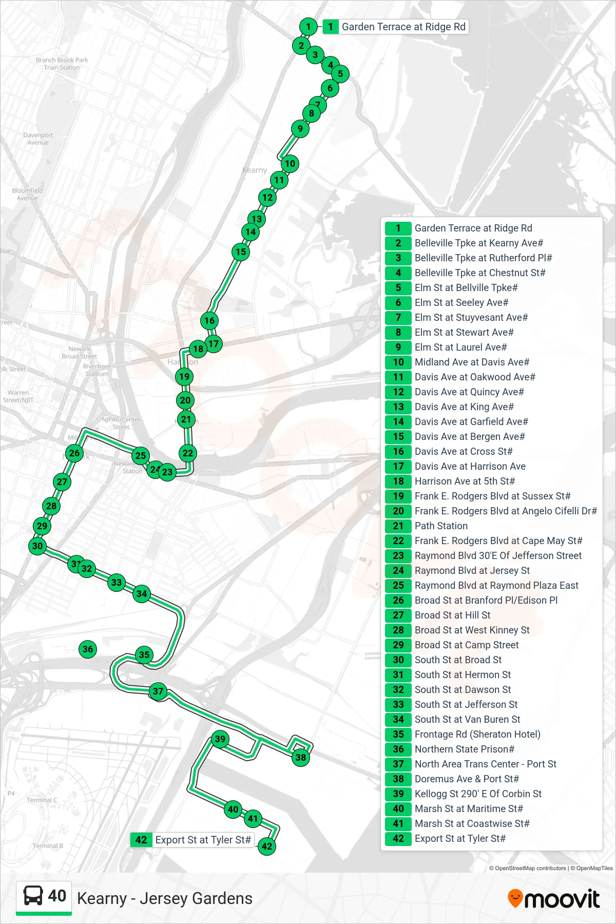
Stops list (40 - Port Newark Tyler & Marsh)
- Garden Terrace at Ridge Rd
- Belleville Tpke at Kearny Ave#
- Belleville Tpke at Rutherford Pl#
- Belleville Tpke at Chestnut St#
- Elm St at Bellville Tpke#
- Elm St at Seeley Ave#
- Elm St at Stuyvesant Ave#
- Elm St at Stewart Ave#
- Elm St at Laurel Ave#
- Midland Ave at Davis Ave#
- Davis Ave at Oakwood Ave#
- Davis Ave at Quincy Ave#
- Davis Ave at King Ave#
- Davis Ave at Garfield Ave#
- Davis Ave at Bergen Ave#
- Davis Ave at Cross St#
- Davis Ave at Harrison Ave
- Harrison Ave at 5th St#
- Frank E. Rodgers Blvd at Sussex St#
- Frank E. Rodgers Blvd at Angelo Cifelli Dr#
- Path Station
- Frank E. Rodgers Blvd at Cape May St#
- Raymond Blvd 30'E Of Jefferson Street
- Raymond Blvd at Jersey St
- Raymond Blvd at Raymond Plaza East
- Broad St at Branford Pl/Edison Pl
- Broad St at Hill St
- Broad St at West Kinney St
- Broad St at Camp Street
- South St at Broad St
- South St at Hermon St
- South St at Dawson St
- South St at Jefferson St
- South St at Van Buren St
- Frontage Rd (Sheraton Hotel)
- Northern State Prison#
- North Area Trans Center - Port St
- Doremus Ave & Port St#
- Kellogg St 290' E Of Corbin St
- Marsh St at Maritime St#
- Marsh St at Coastwise St#
- Export St at Tyler St#