
40 Bus Route Map
View the 40 route map and see all 40 stops along the route. The map of 40 shows where the bus travels and the location of each stop, making it easy to understand the entire route at a glance.
Explore TriMet routes on the map and see where TriMet bus services operate. Use the 40 map to find bus stops and see how the 40 connects different areas along its trip.
All 40 stops on the map are displayed in route order, helping you follow the 40 bus from the first stop to the last.
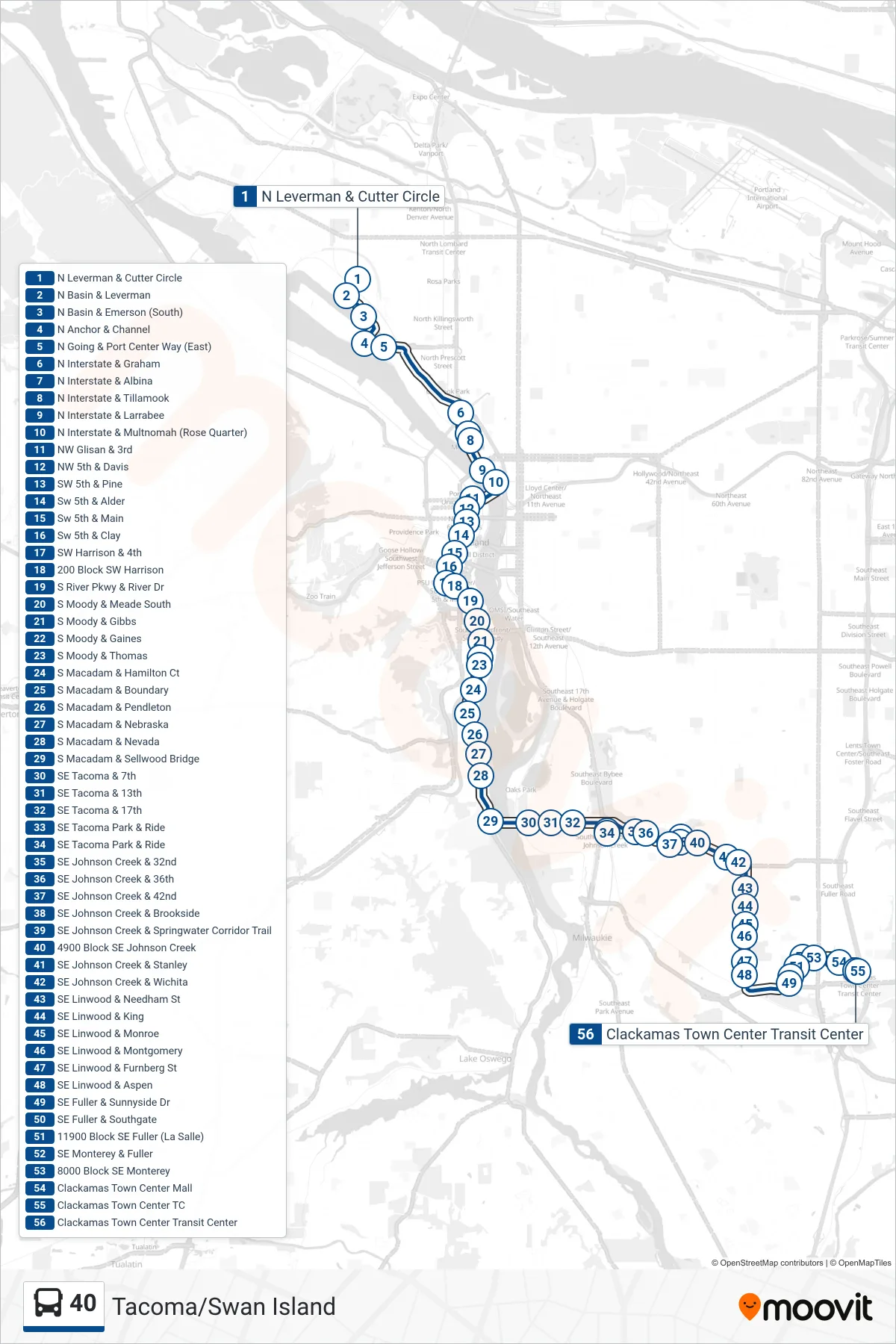
Stops list (40 - Clackamas Town Center Transit Center)
- N Leverman & Cutter Circle
- N Basin & Leverman
- N Basin & Emerson (South)
- N Anchor & Channel
- N Going & Port Center Way (East)
- N Interstate & Graham
- N Interstate & Albina
- N Interstate & Tillamook
- N Interstate & Larrabee
- N Interstate & Multnomah (Rose Quarter)
- NW Glisan & 3rd
- NW 5th & Davis
- SW 5th & Pine
- Sw 5th & Alder
- Sw 5th & Main
- Sw 5th & Clay
- SW Harrison & 4th
- 200 Block SW Harrison
- S River Pkwy & River Dr
- S Moody & Meade South
- S Moody & Gibbs
- S Moody & Gaines
- S Moody & Thomas
- S Macadam & Hamilton Ct
- S Macadam & Boundary
- S Macadam & Pendleton
- S Macadam & Nebraska
- S Macadam & Nevada
- S Macadam & Sellwood Bridge
- SE Tacoma & 7th
- SE Tacoma & 13th
- SE Tacoma & 17th
- SE Tacoma Park & Ride
- SE Tacoma Park & Ride
- SE Johnson Creek & 32nd
- SE Johnson Creek & 36th
- SE Johnson Creek & 42nd
- SE Johnson Creek & Brookside
- SE Johnson Creek & Springwater Corridor Trail
- 4900 Block SE Johnson Creek
- SE Johnson Creek & Stanley
- SE Johnson Creek & Wichita
- SE Linwood & Needham St
- SE Linwood & King
- SE Linwood & Monroe
- SE Linwood & Montgomery
- SE Linwood & Furnberg St
- SE Linwood & Aspen
- SE Fuller & Sunnyside Dr
- SE Fuller & Southgate
- 11900 Block SE Fuller (La Salle)
- SE Monterey & Fuller
- 8000 Block SE Monterey
- Clackamas Town Center Mall
- Clackamas Town Center TC
- Clackamas Town Center Transit Center