
40 Bus Route Map
View the 40 route map and see all 40 stops along the route. The map of 40 shows where the bus travels and the location of each stop, making it easy to understand the entire route at a glance.
Explore Rogue Valley Transportation District routes on the map and see where Rogue Valley Transportation District bus services operate. Use the 40 map to find bus stops and see how the 40 connects different areas along its trip.
All 40 stops on the map are displayed in route order, helping you follow the 40 bus from the first stop to the last.
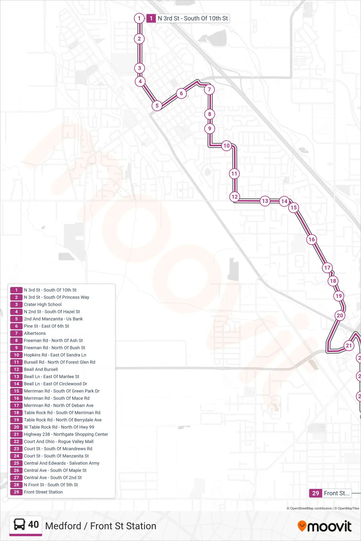
Stops list (40 - Medford / Front St Station)
- N 3rd St - South Of 10th St
- N 3rd St - South Of Princess Way
- Crater High School
- N 2nd St - South Of Hazel St
- 2nd And Manzanita - Us Bank
- Pine St - East Of 6th St
- Albertsons
- Freeman Rd - North Of Ash St
- Freeman Rd - North Of Bush St
- Hopkins Rd - East Of Sandra Ln
- Bursell Rd - North Of Forest Glen Rd
- Beall And Bursell
- Beall Ln - East Of Marilee St
- Beall Ln - East Of Circlewood Dr
- Merriman Rd - South Of Green Park Dr
- Merriman Rd - South Of Mace Rd
- Merriman Rd - North Of Debarr Ave
- Table Rock Rd - South Of Merriman Rd
- Table Rock Rd - North Of Berrydale Ave
- W Table Rock Rd - North Of Hwy 99
- Highway 238 - Northgate Shopping Center
- Court And Ohio - Rogue Valley Mall
- Court St - South Of Mcandrews Rd
- Court St - South Of Manzanita St
- Central And Edwards - Salvation Army
- Central Ave - South Of Maple St
- Central Ave - South Of 2nd St
- N Front St - South Of 5th St
- Front Street Station