
40 Bus Route Map
View the 40 route map and see all 40 stops along the route. The map of 40 shows where the bus travels and the location of each stop, making it easy to understand the entire route at a glance.
Explore Sonoma County Transit routes on the map and see where Sonoma County Transit bus services operate. Use the 40 map to find bus stops and see how the 40 connects different areas along its trip.
All 40 stops on the map are displayed in route order, helping you follow the 40 bus from the first stop to the last.
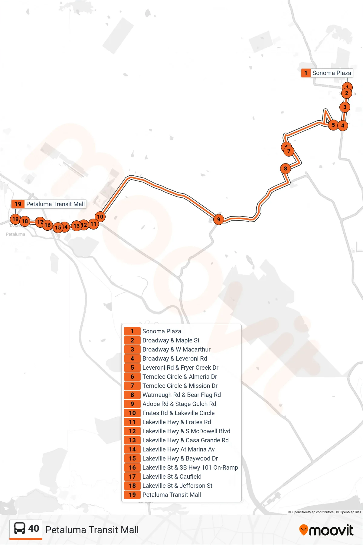
Stops list (40 - Petaluma Transit Mall)
- Sonoma Plaza
- Broadway & Maple St
- Broadway & W Macarthur
- Broadway & Leveroni Rd
- Leveroni Rd & Fryer Creek Dr
- Temelec Circle & Almeria Dr
- Temelec Circle & Mission Dr
- Watmaugh Rd & Bear Flag Rd
- Adobe Rd & Stage Gulch Rd
- Frates Rd & Lakeville Circle
- Lakeville Hwy & Frates Rd
- Lakeville Hwy & S McDowell Blvd
- Lakeville Hwy & Casa Grande Rd
- Lakeville Hwy At Marina Av
- Lakeville Hwy & Baywood Dr
- Lakeville St & SB Hwy 101 On-Ramp
- Lakeville St & Caufield
- Lakeville St & Jefferson St
- Petaluma Transit Mall