
40 Bus Route Map
View the 40 route map and see all 40 stops along the route. The map of 40 shows where the bus travels and the location of each stop, making it easy to understand the entire route at a glance.
Explore SBG routes on the map and see where SBG bus services operate. Use the 40 map to find bus stops and see how the 40 connects different areas along its trip.
All 40 stops on the map are displayed in route order, helping you follow the 40 bus from the first stop to the last.
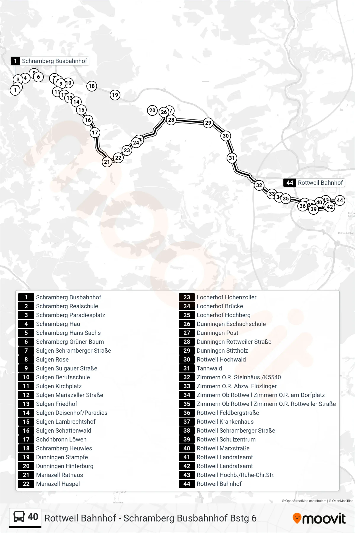
Stops list (40 - Rottweil Bahnhof)
- Schramberg Busbahnhof
- Schramberg Realschule
- Schramberg Paradiesplatz
- Schramberg Hau
- Schramberg Hans Sachs
- Schramberg Grüner Baum
- Sulgen Schramberger Straße
- Sulgen Rose
- Sulgen Sulgauer Straße
- Sulgen Berufsschule
- Sulgen Kirchplatz
- Sulgen Mariazeller Straße
- Sulgen Friedhof
- Sulgen Deisenhof/Paradies
- Sulgen Lambrechtshof
- Sulgen Schattenwald
- Schönbronn Löwen
- Schramberg Heuwies
- Dunningen Stampfe
- Dunningen Hinterburg
- Mariazell Rathaus
- Mariazell Haspel
- Locherhof Hohenzoller
- Locherhof Brücke
- Locherhof Hochberg
- Dunningen Eschachschule
- Dunningen Post
- Dunningen Rottweiler Straße
- Dunningen Stittholz
- Rottweil Hochwald
- Tannwald
- Zimmern O.R. Steinhäus./K5540
- Zimmern O.R. Abzw. Flözlinger.
- Zimmern Ob Rottweil Zimmern O.R. am Dorfplatz
- Zimmern Ob Rottweil Zimmern O.R. Rottweiler Straße
- Rottweil Feldbergstraße
- Rottweil Krankenhaus
- Rottweil Schramberger Straße
- Rottweil Schulzentrum
- Rottweil Marxstraße
- Rottweil Landratsamt
- Rottweil Landratsamt
- Rottweil Hochb./Ruhe-Chr.Str.
- Rottweil Bahnhof