
400 Bus Route Map
View the 400 route map and see all 400 stops along the route. The map of 400 shows where the bus travels and the location of each stop, making it easy to understand the entire route at a glance.
Explore DSW Bus routes on the map and see where DSW Bus bus services operate. Use the 400 map to find bus stops and see how the 400 connects different areas along its trip.
All 400 stops on the map are displayed in route order, helping you follow the 400 bus from the first stop to the last.
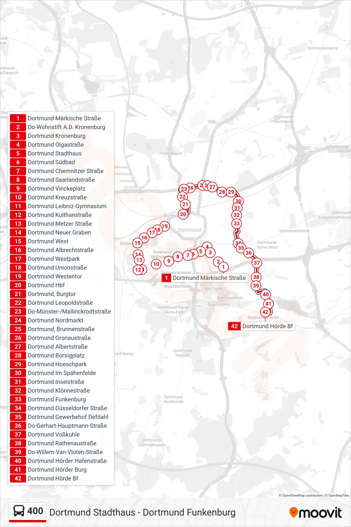
Stops list (400 - Dortmund Hörde Bf)
- Dortmund Märkische Straße
- Do-Wohnstift A.D. Kronenburg
- Dortmund Kronenburg
- Dortmund Olgastraße
- Dortmund Stadthaus
- Dortmund Südbad
- Dortmund Chemnitzer Straße
- Dortmund Saarlandstraße
- Dortmund Vinckeplatz
- Dortmund Kreuzstraße
- Dortmund Leibniz-Gymnasium
- Dortmund Kuithanstraße
- Dortmund Metzer Straße
- Dortmund Neuer Graben
- Dortmund West
- Dortmund Albrechtstraße
- Dortmund Westpark
- Dortmund Unionstraße
- Dortmund Westentor
- Dortmund Hbf
- Dortmund, Burgtor
- Dortmund Leopoldstraße
- Do-Münster-/Mallinckrodtstraße
- Dortmund Nordmarkt
- Dortmund, Brunnenstraße
- Dortmund Gronaustraße
- Dortmund Albertstraße
- Dortmund Borsigplatz
- Dortmund Hoeschpark
- Dortmund Im Spähenfelde
- Dortmund Inselstraße
- Dortmund Klönnestraße
- Dortmund Funkenburg
- Dortmund Düsseldorfer Straße
- Dortmund Gewerbehof Defdahl
- Do-Gerhart-Hauptmann-Straße
- Dortmund Voßkuhle
- Dortmund Rathenaustraße
- Do-Willem-Van-Vloten-Straße
- Dortmund Hörder Hafenstraße
- Dortmund Hörder Burg
- Dortmund Hörde Bf