
41 Bus Route Map
View the 41 route map and see all 41 stops along the route. The map of 41 shows where the bus travels and the location of each stop, making it easy to understand the entire route at a glance.
Explore Franklin Regional Transit Authority routes on the map and see where Franklin Regional Transit Authority bus services operate. Use the 41 map to find bus stops and see how the 41 connects different areas along its trip.
All 41 stops on the map are displayed in route order, helping you follow the 41 bus from the first stop to the last.
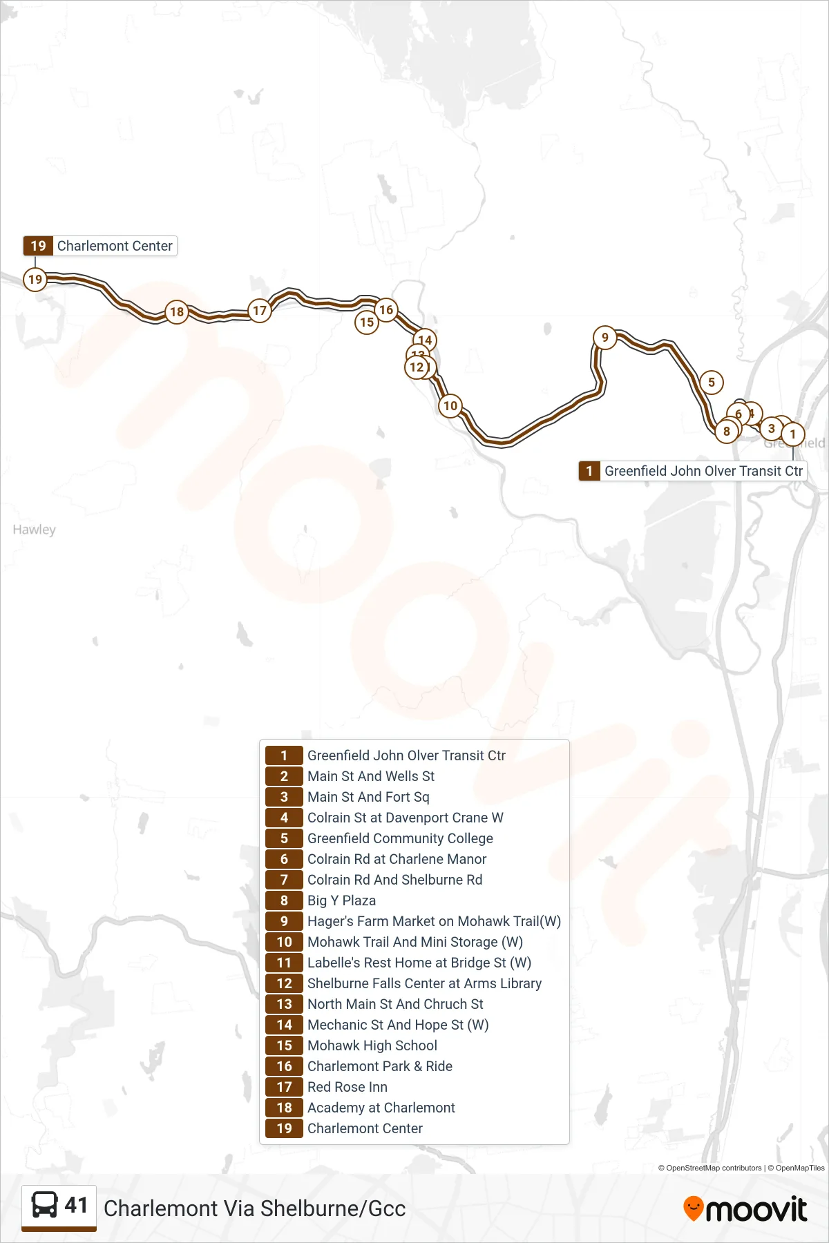
Stops list (41 - Charlemont Via Shelburne/Gcc)
- Greenfield John Olver Transit Ctr
- Main St And Wells St
- Main St And Fort Sq
- Colrain St at Davenport Crane W
- Greenfield Community College
- Colrain Rd at Charlene Manor
- Colrain Rd And Shelburne Rd
- Big Y Plaza
- Hager's Farm Market on Mohawk Trail(W)
- Mohawk Trail And Mini Storage (W)
- Labelle's Rest Home at Bridge St (W)
- Shelburne Falls Center at Arms Library
- North Main St And Chruch St
- Mechanic St And Hope St (W)
- Mohawk High School
- Charlemont Park & Ride
- Red Rose Inn
- Academy at Charlemont
- Charlemont Center