
41 Bus Route Map
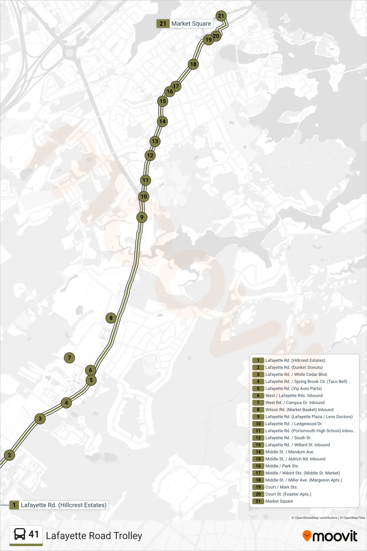
View the 41 route map and see all 41 stops along the route. The map of 41 shows where the bus travels and the location of each stop, making it easy to understand the entire route at a glance.
Explore Cooperative Alliance for Seacoast Transportation routes on the map and see where Cooperative Alliance for Seacoast Transportation bus services operate. Use the 41 map to find bus stops and see how the 41 connects different areas along its trip.
All 41 stops on the map are displayed in route order, helping you follow the 41 bus from the first stop to the last.
Stops list (41 - Inbound)
- Lafayette Rd. (Hillcrest Estates)
- Lafayette Rd. (Dunkin' Donuts)
- Lafayette Rd. / White Cedar Blvd.
- Lafayette Rd. / Spring Brook Cir. (Taco Bell)
- Lafayette Rd. (Vip Auto Parts)
- West / Lafayette Rds. Inbound
- West Rd. / Campus Dr. Inbound
- Wilson Rd. (Market Basket) Inbound
- Lafayette Rd. (Lafayette Plaza / Lens Doctors)
- Lafayette Rd. / Ledgewood Dr.
- Lafayette Rd. (Portsmouth High School) Inbound
- Lafayette Rd. / South St.
- Lafayette Rd. / Willard St. Inbound
- Middle St. / Mendum Ave.
- Middle St. / Aldrich Rd. Inbound
- Middle / Park Sts.
- Middle / Wibird Sts. (Middle St. Market)
- Middle St. / Miller Ave. (Margeson Apts.)
- Court / Mark Sts.
- Court St. (Feaster Apts.)
- Market Square