
41 Bus Route Map
View the 41 route map and see all 41 stops along the route. The map of 41 shows where the bus travels and the location of each stop, making it easy to understand the entire route at a glance.
Explore Bühler routes on the map and see where Bühler bus services operate. Use the 41 map to find bus stops and see how the 41 connects different areas along its trip.
All 41 stops on the map are displayed in route order, helping you follow the 41 bus from the first stop to the last.
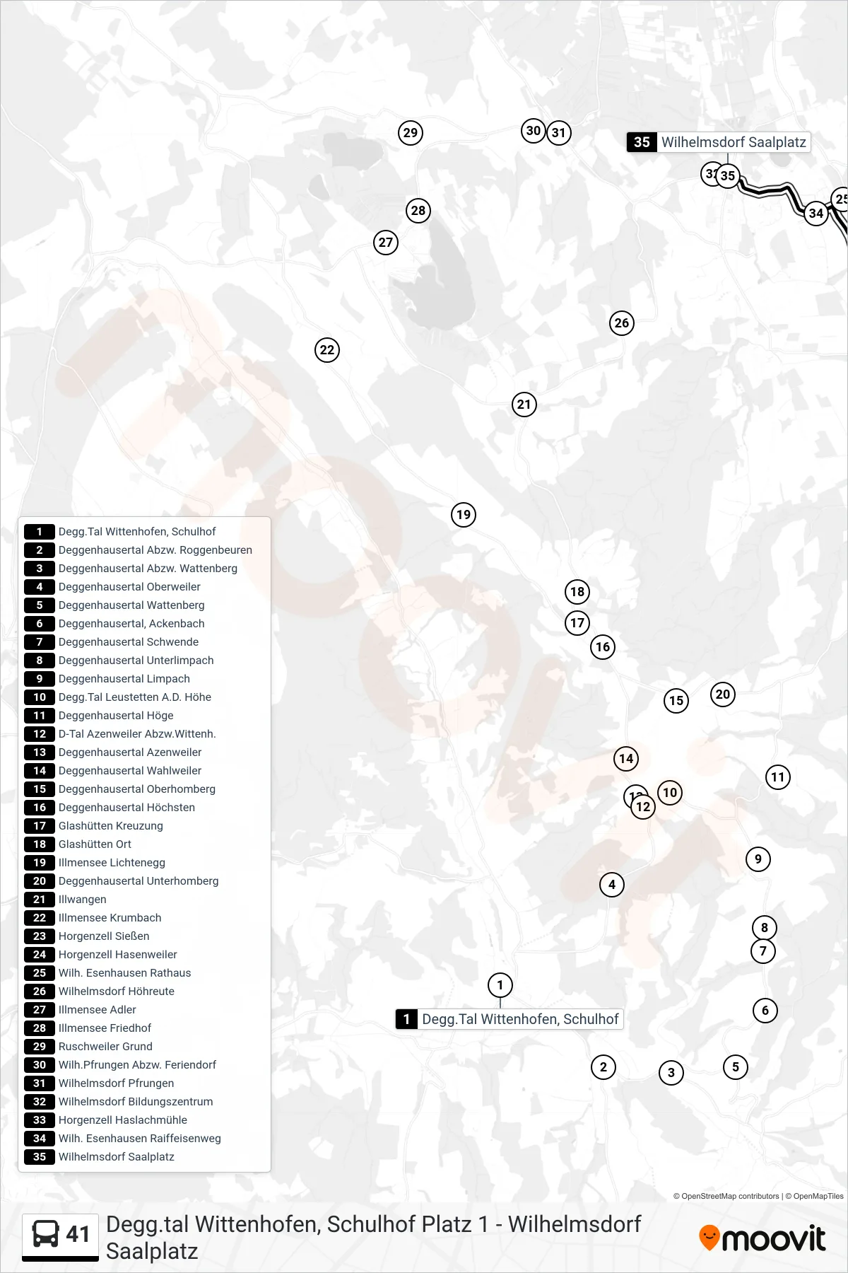
Stops list (41 - Wilhelmsdorf Saalplatz)
- Degg.Tal Wittenhofen, Schulhof
- Deggenhausertal Abzw. Roggenbeuren
- Deggenhausertal Abzw. Wattenberg
- Deggenhausertal Oberweiler
- Deggenhausertal Wattenberg
- Deggenhausertal, Ackenbach
- Deggenhausertal Schwende
- Deggenhausertal Unterlimpach
- Deggenhausertal Limpach
- Degg.Tal Leustetten A.D. Höhe
- Deggenhausertal Höge
- D-Tal Azenweiler Abzw.Wittenh.
- Deggenhausertal Azenweiler
- Deggenhausertal Wahlweiler
- Deggenhausertal Oberhomberg
- Deggenhausertal Höchsten
- Glashütten Kreuzung
- Glashütten Ort
- Illmensee Lichtenegg
- Deggenhausertal Unterhomberg
- Illwangen
- Illmensee Krumbach
- Horgenzell Sießen
- Horgenzell Hasenweiler
- Wilh. Esenhausen Rathaus
- Wilhelmsdorf Höhreute
- Illmensee Adler
- Illmensee Friedhof
- Ruschweiler Grund
- Wilh.Pfrungen Abzw. Feriendorf
- Wilhelmsdorf Pfrungen
- Wilhelmsdorf Bildungszentrum
- Horgenzell Haslachmühle
- Wilh. Esenhausen Raiffeisenweg
- Wilhelmsdorf Saalplatz
Change direction
- Route Map - 41 - Degg.Tal Deggenhausen, Kirche
- Route Map - 41 - Deggenhausertal Höchsten
- Route Map - 41 - Wilhelmsdorf Kath. Kirche
- Route Map - 41 - Deggenhausertal Urnau Kirche
- Route Map - 41 - Wilhelmsdorf Bildungszentrum
- Route Map - 41 - Degg.Tal Wittenhofen, Schulhof
- Route Map - 41 - Degg.Tal Wittenhofen, Schulhof