
41 Bus Route Map
View the 41 route map and see all 41 stops along the route. The map of 41 shows where the bus travels and the location of each stop, making it easy to understand the entire route at a glance.
Explore Süddeustche Verkehrslinien routes on the map and see where Süddeustche Verkehrslinien bus services operate. Use the 41 map to find bus stops and see how the 41 connects different areas along its trip.
All 41 stops on the map are displayed in route order, helping you follow the 41 bus from the first stop to the last.
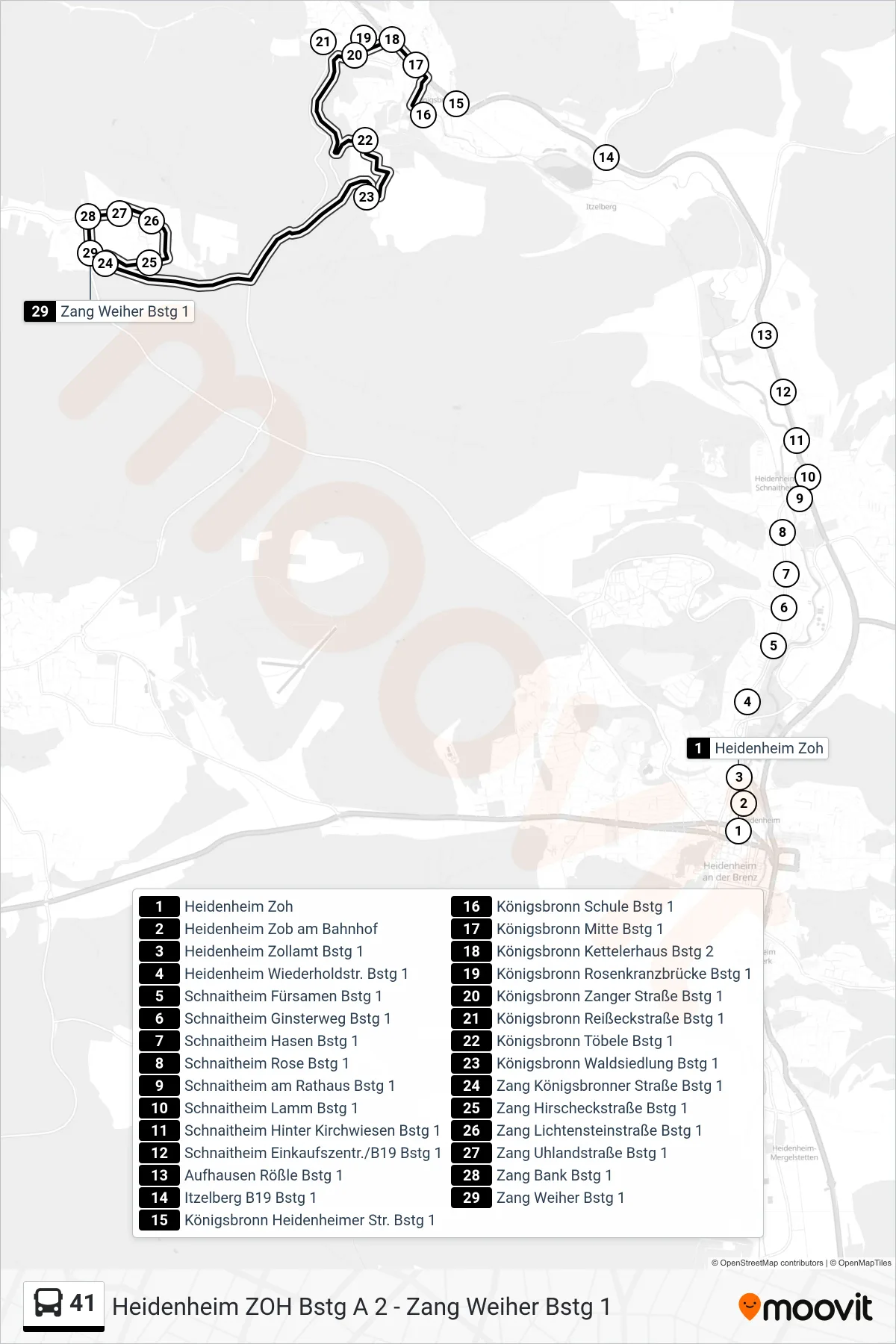
Stops list (41 - Zang Weiher)
- Heidenheim Zoh
- Heidenheim Zob am Bahnhof
- Heidenheim Zollamt Bstg 1
- Heidenheim Wiederholdstr. Bstg 1
- Schnaitheim Fürsamen Bstg 1
- Schnaitheim Ginsterweg Bstg 1
- Schnaitheim Hasen Bstg 1
- Schnaitheim Rose Bstg 1
- Schnaitheim am Rathaus Bstg 1
- Schnaitheim Lamm Bstg 1
- Schnaitheim Hinter Kirchwiesen Bstg 1
- Schnaitheim Einkaufszentr./B19 Bstg 1
- Aufhausen Rößle Bstg 1
- Itzelberg B19 Bstg 1
- Königsbronn Heidenheimer Str. Bstg 1
- Königsbronn Schule Bstg 1
- Königsbronn Mitte Bstg 1
- Königsbronn Kettelerhaus Bstg 2
- Königsbronn Rosenkranzbrücke Bstg 1
- Königsbronn Zanger Straße Bstg 1
- Königsbronn Reißeckstraße Bstg 1
- Königsbronn Töbele Bstg 1
- Königsbronn Waldsiedlung Bstg 1
- Zang Königsbronner Straße Bstg 1
- Zang Hirscheckstraße Bstg 1
- Zang Lichtensteinstraße Bstg 1
- Zang Uhlandstraße Bstg 1
- Zang Bank Bstg 1
- Zang Weiher Bstg 1