
411 Bus Route Map
View the 411 route map and see all 411 stops along the route. The map of 411 shows where the bus travels and the location of each stop, making it easy to understand the entire route at a glance.
Explore Busverkehr Oder-Spree GmbH routes on the map and see where Busverkehr Oder-Spree GmbH bus services operate. Use the 411 map to find bus stops and see how the 411 connects different areas along its trip.
All 411 stops on the map are displayed in route order, helping you follow the 411 bus from the first stop to the last.
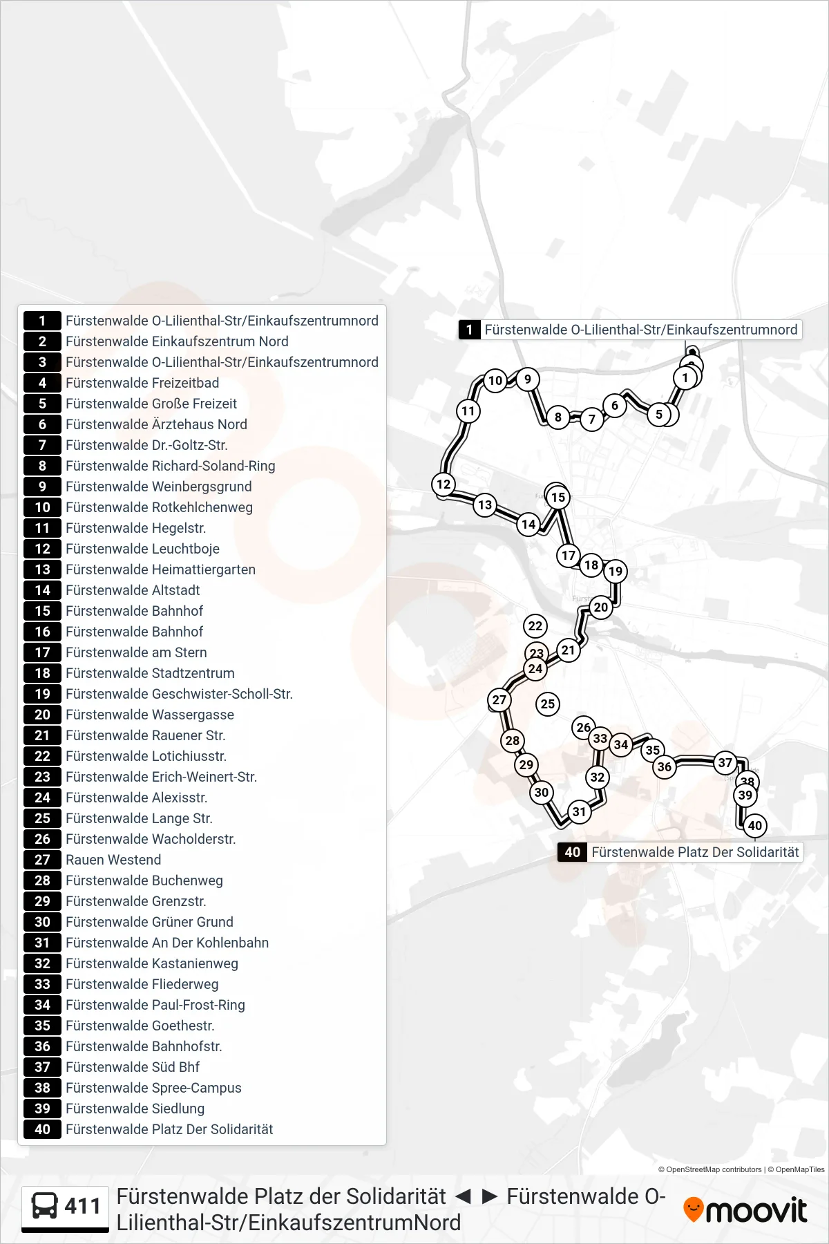
Stops list (411 - Fürstenwalde Platz Der Solidarität)
- Fürstenwalde O-Lilienthal-Str/Einkaufszentrumnord
- Fürstenwalde Einkaufszentrum Nord
- Fürstenwalde O-Lilienthal-Str/Einkaufszentrumnord
- Fürstenwalde Freizeitbad
- Fürstenwalde Große Freizeit
- Fürstenwalde Ärztehaus Nord
- Fürstenwalde Dr.-Goltz-Str.
- Fürstenwalde Richard-Soland-Ring
- Fürstenwalde Weinbergsgrund
- Fürstenwalde Rotkehlchenweg
- Fürstenwalde Hegelstr.
- Fürstenwalde Leuchtboje
- Fürstenwalde Heimattiergarten
- Fürstenwalde Altstadt
- Fürstenwalde Bahnhof
- Fürstenwalde Bahnhof
- Fürstenwalde am Stern
- Fürstenwalde Stadtzentrum
- Fürstenwalde Geschwister-Scholl-Str.
- Fürstenwalde Wassergasse
- Fürstenwalde Rauener Str.
- Fürstenwalde Lotichiusstr.
- Fürstenwalde Erich-Weinert-Str.
- Fürstenwalde Alexisstr.
- Fürstenwalde Lange Str.
- Fürstenwalde Wacholderstr.
- Rauen Westend
- Fürstenwalde Buchenweg
- Fürstenwalde Grenzstr.
- Fürstenwalde Grüner Grund
- Fürstenwalde An Der Kohlenbahn
- Fürstenwalde Kastanienweg
- Fürstenwalde Fliederweg
- Fürstenwalde Paul-Frost-Ring
- Fürstenwalde Goethestr.
- Fürstenwalde Bahnhofstr.
- Fürstenwalde Süd Bhf
- Fürstenwalde Spree-Campus
- Fürstenwalde Siedlung
- Fürstenwalde Platz Der Solidarität