
411 Bus Route Map
View the 411 route map and see all 411 stops along the route. The map of 411 shows where the bus travels and the location of each stop, making it easy to understand the entire route at a glance.
Explore DSW Bus routes on the map and see where DSW Bus bus services operate. Use the 411 map to find bus stops and see how the 411 connects different areas along its trip.
All 411 stops on the map are displayed in route order, helping you follow the 411 bus from the first stop to the last.
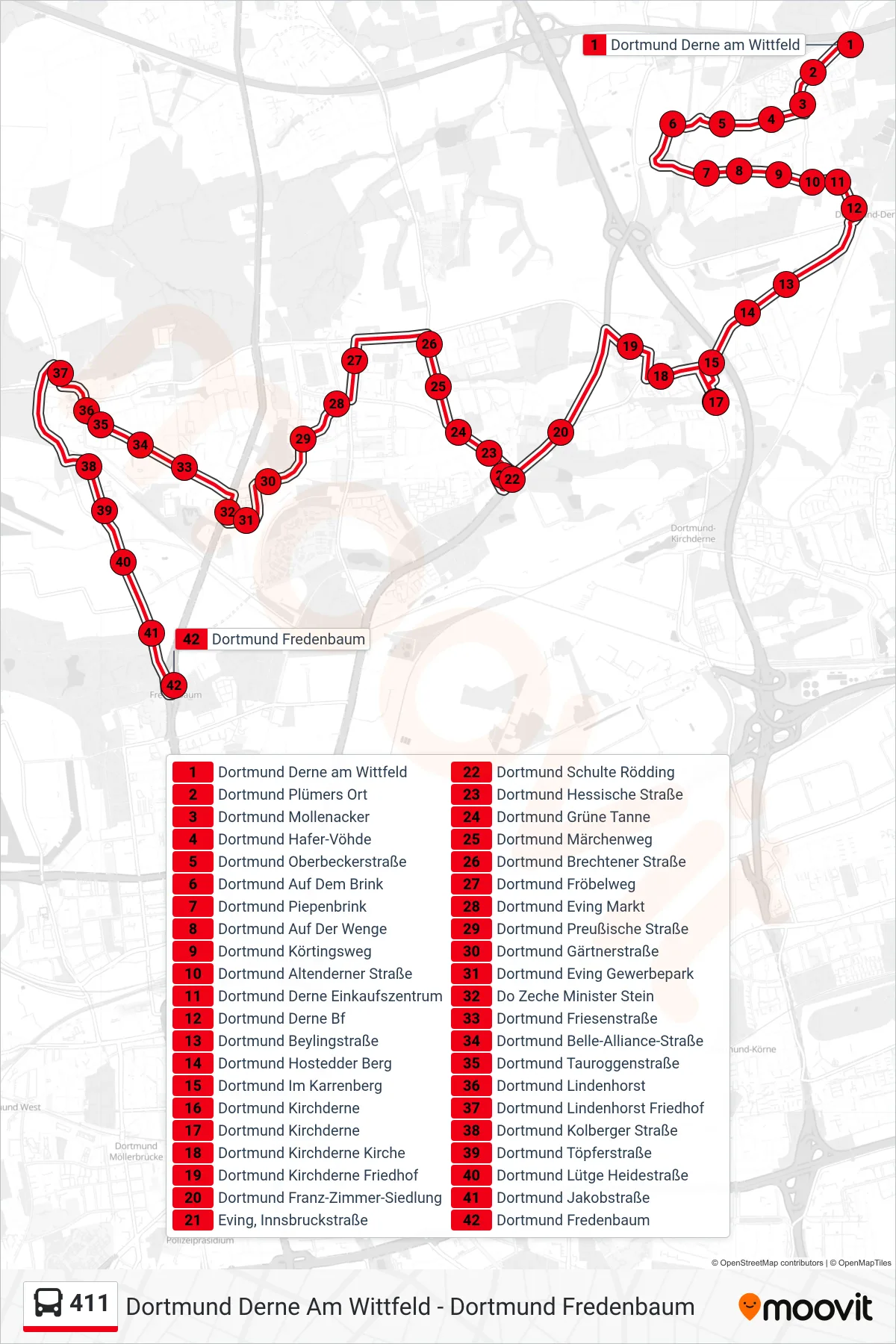
Stops list (411 - Dortmund Fredenbaum)
- Dortmund Derne am Wittfeld
- Dortmund Plümers Ort
- Dortmund Mollenacker
- Dortmund Hafer-Vöhde
- Dortmund Oberbeckerstraße
- Dortmund Auf Dem Brink
- Dortmund Piepenbrink
- Dortmund Auf Der Wenge
- Dortmund Körtingsweg
- Dortmund Altenderner Straße
- Dortmund Derne Einkaufszentrum
- Dortmund Derne Bf
- Dortmund Beylingstraße
- Dortmund Hostedder Berg
- Dortmund Im Karrenberg
- Dortmund Kirchderne
- Dortmund Kirchderne
- Dortmund Kirchderne Kirche
- Dortmund Kirchderne Friedhof
- Dortmund Franz-Zimmer-Siedlung
- Eving, Innsbruckstraße
- Dortmund Schulte Rödding
- Dortmund Hessische Straße
- Dortmund Grüne Tanne
- Dortmund Märchenweg
- Dortmund Brechtener Straße
- Dortmund Fröbelweg
- Dortmund Eving Markt
- Dortmund Preußische Straße
- Dortmund Gärtnerstraße
- Dortmund Eving Gewerbepark
- Do Zeche Minister Stein
- Dortmund Friesenstraße
- Dortmund Belle-Alliance-Straße
- Dortmund Tauroggenstraße
- Dortmund Lindenhorst
- Dortmund Lindenhorst Friedhof
- Dortmund Kolberger Straße
- Dortmund Töpferstraße
- Dortmund Lütge Heidestraße
- Dortmund Jakobstraße
- Dortmund Fredenbaum