
413 Bus Route Map
View the 413 route map and see all 413 stops along the route. The map of 413 shows where the bus travels and the location of each stop, making it easy to understand the entire route at a glance.
Explore De Lijn routes on the map and see where De Lijn bus services operate. Use the 413 map to find bus stops and see how the 413 connects different areas along its trip.
All 413 stops on the map are displayed in route order, helping you follow the 413 bus from the first stop to the last.
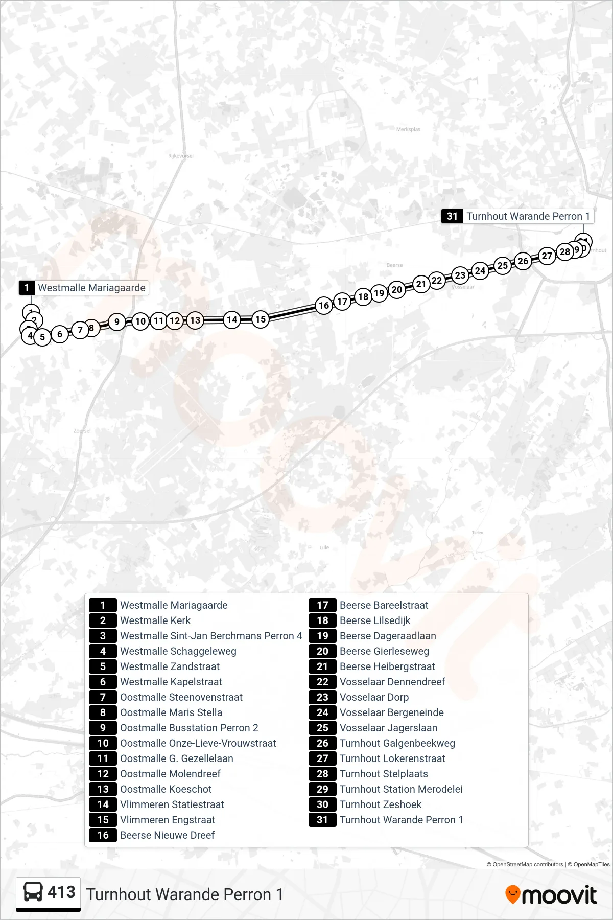
Stops list (413 - Turnhout Warande Platform 1)
- Westmalle Mariagaarde
- Westmalle Church
- Westmalle St. John Berchmans Platform 4
- Westmalle Schaggele Way
- Westmalle Sand Street
- Westmalle Chapel Street
- Oostmalle Brick Kiln Street
- Oostmalle Maris Stella
- Oostmalle Bus Station Platform 2
- Oostmalle Our Lady Street
- Oostmalle G. Gezelle Avenue
- Oostmalle Mill Drive
- Oostmalle Koeschot
- Vlimmeren Station Street
- Vlimmeren Narrow Street
- Beerse New Drive
- Beerse Bareel Street
- Beerse Lilsedijk
- Beerse Dawn Avenue
- Beerse Gierleseweg
- Beerse Heiberg Street
- Vosselaar Pine Lane
- Vosselaar Village
- Vosselaar Bergeneinde
- Vosselaar Hunters Lane
- Turnhout Gallows Creek Road
- Turnhout Lokeren Street
- Turnhout Depot
- Turnhout Station Merodel Avenue
- Turnhout Hexagon
- Turnhout Warande Platform 1