
414 Bus Route Map
View the 414 route map and see all 414 stops along the route. The map of 414 shows where the bus travels and the location of each stop, making it easy to understand the entire route at a glance.
Explore Nomad Car (Région Normandie) routes on the map and see where Nomad Car (Région Normandie) bus services operate. Use the 414 map to find bus stops and see how the 414 connects different areas along its trip.
All 414 stops on the map are displayed in route order, helping you follow the 414 bus from the first stop to the last.
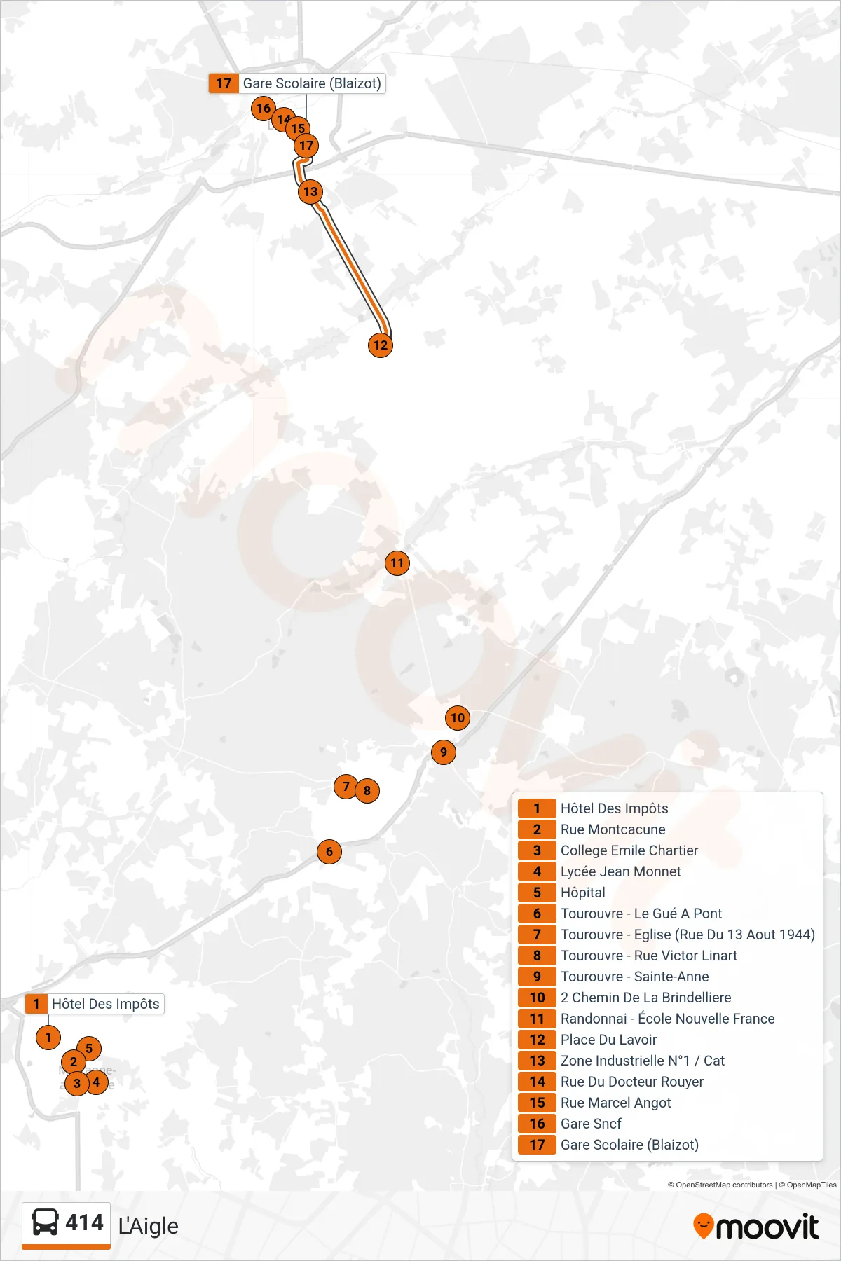
Stops list (414 - L'Aigle)
- Hôtel Des Impôts
- Rue Montcacune
- College Emile Chartier
- Lycée Jean Monnet
- Hôpital
- Tourouvre - Le Gué A Pont
- Tourouvre - Eglise (Rue Du 13 Aout 1944)
- Tourouvre - Rue Victor Linart
- Tourouvre - Sainte-Anne
- 2 Chemin De La Brindelliere
- Randonnai - École Nouvelle France
- Place Du Lavoir
- Zone Industrielle N°1 / Cat
- Rue Du Docteur Rouyer
- Rue Marcel Angot
- Gare Sncf
- Gare Scolaire (Blaizot)