
415 Bus Route Map
View the 415 route map and see all 415 stops along the route. The map of 415 shows where the bus travels and the location of each stop, making it easy to understand the entire route at a glance.
Explore FriBus routes on the map and see where FriBus bus services operate. Use the 415 map to find bus stops and see how the 415 connects different areas along its trip.
All 415 stops on the map are displayed in route order, helping you follow the 415 bus from the first stop to the last.
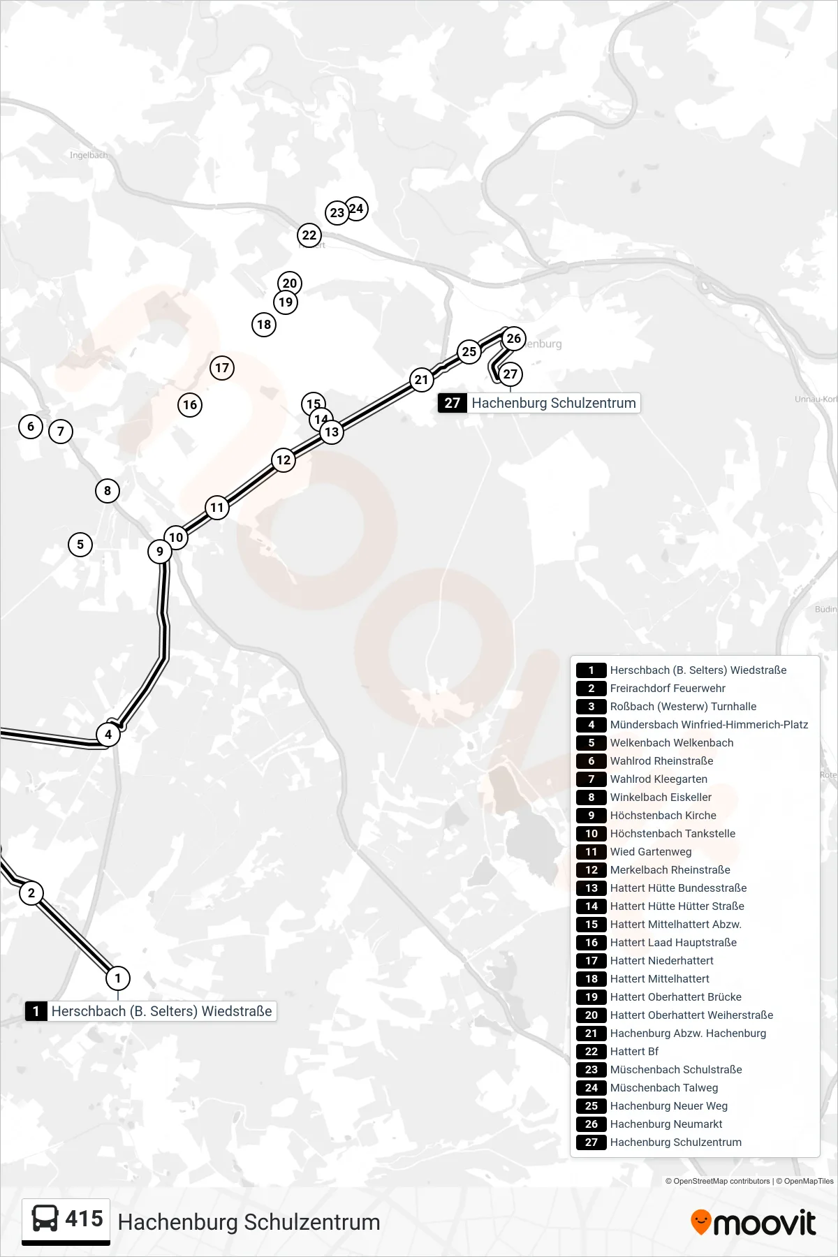
Stops list (415 - Hachenburg Schulzentrum)
- Herschbach (B. Selters) Wiedstraße
- Freirachdorf Feuerwehr
- Roßbach (Westerw) Turnhalle
- Mündersbach Winfried-Himmerich-Platz
- Welkenbach Welkenbach
- Wahlrod Rheinstraße
- Wahlrod Kleegarten
- Winkelbach Eiskeller
- Höchstenbach Kirche
- Höchstenbach Tankstelle
- Wied Gartenweg
- Merkelbach Rheinstraße
- Hattert Hütte Bundesstraße
- Hattert Hütte Hütter Straße
- Hattert Mittelhattert Abzw.
- Hattert Laad Hauptstraße
- Hattert Niederhattert
- Hattert Mittelhattert
- Hattert Oberhattert Brücke
- Hattert Oberhattert Weiherstraße
- Hachenburg Abzw. Hachenburg
- Hattert Bf
- Müschenbach Schulstraße
- Müschenbach Talweg
- Hachenburg Neuer Weg
- Hachenburg Neumarkt
- Hachenburg Schulzentrum
Change direction
- Route Map - 415 - Hachenburg Altstadt Grundschule
- Route Map - 415 - Müschenbach Grundschule
- Route Map - 415 - Hachenburg Neumarkt
- Route Map - 415 - Herschbach (B. Selters) Wiedstraße
- Route Map - 415 - Wahlrod Rheinstraße
- Route Map - 415 - Müschenbach Talweg
- Route Map - 415 - Welkenbach Welkenbach
- Route Map - 415 - Müschenbach Grundschule
- Route Map - 415 - Hattert Hütte Hütter Straße
- Route Map - 415 - Streithausen Marienstatt Gymnasium
- Route Map - 415 - Merkelbach Rheinstraße
- Route Map - 415 - Roßbach (Westerw) Turnhalle