
417 Bus Route Map
View the 417 route map and see all 417 stops along the route. The map of 417 shows where the bus travels and the location of each stop, making it easy to understand the entire route at a glance.
Explore Nomad Car (Région Normandie) routes on the map and see where Nomad Car (Région Normandie) bus services operate. Use the 417 map to find bus stops and see how the 417 connects different areas along its trip.
All 417 stops on the map are displayed in route order, helping you follow the 417 bus from the first stop to the last.
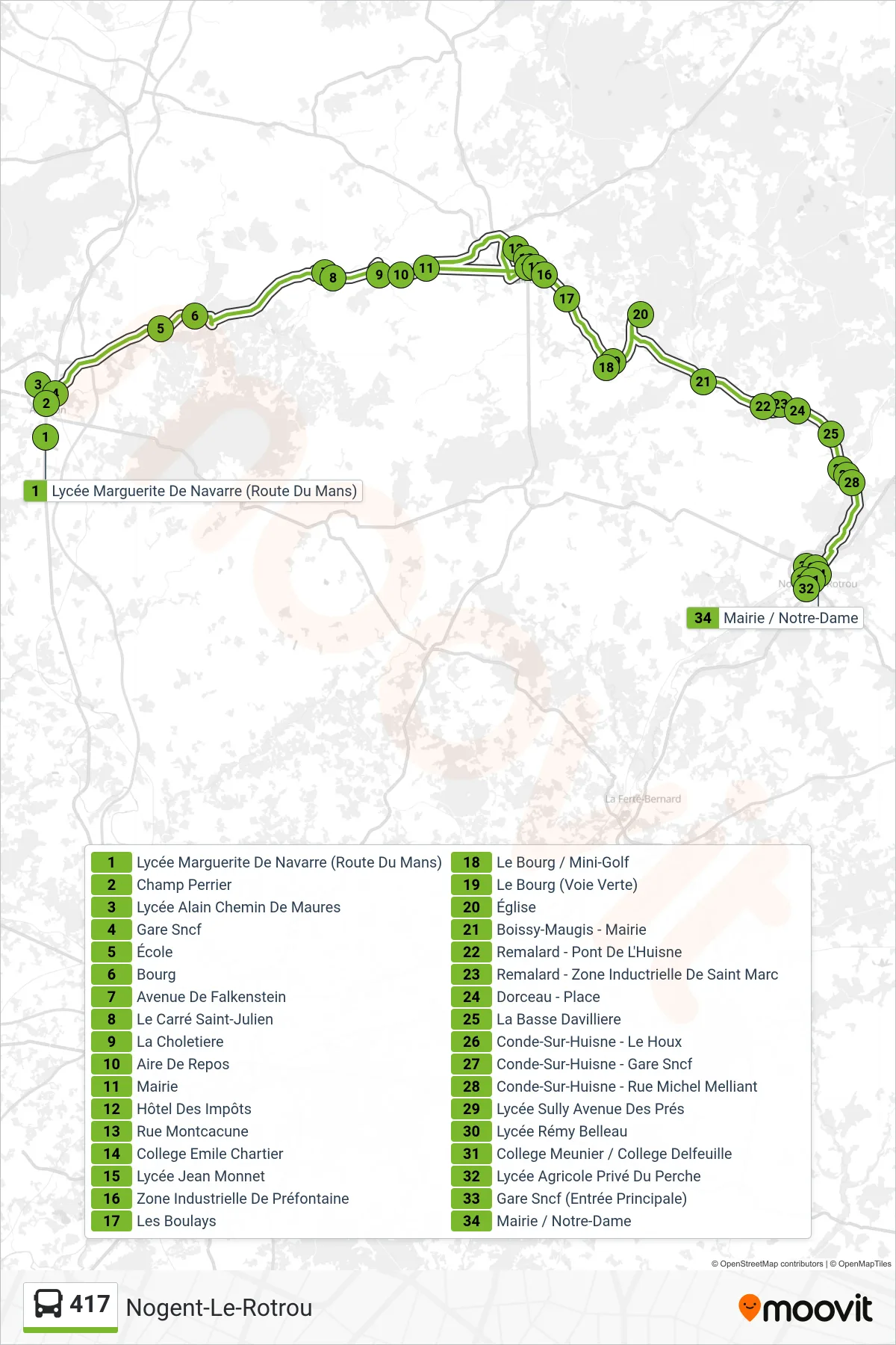
Stops list (417 - Nogent-Le-Rotrou)
- Lycée Marguerite De Navarre (Route Du Mans)
- Champ Perrier
- Lycée Alain Chemin De Maures
- Gare Sncf
- École
- Bourg
- Avenue De Falkenstein
- Le Carré Saint-Julien
- La Choletiere
- Aire De Repos
- Mairie
- Hôtel Des Impôts
- Rue Montcacune
- College Emile Chartier
- Lycée Jean Monnet
- Zone Industrielle De Préfontaine
- Les Boulays
- Le Bourg / Mini-Golf
- Le Bourg (Voie Verte)
- Église
- Boissy-Maugis - Mairie
- Remalard - Pont De L'Huisne
- Remalard - Zone Inductrielle De Saint Marc
- Dorceau - Place
- La Basse Davilliere
- Conde-Sur-Huisne - Le Houx
- Conde-Sur-Huisne - Gare Sncf
- Conde-Sur-Huisne - Rue Michel Melliant
- Lycée Sully Avenue Des Prés
- Lycée Rémy Belleau
- College Meunier / College Delfeuille
- Lycée Agricole Privé Du Perche
- Gare Sncf (Entrée Principale)
- Mairie / Notre-Dame
Change direction
- Route Map - 417 - Saint-Langis-Lès-Mortagne
- Route Map - 417 - La Chapelle-Montligeon
- Route Map - 417 - Le Mêle-Sur-Sarthe
- Route Map - 417 - Saint-Germain-Des-Grois
- Route Map - 417 - Mortagne-Au-Perche
- Route Map - 417 - Sablons Sur Huisne
- Route Map - 417 - Rémalard En Perche
- Route Map - 417 - Alençon
- Route Map - 417 - Alençon
- Route Map - 417 - Mortagne-Au-Perche