
418 Bus Route Map
View the 418 route map and see all 418 stops along the route. The map of 418 shows where the bus travels and the location of each stop, making it easy to understand the entire route at a glance.
Explore Transportes Santo Antônio routes on the map and see where Transportes Santo Antônio bus services operate. Use the 418 map to find bus stops and see how the 418 connects different areas along its trip.
All 418 stops on the map are displayed in route order, helping you follow the 418 bus from the first stop to the last.
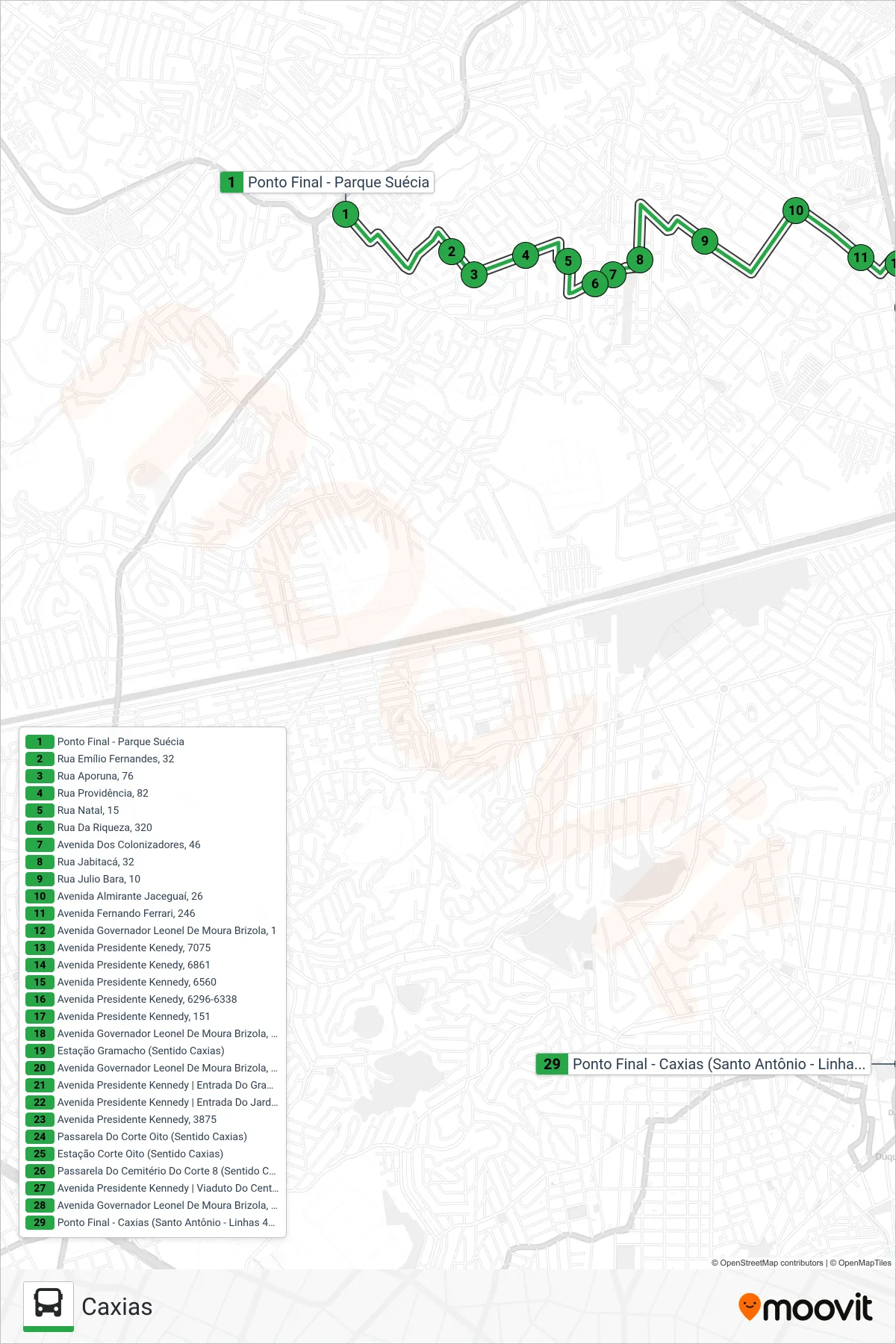
Stops list (418 - Caxias)
- Ponto Final - Parque Suécia
- Rua Emílio Fernandes, 32
- Rua Aporuna, 76
- Rua Providência, 82
- Rua Natal, 15
- Rua Da Riqueza, 320
- Avenida Dos Colonizadores, 46
- Rua Jabitacá, 32
- Rua Julio Bara, 10
- Avenida Almirante Jaceguaí, 26
- Avenida Fernando Ferrari, 246
- Avenida Governador Leonel De Moura Brizola, 1
- Avenida Presidente Kenedy, 7075
- Avenida Presidente Kenedy, 6861
- Avenida Presidente Kennedy, 6560
- Avenida Presidente Kenedy, 6296-6338
- Avenida Presidente Kennedy, 151
- Avenida Governador Leonel De Moura Brizola, 35
- Estação Gramacho (Sentido Caxias)
- Avenida Governador Leonel De Moura Brizola, 2164
- Avenida Presidente Kennedy | Entrada Do Gramacho (Sentido Caxias)
- Avenida Presidente Kennedy | Entrada Do Jardim Leal (Sentido Caxias)
- Avenida Presidente Kennedy, 3875
- Passarela Do Corte Oito (Sentido Caxias)
- Estação Corte Oito (Sentido Caxias)
- Passarela Do Cemitério Do Corte 8 (Sentido Caxias)
- Avenida Presidente Kennedy | Viaduto Do Centenário (Sentido Caxias)
- Avenida Governador Leonel De Moura Brizola, 2259
- Ponto Final - Caxias (Santo Antônio - Linhas 418 E 500)