
41C Bus Route Map
View the 41C route map and see all 41C stops along the route. The map of 41C shows where the bus travels and the location of each stop, making it easy to understand the entire route at a glance.
Explore Bus Átha Cliath – Dublin Bus routes on the map and see where Bus Átha Cliath – Dublin Bus bus services operate. Use the 41C map to find bus stops and see how the 41C connects different areas along its trip.
All 41C stops on the map are displayed in route order, helping you follow the 41C bus from the first stop to the last.
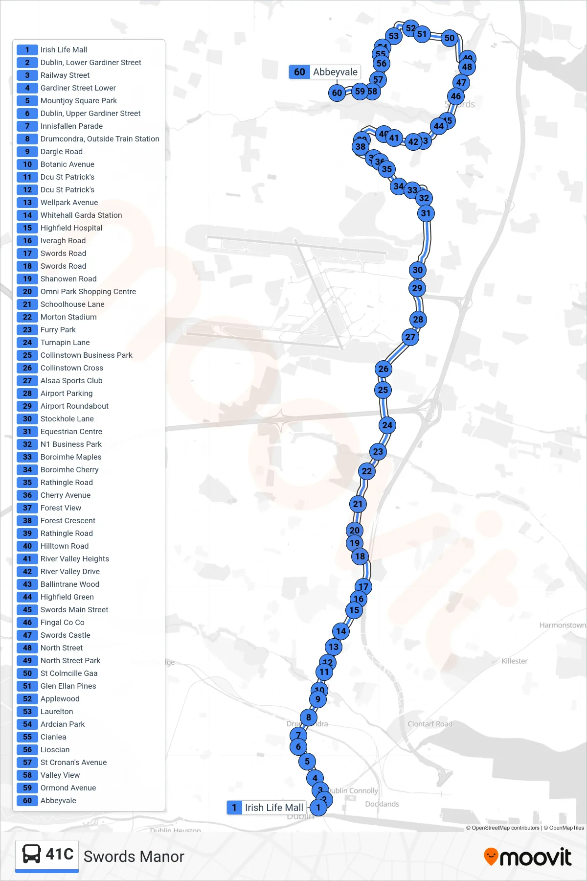
Stops list (41C - Swords Manor)
- Irish Life Mall
- Dublin, Lower Gardiner Street
- Railway Street
- Gardiner Street Lower
- Mountjoy Square Park
- Dublin, Upper Gardiner Street
- Innisfallen Parade
- Drumcondra, Outside Train Station
- Dargle Road
- Botanic Avenue
- Dcu St Patrick's
- Dcu St Patrick's
- Wellpark Avenue
- Whitehall Garda Station
- Highfield Hospital
- Iveragh Road
- Swords Road
- Swords Road
- Shanowen Road
- Omni Park Shopping Centre
- Schoolhouse Lane
- Morton Stadium
- Furry Park
- Turnapin Lane
- Collinstown Business Park
- Collinstown Cross
- Alsaa Sports Club
- Airport Parking
- Airport Roundabout
- Stockhole Lane
- Equestrian Centre
- N1 Business Park
- Boroimhe Maples
- Boroimhe Cherry
- Rathingle Road
- Cherry Avenue
- Forest View
- Forest Crescent
- Rathingle Road
- Hilltown Road
- River Valley Heights
- River Valley Drive
- Ballintrane Wood
- Highfield Green
- Swords Main Street
- Fingal Co Co
- Swords Castle
- North Street
- North Street Park
- St Colmcille Gaa
- Glen Ellan Pines
- Applewood
- Laurelton
- Ardcian Park
- Cianlea
- Lioscian
- St Cronan's Avenue
- Valley View
- Ormond Avenue
- Abbeyvale