
42 Bus Route Map
View the 42 route map and see all 42 stops along the route. The map of 42 shows where the bus travels and the location of each stop, making it easy to understand the entire route at a glance.
Explore KP Kyivpastrans routes on the map and see where KP Kyivpastrans bus services operate. Use the 42 map to find bus stops and see how the 42 connects different areas along its trip.
All 42 stops on the map are displayed in route order, helping you follow the 42 bus from the first stop to the last.
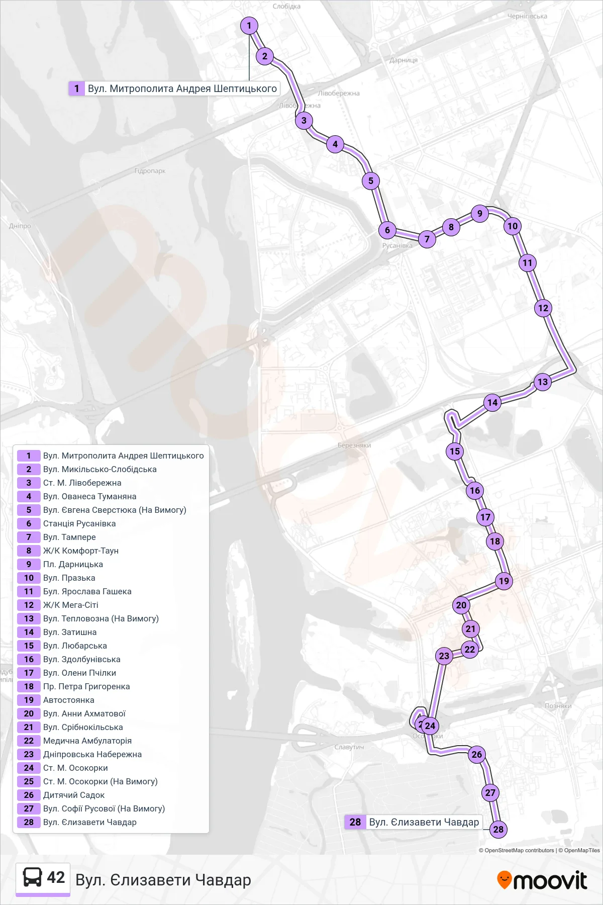
Stops list (42 - Yelyzavety Chavdar St.)
- Metropolitan Andrey Sheptytsky St
- Mykilsko-Slobidska Street
- Livoberezhna Metro Station
- Hovanes Tumanian Street
- Yevhena Sverstyuka Street (On Demand)
- Rusanivka Station
- Tampere Street
- Comfort Town Complex
- Darnytska Square
- Prazka Street
- Yaroslava Hasheka Boulevard
- Mega City Complex
- Teplovozna Street (On Request)
- Zatyshna Street
- Liubarska Street
- Zdolbunivska St.
- Oleny Pchilky Street
- Petra Hryhorenka Ave
- Parking Lot
- Anna Akhmatova Street
- Sribnokil'ska Street
- Medical Clinic
- Dnipro Embankment
- Osokorky Metro Station
- Osokorky Metro Station (On Demand)
- Kindergarten
- Sofia Rusova Street (On Demand)
- Yelyzavety Chavdar St.