
42 Bus Route Map
View the 42 route map and see all 42 stops along the route. The map of 42 shows where the bus travels and the location of each stop, making it easy to understand the entire route at a glance.
Explore Autobuses routes on the map and see where Autobuses bus services operate. Use the 42 map to find bus stops and see how the 42 connects different areas along its trip.
All 42 stops on the map are displayed in route order, helping you follow the 42 bus from the first stop to the last.
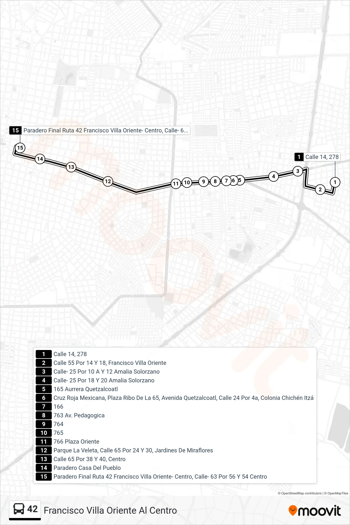
Stops list (42 - Francisco Villa Oriente Al Centro)
- Calle 14, 278
- Calle 55 Por 14 Y 18, Francisco Villa Oriente
- Calle- 25 Por 10 A Y 12 Amalia Solorzano
- Calle- 25 Por 18 Y 20 Amalia Solorzano
- 165 Aurrera Quetzalcoatl
- Cruz Roja Mexicana, Plaza Ribo De La 65, Avenida Quetzalcoatl, Calle 24 Por 4a, Colonia Chichén Itzá
- 166
- 763 Av. Pedagogica
- 764
- 765
- 766 Plaza Oriente
- Parque La Veleta, Calle 65 Por 24 Y 30, Jardines De Miraflores
- Calle 65 Por 38 Y 40, Centro
- Paradero Casa Del Pueblo
- Paradero Final Ruta 42 Francisco Villa Oriente- Centro, Calle- 63 Por 56 Y 54 Centro