
426 Bus Route Map
View the 426 route map and see all 426 stops along the route. The map of 426 shows where the bus travels and the location of each stop, making it easy to understand the entire route at a glance.
Explore Busverkehr Oder-Spree GmbH routes on the map and see where Busverkehr Oder-Spree GmbH bus services operate. Use the 426 map to find bus stops and see how the 426 connects different areas along its trip.
All 426 stops on the map are displayed in route order, helping you follow the 426 bus from the first stop to the last.
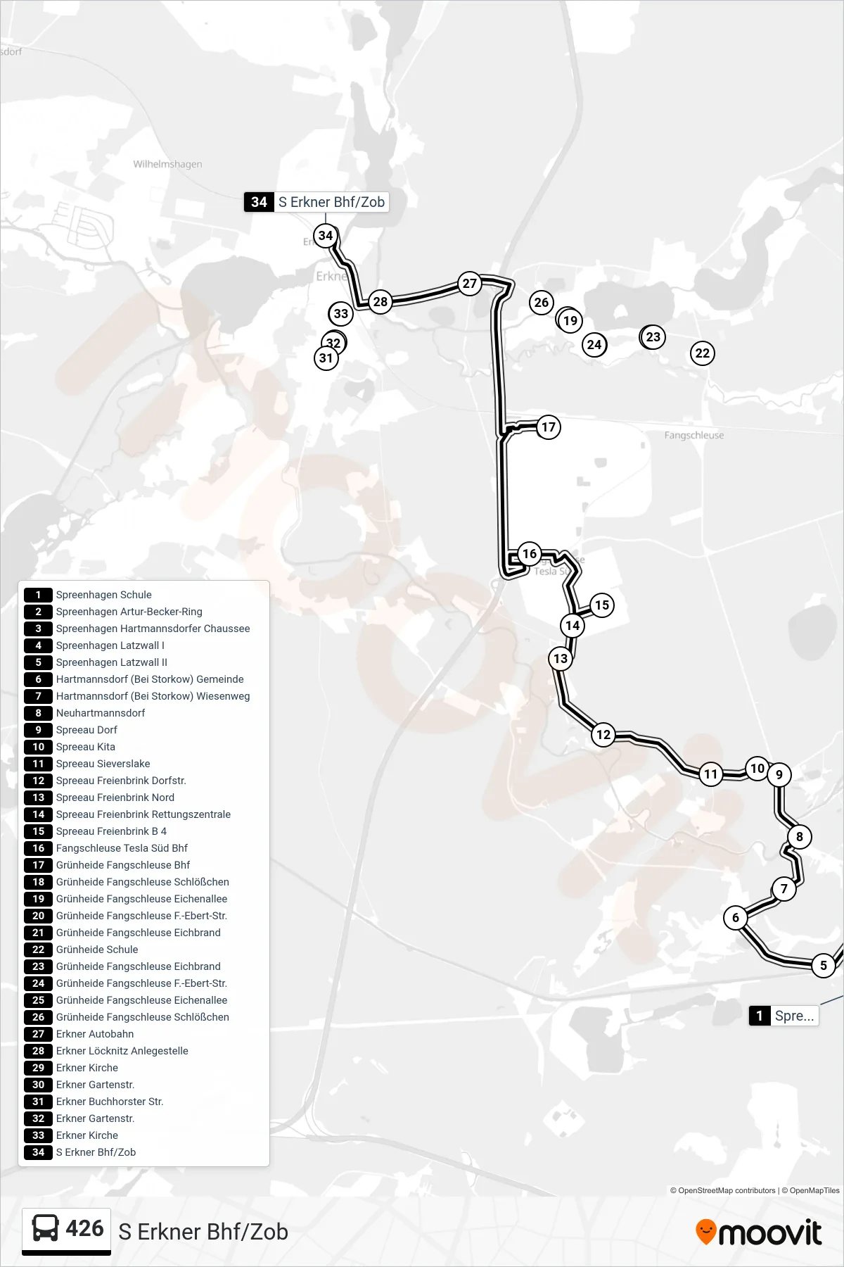
Stops list (426 - S Erkner Bhf/Zob)
- Spreenhagen Schule
- Spreenhagen Artur-Becker-Ring
- Spreenhagen Hartmannsdorfer Chaussee
- Spreenhagen Latzwall I
- Spreenhagen Latzwall II
- Hartmannsdorf (Bei Storkow) Gemeinde
- Hartmannsdorf (Bei Storkow) Wiesenweg
- Neuhartmannsdorf
- Spreeau Dorf
- Spreeau Kita
- Spreeau Sieverslake
- Spreeau Freienbrink Dorfstr.
- Spreeau Freienbrink Nord
- Spreeau Freienbrink Rettungszentrale
- Spreeau Freienbrink B 4
- Fangschleuse Tesla Süd Bhf
- Grünheide Fangschleuse Bhf
- Grünheide Fangschleuse Schlößchen
- Grünheide Fangschleuse Eichenallee
- Grünheide Fangschleuse F.-Ebert-Str.
- Grünheide Fangschleuse Eichbrand
- Grünheide Schule
- Grünheide Fangschleuse Eichbrand
- Grünheide Fangschleuse F.-Ebert-Str.
- Grünheide Fangschleuse Eichenallee
- Grünheide Fangschleuse Schlößchen
- Erkner Autobahn
- Erkner Löcknitz Anlegestelle
- Erkner Kirche
- Erkner Gartenstr.
- Erkner Buchhorster Str.
- Erkner Gartenstr.
- Erkner Kirche
- S Erkner Bhf/Zob