
426 Bus Route Map
View the 426 route map and see all 426 stops along the route. The map of 426 shows where the bus travels and the location of each stop, making it easy to understand the entire route at a glance.
Explore Egged routes on the map and see where Egged bus services operate. Use the 426 map to find bus stops and see how the 426 connects different areas along its trip.
All 426 stops on the map are displayed in route order, helping you follow the 426 bus from the first stop to the last.
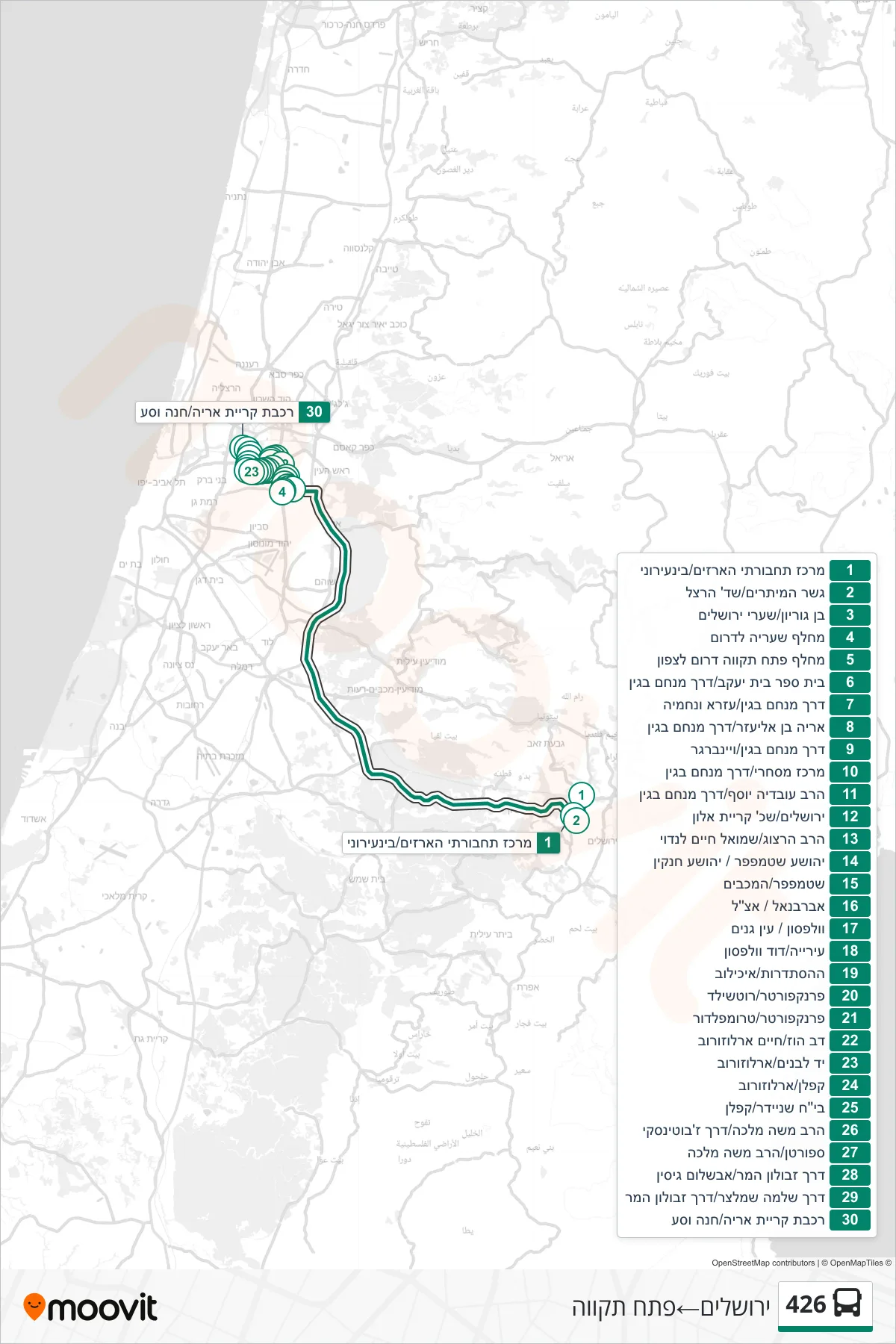
Stops list (426 - Jerusalem→Petah Tikva)
- Arazim Transport Center/Intercity
- String Bridge/Herzl Boulevard
- Ben Gurion/Sha'arei Yerushalayim
- Shaaria Interchange South
- Petah Tikva South Interchange Northbound
- Beit Yaakov School/Menachem Begin Road
- Menachem Begin Road/Ezra VeNehemia
- Aryeh Ben Eliezer/Menachem Begin Road
- Menachem Begin Road/Weinberger
- Commercial Center/Menachem Begin Road
- Rabbi Ovadia Yosef/Menachem Begin Road
- Jerusalem/Kiryat Alon
- Rabbi Herzog/Shmuel Chaim Landau
- Yehoshua Stampfer/Yehoshua Hankin
- Stampfer/HaMaccabim
- Abarbanel/Etzel
- Wolfson/Ein Ganim
- City Hall/David Wolfson
- HaHistadrut/Ichilov
- Frankfurter/Rothschild
- Frankfurter/Trumpeldor
- Dov Hoz/Chaim Arlozorov
- Yad LeBanim/Arlozorov
- Kaplan/Arlozorov
- Schneider Hospital/Kaplan
- HaRav Moshe Malka/Jabotinsky Road
- Sportan/Rabbi Moshe Malka
- Zevulun Hammer Road/Avshalom Gisin
- Shlomo Schmelzer Road/Zevulun Hammer Road
- Kiryat Aryeh Station/Park & Ride