
428 Bus Route Map
View the 428 route map and see all 428 stops along the route. The map of 428 shows where the bus travels and the location of each stop, making it easy to understand the entire route at a glance.
Explore Würzburger Straßenbahn routes on the map and see where Würzburger Straßenbahn bus services operate. Use the 428 map to find bus stops and see how the 428 connects different areas along its trip.
All 428 stops on the map are displayed in route order, helping you follow the 428 bus from the first stop to the last.
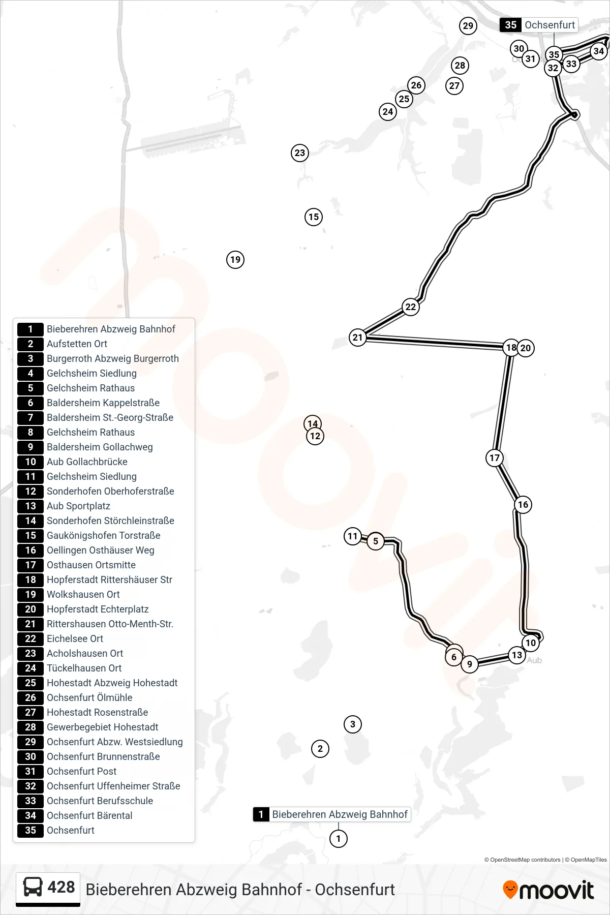
Stops list (428 - Ochsenfurt)
- Bieberehren Abzweig Bahnhof
- Aufstetten Ort
- Burgerroth Abzweig Burgerroth
- Gelchsheim Siedlung
- Gelchsheim Rathaus
- Baldersheim Kappelstraße
- Baldersheim St.-Georg-Straße
- Gelchsheim Rathaus
- Baldersheim Gollachweg
- Aub Gollachbrücke
- Gelchsheim Siedlung
- Sonderhofen Oberhoferstraße
- Aub Sportplatz
- Sonderhofen Störchleinstraße
- Gaukönigshofen Torstraße
- Oellingen Osthäuser Weg
- Osthausen Ortsmitte
- Hopferstadt Rittershäuser Str
- Wolkshausen Ort
- Hopferstadt Echterplatz
- Rittershausen Otto-Menth-Str.
- Eichelsee Ort
- Acholshausen Ort
- Tückelhausen Ort
- Hohestadt Abzweig Hohestadt
- Ochsenfurt Ölmühle
- Hohestadt Rosenstraße
- Gewerbegebiet Hohestadt
- Ochsenfurt Abzw. Westsiedlung
- Ochsenfurt Brunnenstraße
- Ochsenfurt Post
- Ochsenfurt Uffenheimer Straße
- Ochsenfurt Berufsschule
- Ochsenfurt Bärental
- Ochsenfurt