
429 Bus Route Map
View the 429 route map and see all 429 stops along the route. The map of 429 shows where the bus travels and the location of each stop, making it easy to understand the entire route at a glance.
Explore MBTA routes on the map and see where MBTA bus services operate. Use the 429 map to find bus stops and see how the 429 connects different areas along its trip.
All 429 stops on the map are displayed in route order, helping you follow the 429 bus from the first stop to the last.
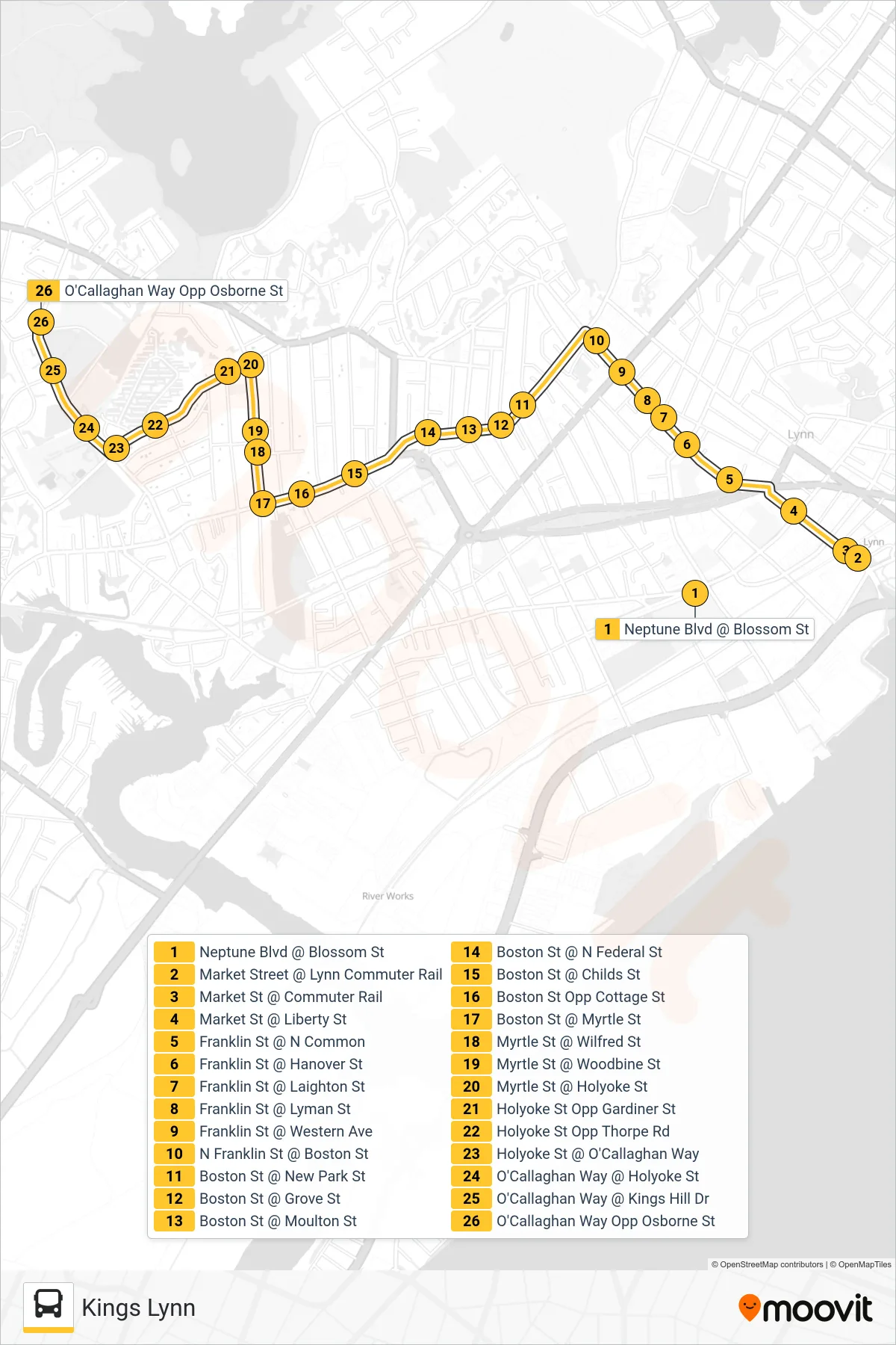
Stops list (429 - Kings Lynn)
- Neptune Blvd @ Blossom St
- Market Street @ Lynn Commuter Rail
- Market St @ Commuter Rail
- Market St @ Liberty St
- Franklin St @ N Common
- Franklin St @ Hanover St
- Franklin St @ Laighton St
- Franklin St @ Lyman St
- Franklin St @ Western Ave
- N Franklin St @ Boston St
- Boston St @ New Park St
- Boston St @ Grove St
- Boston St @ Moulton St
- Boston St @ N Federal St
- Boston St @ Childs St
- Boston St Opp Cottage St
- Boston St @ Myrtle St
- Myrtle St @ Wilfred St
- Myrtle St @ Woodbine St
- Myrtle St @ Holyoke St
- Holyoke St Opp Gardiner St
- Holyoke St Opp Thorpe Rd
- Holyoke St @ O'Callaghan Way
- O'Callaghan Way @ Holyoke St
- O'Callaghan Way @ Kings Hill Dr
- O'Callaghan Way Opp Osborne St