
42A Bus Route Map
View the 42A route map and see all 42A stops along the route. The map of 42A shows where the bus travels and the location of each stop, making it easy to understand the entire route at a glance.
Explore Grosseto, Siena and Provinces - Tuscan Bus Lines routes on the map and see where Grosseto, Siena and Provinces - Tuscan Bus Lines bus services operate. Use the 42A map to find bus stops and see how the 42A connects different areas along its trip.
All 42A stops on the map are displayed in route order, helping you follow the 42A bus from the first stop to the last.
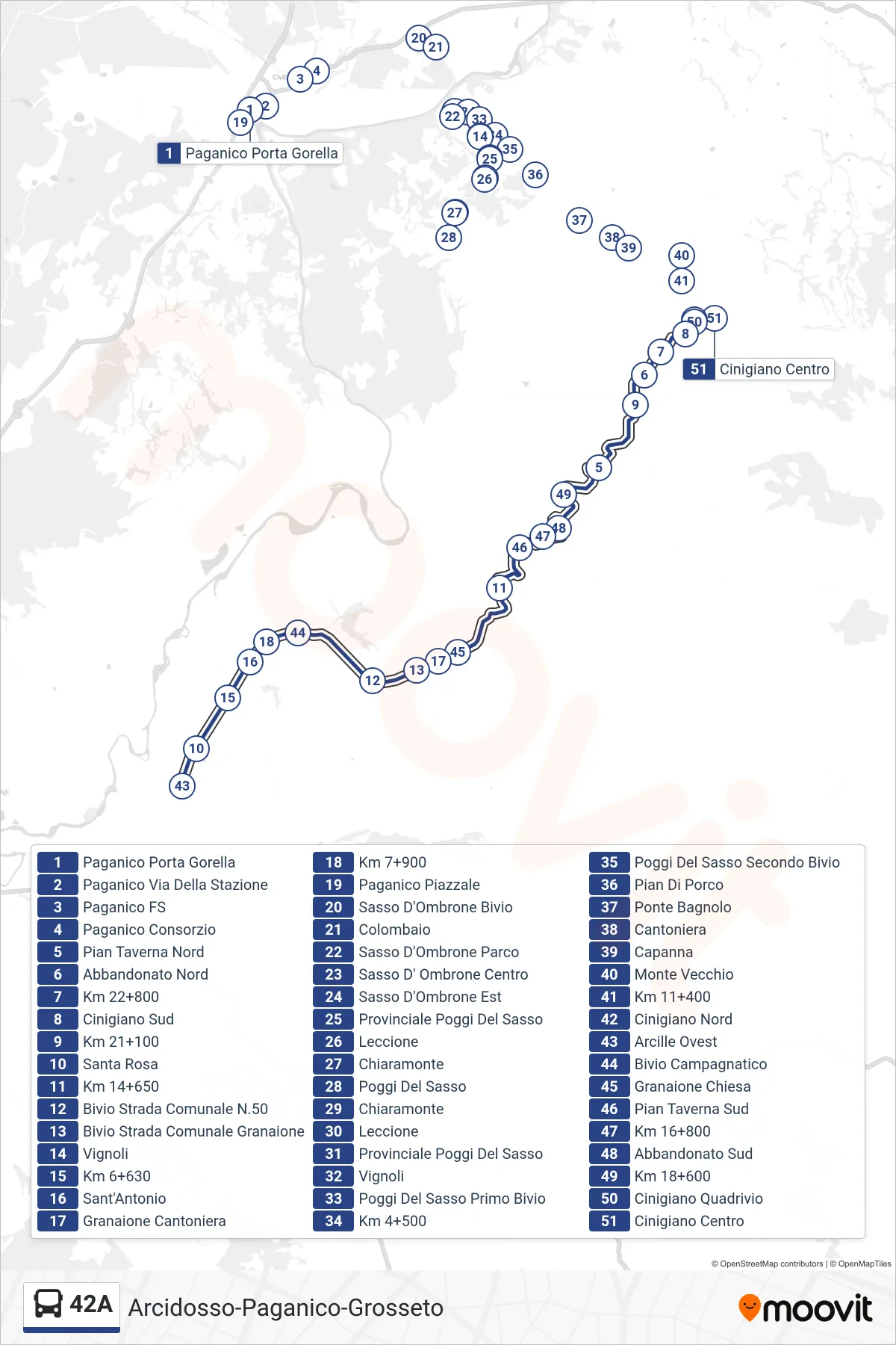
Stops list (42A - Cinigiano Center)
- Paganico Porta Gorella
- Paganico Station Road
- Paganico Railway Station
- Paganico Consortium
- North Pian Taverna
- North Abandoned
- Km 22+800
- Cinigiano South
- Km 21+100
- Santa Rosa
- Km 14+650
- Municipal Road N.50 Junction
- Municipal Road Granaione Junction
- Vignoli
- Km 6+630
- Sant'Antonio
- Granaione Checkpoint
- Km 7+900
- Paganico Square
- Sasso D'Ombrone Junction
- Colombaio
- Sasso d'Ombrone Park
- Sasso D'Ombrone Center
- Sasso d'Ombrone East
- Provincial Poggi Del Sasso
- Leccione
- Chiaramonte
- Poggi Del Sasso
- Chiaramonte
- Leccione
- Provincial Poggi Del Sasso
- Vignoli
- Poggi Del Sasso First Junction
- Km 4+500
- Poggi Del Sasso Second Junction
- Pian di Porco
- Bagnolo Bridge
- Cantoniera
- Capanna
- Monte Vecchio
- Km 11+400
- Cinigiano North
- Arcille West
- Campagnatico Junction
- Granaione Church
- South Pian Taverna
- Km 16+800
- South Abandoned
- Km 18+600
- Cinigiano Crossroads
- Cinigiano Center
Change direction
- Route Map - 42A - Arcidosso Bus Station
- Route Map - 42A - Cinigiano Center
- Route Map - 42A - Paganico Square
- Route Map - 42A - Castel Del Piano Central
- Route Map - 42A - Sasso D'Ombrone Center
- Route Map - 42A - Falsettaio (South)
- Route Map - 42A - Arcidosso Bus Station
- Route Map - 42A - Arcille West
- Route Map - 42A - Castel Del Piano Central