
43 Bus Route Map
View the 43 route map and see all 43 stops along the route. The map of 43 shows where the bus travels and the location of each stop, making it easy to understand the entire route at a glance.
Explore TEC Charleroi routes on the map and see where TEC Charleroi bus services operate. Use the 43 map to find bus stops and see how the 43 connects different areas along its trip.
All 43 stops on the map are displayed in route order, helping you follow the 43 bus from the first stop to the last.
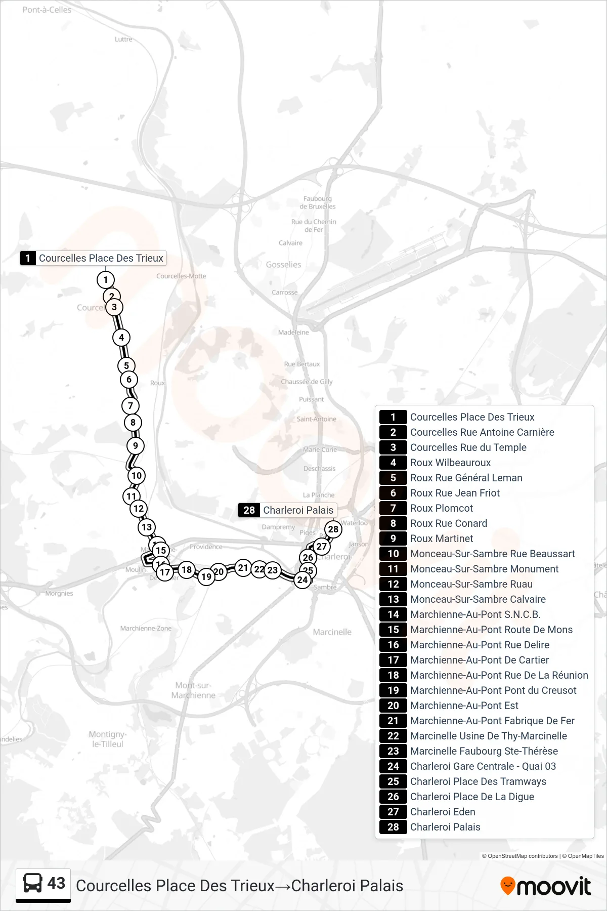
Stops list (43 - Courcelles Trieux Square→Charleroi Palace)
- Courcelles Trieux Square
- Courcelles Antoine Carnière Street
- Courcelles Temple Street
- Roux Wilbeauroux
- Roux General Leman Street
- Roux Jean Friot Street
- Roux Plomcot
- Roux Conard Street
- Roux Martinet
- Monceau-Sur-Sambre Beaussart Street
- Monceau-Sur-Sambre Monument
- Monceau-Sur-Sambre Ruau
- Monceau-Sur-Sambre Calvary
- Marchienne-Au-Pont Railway Station
- Marchienne-Au-Pont Mons Road
- Marchienne-Au-Pont Delire Street
- Marchienne-Au-Pont De Cartier
- Marchienne-Au-Pont Reunion Street
- Marchienne-Au-Pont Creusot Bridge
- Marchienne-Au-Pont East
- Marchienne-Au-Pont Iron Factory
- Marcinelle Thy-Marcinelle Factory
- Marcinelle St. Therese Suburb
- Charleroi Central Station - Platform 03
- Charleroi Tramways Square
- Charleroi Digue Square
- Charleroi Eden
- Charleroi Palace
Change direction
- Route Map - 43 - Charleroi Central Station - Platform 09→Charleroi Central Station - Platform 05
- Route Map - 43 - Trazegnies The Schools→Charleroi Palace
- Route Map - 43 - Charleroi Central Station - Platform 09→Trazegnies The Schools
- Route Map - 43 - Charleroi Central Station - Platform 09→Courcelles Trieux Square
- Route Map - 43 - Trazegnies The Schools→Charleroi Central Station - Platform 05