
434 Bus Route Map
View the 434 route map and see all 434 stops along the route. The map of 434 shows where the bus travels and the location of each stop, making it easy to understand the entire route at a glance.
Explore wupsi wupsi GmbH routes on the map and see where wupsi wupsi GmbH bus services operate. Use the 434 map to find bus stops and see how the 434 connects different areas along its trip.
All 434 stops on the map are displayed in route order, helping you follow the 434 bus from the first stop to the last.
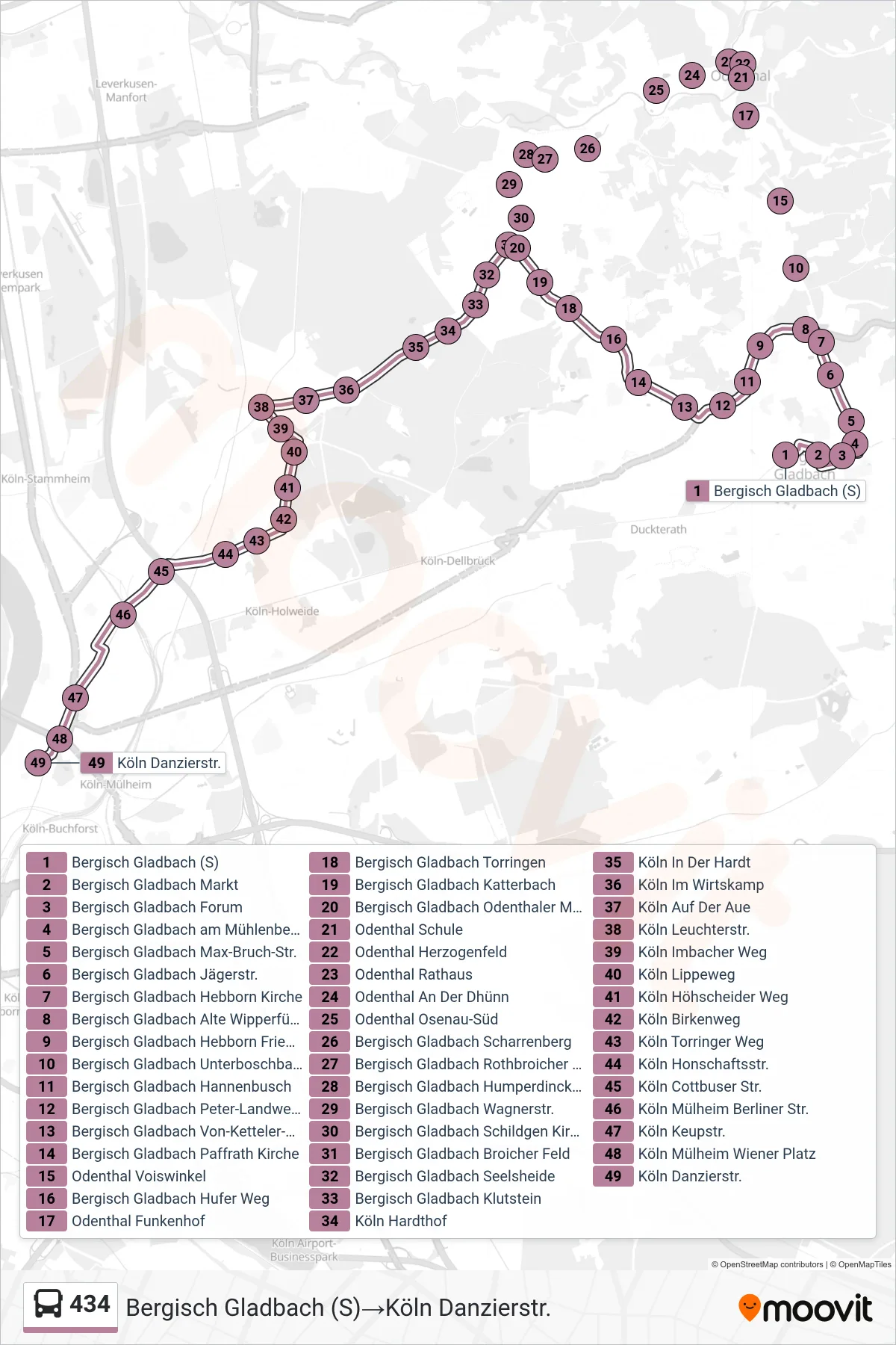

Stops list (434 - Bergisch Gladbach (S)→Köln Danzierstr.)
- Bergisch Gladbach (S)
- Bergisch Gladbach Markt
- Bergisch Gladbach Forum
- Bergisch Gladbach am Mühlenberg
- Bergisch Gladbach Max-Bruch-Str.
- Bergisch Gladbach Jägerstr.
- Bergisch Gladbach Hebborn Kirche
- Bergisch Gladbach Unterboschbach
- Odenthal Voiswinkel
- Odenthal Funkenhof
- Odenthal Schule
- Odenthal Herzogenfeld
- Odenthal Rathaus
- Odenthal An Der Dhünn
- Odenthal Osenau-Süd
- Bergisch Gladbach Scharrenberg
- Bergisch Gladbach Brahmsstr.
- Bergisch Gladbach Schildgen Kirche
- Bergisch Gladbach Broicher Feld
- Bergisch Gladbach Seelsheide
- Bergisch Gladbach Klutstein
- Köln Hardthof
- Köln In Der Hardt
- Köln Im Wirtskamp
- Köln Auf Der Aue
- Köln Leuchterstr.
- Köln Imbacher Weg
- Köln Lippeweg
- Köln Höhscheider Weg
- Köln Birkenweg
- Köln Torringer Weg
- Köln Honschaftsstr.
- Köln Cottbuser Str.
- Köln Mülheim Berliner Str.
- Köln Keupstr.
- Köln Mülheim Wiener Platz
- Köln Danzierstr.
Change direction
- Route Map - 434 - Köln Imbacher Weg→Bergisch Gladbach (S)
- Route Map - 434 - Bergisch Gladbach (S)→Köln Leuchterstr.
- Route Map - 434 - Bergisch Gladbach Schildgen Kirche→Bergisch Gladbach (S)
- Route Map - 434 - Bergisch Gladbach (S)→Köln Imbacher Weg
- Route Map - 434 - Köln Leuchterstr.→Bergisch Gladbach Broicher Feld
- Route Map - 434 - Köln Danzierstr.→Bergisch Gladbach (S)
- Route Map - 434 - Köln Leuchterstr.→Bergisch Gladbach (S)
- Route Map - 434 - Odenthal Schule→Bergisch Gladbach Schildgen Kirche