
435 Bus Route Map
View the 435 route map and see all 435 stops along the route. The map of 435 shows where the bus travels and the location of each stop, making it easy to understand the entire route at a glance.
Explore WestVerkehr GmbH routes on the map and see where WestVerkehr GmbH bus services operate. Use the 435 map to find bus stops and see how the 435 connects different areas along its trip.
All 435 stops on the map are displayed in route order, helping you follow the 435 bus from the first stop to the last.
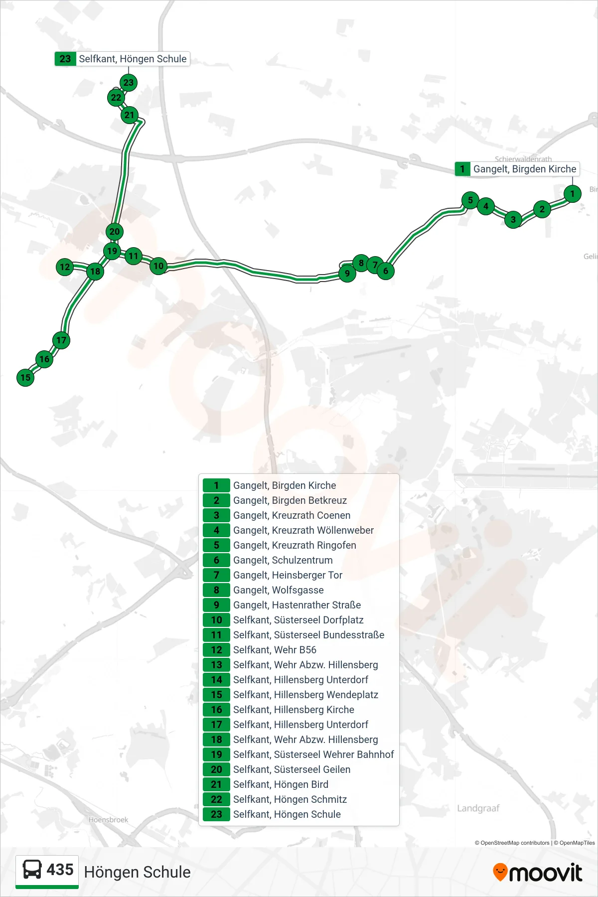
Stops list (435 - Höngen Schule)
- Gangelt, Birgden Kirche
- Gangelt, Birgden Betkreuz
- Gangelt, Kreuzrath Coenen
- Gangelt, Kreuzrath Wöllenweber
- Gangelt, Kreuzrath Ringofen
- Gangelt, Schulzentrum
- Gangelt, Heinsberger Tor
- Gangelt, Wolfsgasse
- Gangelt, Hastenrather Straße
- Selfkant, Süsterseel Dorfplatz
- Selfkant, Süsterseel Bundesstraße
- Selfkant, Wehr B56
- Selfkant, Wehr Abzw. Hillensberg
- Selfkant, Hillensberg Unterdorf
- Selfkant, Hillensberg Wendeplatz
- Selfkant, Hillensberg Kirche
- Selfkant, Hillensberg Unterdorf
- Selfkant, Wehr Abzw. Hillensberg
- Selfkant, Süsterseel Wehrer Bahnhof
- Selfkant, Süsterseel Geilen
- Selfkant, Höngen Bird
- Selfkant, Höngen Schmitz
- Selfkant, Höngen Schule
Change direction
- Route Map - 435 - Einsatzwagen Gangelt
- Route Map - 435 - Selfkant, Höngen Schule
- Route Map - 435 - Birgden Schule Weiter Als 423
- Route Map - 435 - Einsatzwagen Gangelt Schulz.
- Route Map - 435 - Gangelt, Schulzentrum
- Route Map - 435 - Geilenkirchen, Bahnhof (Bus)
- Route Map - 435 - Einsatzwagen Gangelt Ü.Birgd.
- Route Map - 435 - Birgden Schule
- Route Map - 435 - Tüddern Apotheke