
439 Bus Route Map
View the 439 route map and see all 439 stops along the route. The map of 439 shows where the bus travels and the location of each stop, making it easy to understand the entire route at a glance.
Explore FriBus routes on the map and see where FriBus bus services operate. Use the 439 map to find bus stops and see how the 439 connects different areas along its trip.
All 439 stops on the map are displayed in route order, helping you follow the 439 bus from the first stop to the last.
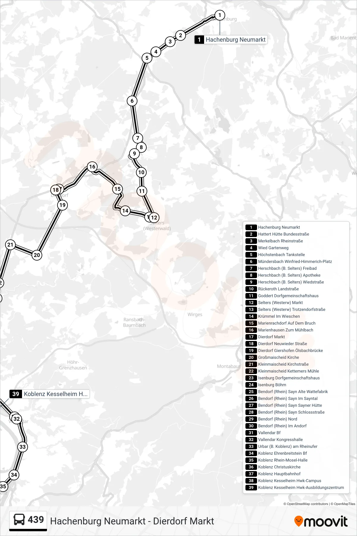
Stops list (439 - Koblenz Kesselheim Hwk-Ausbildungszentrum)
- Hachenburg Neumarkt
- Hattert Hütte Bundesstraße
- Merkelbach Rheinstraße
- Wied Gartenweg
- Höchstenbach Tankstelle
- Mündersbach Winfried-Himmerich-Platz
- Herschbach (B. Selters) Freibad
- Herschbach (B. Selters) Apotheke
- Herschbach (B. Selters) Wiedstraße
- Rückeroth Landstraße
- Goddert Dorfgemeinschaftshaus
- Selters (Westerw) Markt
- Selters (Westerw) Trotzendorfstraße
- Krümmel Im Wieschen
- Marienrachdorf Auf Dem Bruch
- Marienhausen Zum Mühlbach
- Dierdorf Markt
- Dierdorf Neuwieder Straße
- Dierdorf Giershofen Ölsbachbrücke
- Großmaischeid Kirche
- Kleinmaischeid Kirchstraße
- Kleinmaischeid Kettemers Mühle
- Isenburg Dorfgemeinschaftshaus
- Isenburg Böhm
- Bendorf (Rhein) Sayn Alte Wattefabrik
- Bendorf (Rhein) Sayn Im Sayntal
- Bendorf (Rhein) Sayn Sayner Hütte
- Bendorf (Rhein) Sayn Schlossstraße
- Bendorf (Rhein) Nord
- Bendorf (Rhein) Im Andorf
- Vallendar Bf
- Vallendar Kongresshalle
- Urbar (B. Koblenz) am Rheinufer
- Koblenz Ehrenbreitstein Bf
- Koblenz Rhein-Mosel-Halle
- Koblenz Christuskirche
- Koblenz Hauptbahnhof
- Koblenz Kesselheim Hwk-Campus
- Koblenz Kesselheim Hwk-Ausbildungszentrum