
44 Bus Route Map
View the 44 route map and see all 44 stops along the route. The map of 44 shows where the bus travels and the location of each stop, making it easy to understand the entire route at a glance.
Explore Astuce (Métropole Rouen Normandie) routes on the map and see where Astuce (Métropole Rouen Normandie) bus services operate. Use the 44 map to find bus stops and see how the 44 connects different areas along its trip.
All 44 stops on the map are displayed in route order, helping you follow the 44 bus from the first stop to the last.
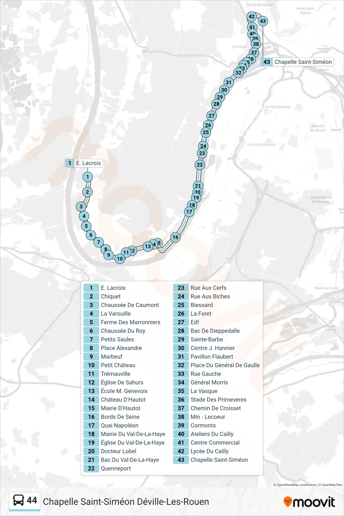
Stops list (44 - Chapelle Saint-Siméon Déville-Les-Rouen)
- E. Lacroix
- Chiquet
- Chaussée De Caumont
- La Varouille
- Ferme Des Marronniers
- Chaussée Du Roy
- Petits Saules
- Place Alexandre
- Marbeuf
- Petit Château
- Trémauville
- Église De Sahurs
- École M. Genevoix
- Château D'Hautot
- Mairie D'Hautot
- Bords De Seine
- Quai Napoléon
- Mairie Du Val-De-La-Haye
- Église Du Val-De-La-Haye
- Docteur Lobel
- Bac Du Val-De-La-Haye
- Quenneport
- Rue Aux Cerfs
- Rue Aux Biches
- Biessard
- La Foret
- Edf
- Bac De Dieppedalle
- Sainte-Barbe
- Centre J. Hannier
- Pavillon Flaubert
- Place Du Général De Gaulle
- Rue Gauche
- Général Morris
- La Vasque
- Stade Des Primeveres
- Chemin De Croisset
- Min - Lecoeur
- Cormonts
- Ateliers Du Cailly
- Centre Commercial
- Lycée Du Cailly
- Chapelle Saint-Siméon