
441 Bus Route Map
View the 441 route map and see all 441 stops along the route. The map of 441 shows where the bus travels and the location of each stop, making it easy to understand the entire route at a glance.
Explore Busverkehr Oder-Spree GmbH routes on the map and see where Busverkehr Oder-Spree GmbH bus services operate. Use the 441 map to find bus stops and see how the 441 connects different areas along its trip.
All 441 stops on the map are displayed in route order, helping you follow the 441 bus from the first stop to the last.
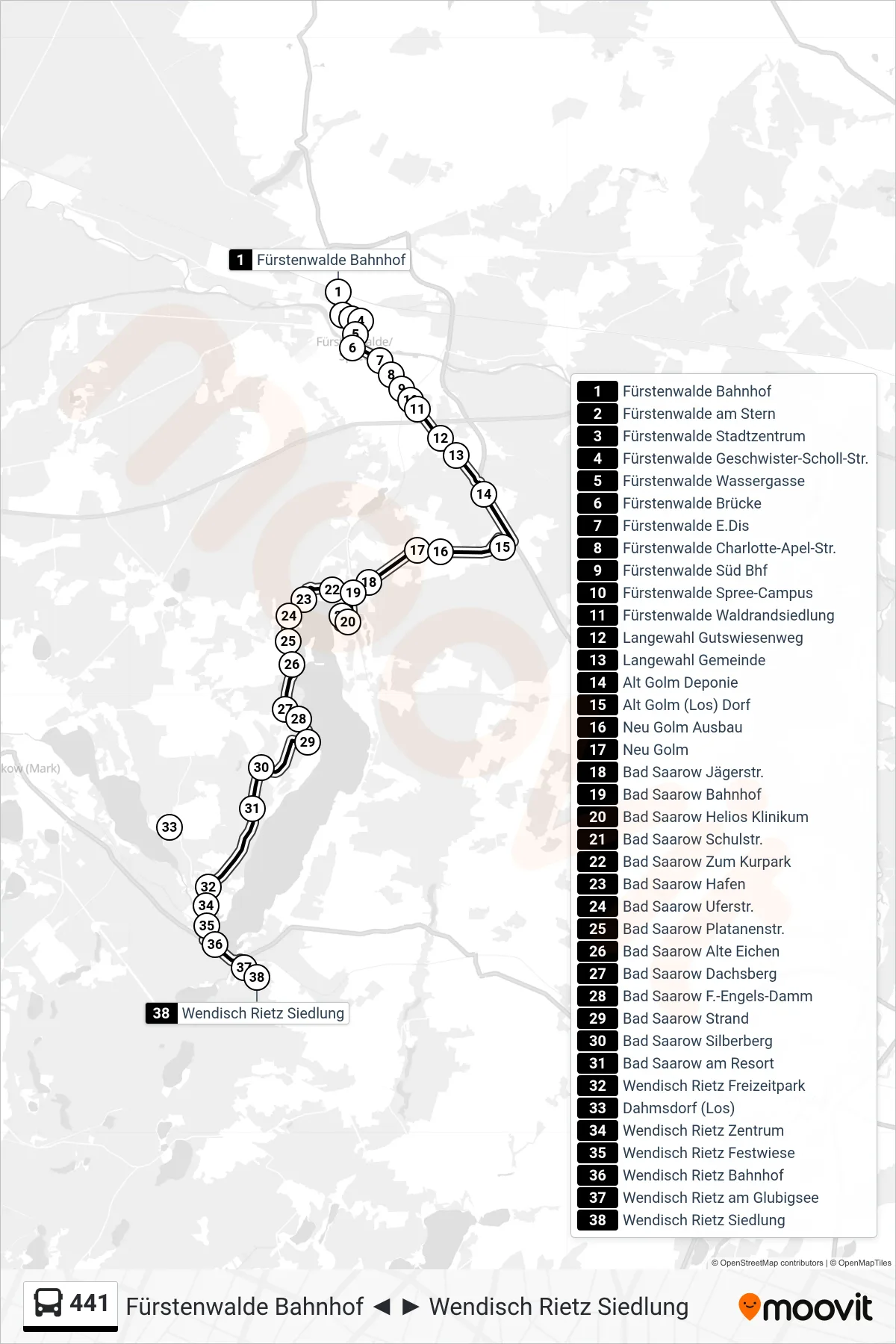
Stops list (441 - Wendisch Rietz Siedlung)
- Fürstenwalde Bahnhof
- Fürstenwalde am Stern
- Fürstenwalde Stadtzentrum
- Fürstenwalde Geschwister-Scholl-Str.
- Fürstenwalde Wassergasse
- Fürstenwalde Brücke
- Fürstenwalde E.Dis
- Fürstenwalde Charlotte-Apel-Str.
- Fürstenwalde Süd Bhf
- Fürstenwalde Spree-Campus
- Fürstenwalde Waldrandsiedlung
- Langewahl Gutswiesenweg
- Langewahl Gemeinde
- Alt Golm Deponie
- Alt Golm (Los) Dorf
- Neu Golm Ausbau
- Neu Golm
- Bad Saarow Jägerstr.
- Bad Saarow Bahnhof
- Bad Saarow Helios Klinikum
- Bad Saarow Schulstr.
- Bad Saarow Zum Kurpark
- Bad Saarow Hafen
- Bad Saarow Uferstr.
- Bad Saarow Platanenstr.
- Bad Saarow Alte Eichen
- Bad Saarow Dachsberg
- Bad Saarow F.-Engels-Damm
- Bad Saarow Strand
- Bad Saarow Silberberg
- Bad Saarow am Resort
- Wendisch Rietz Freizeitpark
- Dahmsdorf (Los)
- Wendisch Rietz Zentrum
- Wendisch Rietz Festwiese
- Wendisch Rietz Bahnhof
- Wendisch Rietz am Glubigsee
- Wendisch Rietz Siedlung