
446 Bus Route Map
View the 446 route map and see all 446 stops along the route. The map of 446 shows where the bus travels and the location of each stop, making it easy to understand the entire route at a glance.
Explore Metropoline routes on the map and see where Metropoline bus services operate. Use the 446 map to find bus stops and see how the 446 connects different areas along its trip.
All 446 stops on the map are displayed in route order, helping you follow the 446 bus from the first stop to the last.
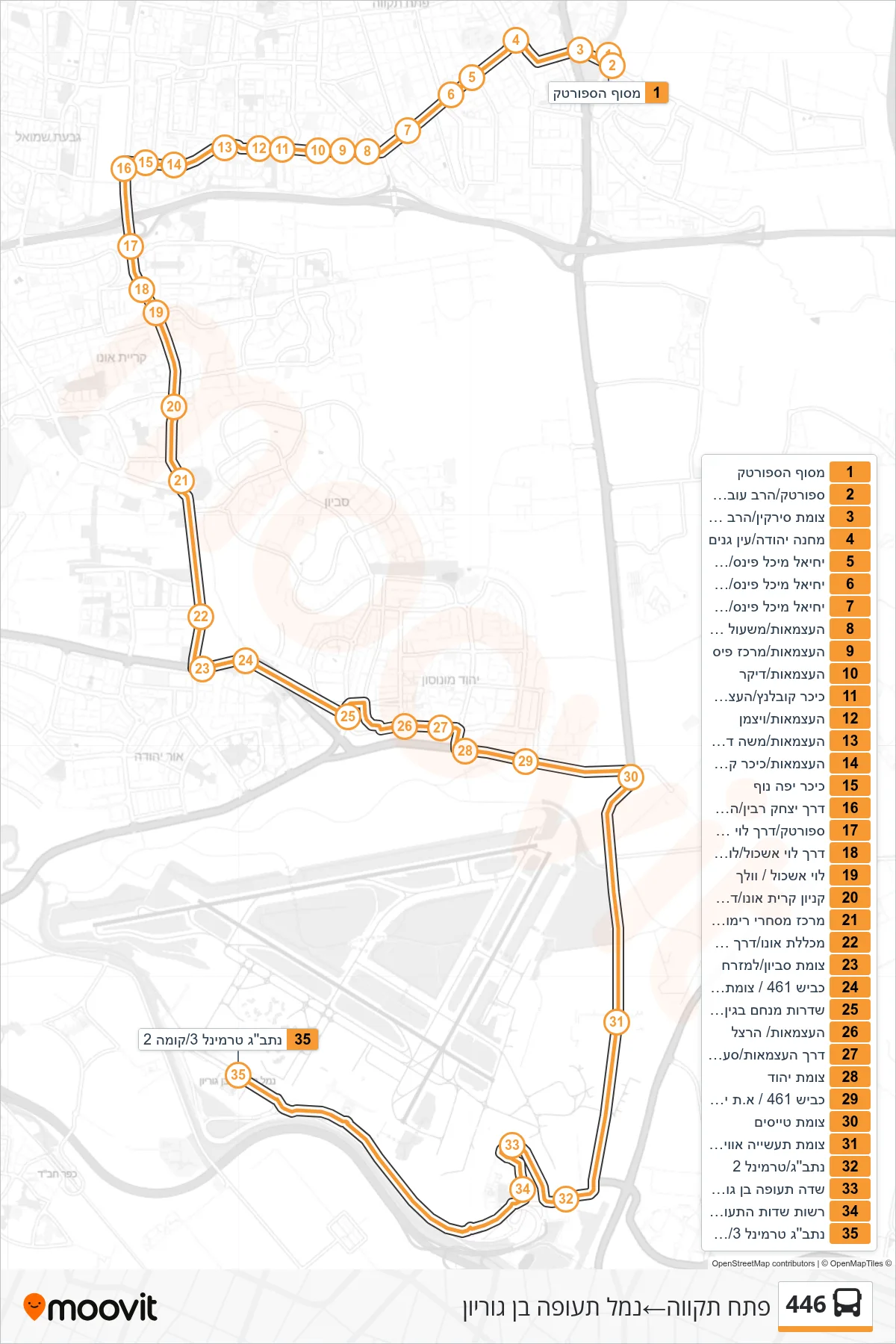
Stops list (446 - Petah Tikva→Ben Gurion Airport)
- Sportek Terminal
- Sportek/Rabbi Ovadia Yosef
- Syrkin Junction/HaRav Ovadia Yosef
- Machane Yehuda/Ein Ganim
- Yechiel Michel Pines/Zvi Hirsch Kalischer
- Yechiel Michel Pines/Orlansky
- Yechiel Michel Pines/Rothschild
- HaAtzmaut/Dr. Naftali Kaventzel Path
- HaAtzmaut/Pais Center
- Ha'Atzmaut/Diker
- Koblenz Square/Ha'Atzmaut
- HaAtzmaut/Weizmann
- HaAtzmaut/Moshe David Meisner
- HaAtzmaut/Kaplansky Square
- Yefe Nof Square
- Yitzhak Rabin Road/HaAtzmaut
- Sportek/Levi Eshkol Road
- Levi Eshkol Road/Los Angeles
- Levi Eshkol/Wallach
- Kiryat Ono Mall/Levi Eshkol Road
- Rimon Shopping Center/Levi Eshkol Road
- Ono College/Alexandroni Road
- Savyon Junction/Eastbound
- Road 461/Neve Monosson Junction
- HaAtzmaut/Savyon Junction
- HaAtzmaut/West Yehud Junction
- HaAtzmaut/Herzl
- Independence Road/Saadia Hatuka
- Yehud Junction
- Road 461/Yehud Industrial Zone
- Tayasim Junction
- Aviation Industry Junction
- Ben Gurion Airport/Terminal 2
- Ben Gurion Airport/Terminal 1
- Airport Authority/HaAliya
- Kanaf
- Ben Gurion Airport Terminal 3/Level 2