
449 Bus Route Map
View the 449 route map and see all 449 stops along the route. The map of 449 shows where the bus travels and the location of each stop, making it easy to understand the entire route at a glance.
Explore Egged routes on the map and see where Egged bus services operate. Use the 449 map to find bus stops and see how the 449 connects different areas along its trip.
All 449 stops on the map are displayed in route order, helping you follow the 449 bus from the first stop to the last.
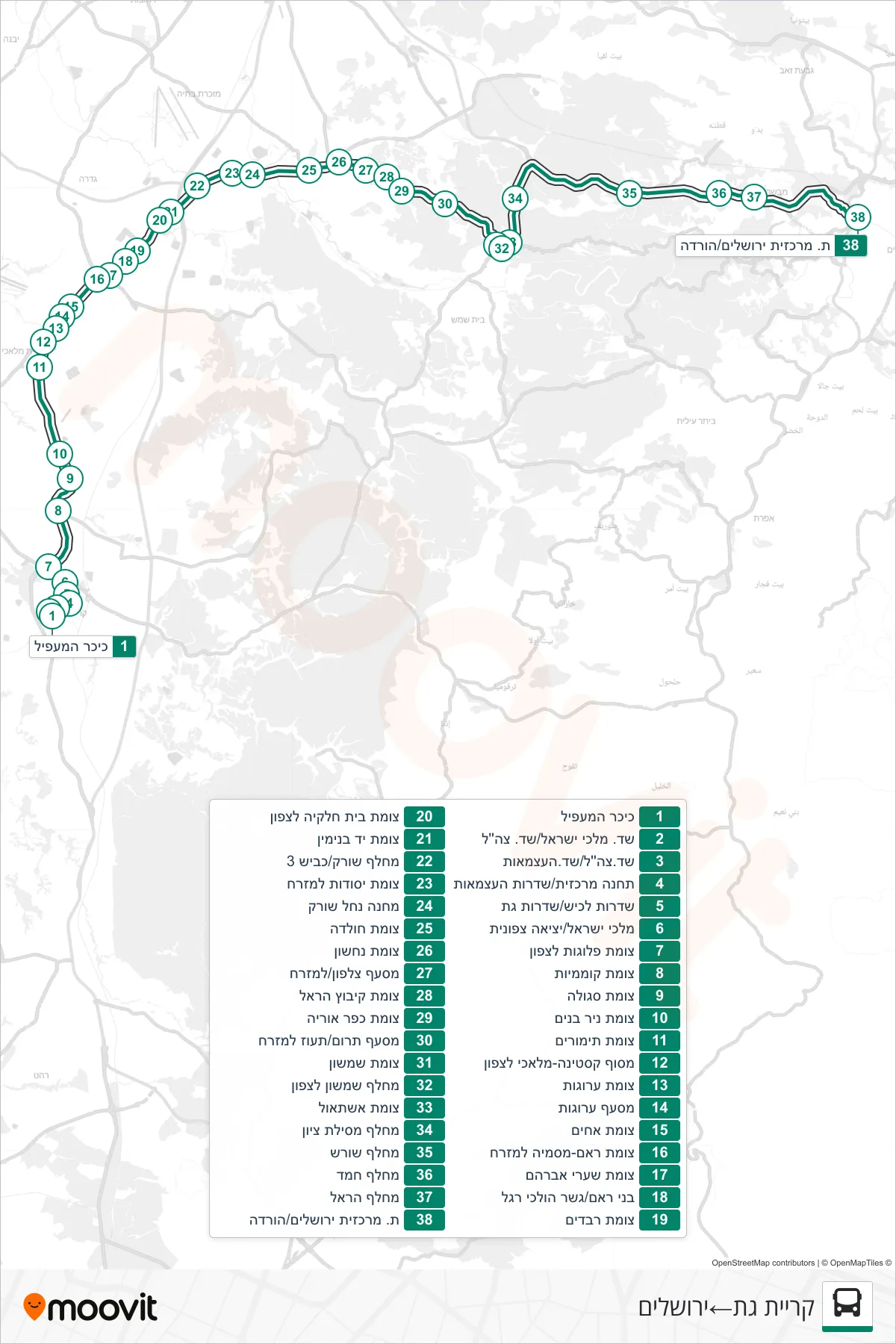
Stops list (449 - Kiryat Gat→Jerusalem)
- HaMaapil Square
- Kings of Israel Blvd/IDF Blvd
- IDF Boulevard/Independence Boulevard
- Central Station/Independence Blvd
- Lachish Blvd/Gat Blvd
- Malchei Israel/North Exit
- Plugot Junction North
- Komemiyut Junction
- Segula Junction
- Nir Banim Junction
- Timorim Junction
- Kastina-Malachi Terminal North
- Arugot Junction
- Arugot Junction
- Achim Junction
- Ra'am-Masmiya Junction Eastbound
- Shaarei Avraham Junction
- Bnei Ram/Pedestrian Bridge
- Revadim Junction
- Beit Hilkiya Junction North
- Yad Binyamin Junction
- Sorek Interchange/Road 3
- Yesodot Junction East
- Nahal Sorek Camp
- Hulda Junction
- Nachshon Junction
- Tzalfon Junction/East
- Kibbutz Harel Junction
- Kfar Uria Junction
- Terom/Taoz East Junction
- Shimshon Junction
- Shimshon Interchange North
- Eshtaol Junction
- Mesilat Zion Interchange
- Shoresh Interchange
- Hamad Interchange
- Harel Interchange
- Jerusalem Central Station/Drop Off