
455 Bus Route Map
View the 455 route map and see all 455 stops along the route. The map of 455 shows where the bus travels and the location of each stop, making it easy to understand the entire route at a glance.
Explore Galeem routes on the map and see where Galeem bus services operate. Use the 455 map to find bus stops and see how the 455 connects different areas along its trip.
All 455 stops on the map are displayed in route order, helping you follow the 455 bus from the first stop to the last.
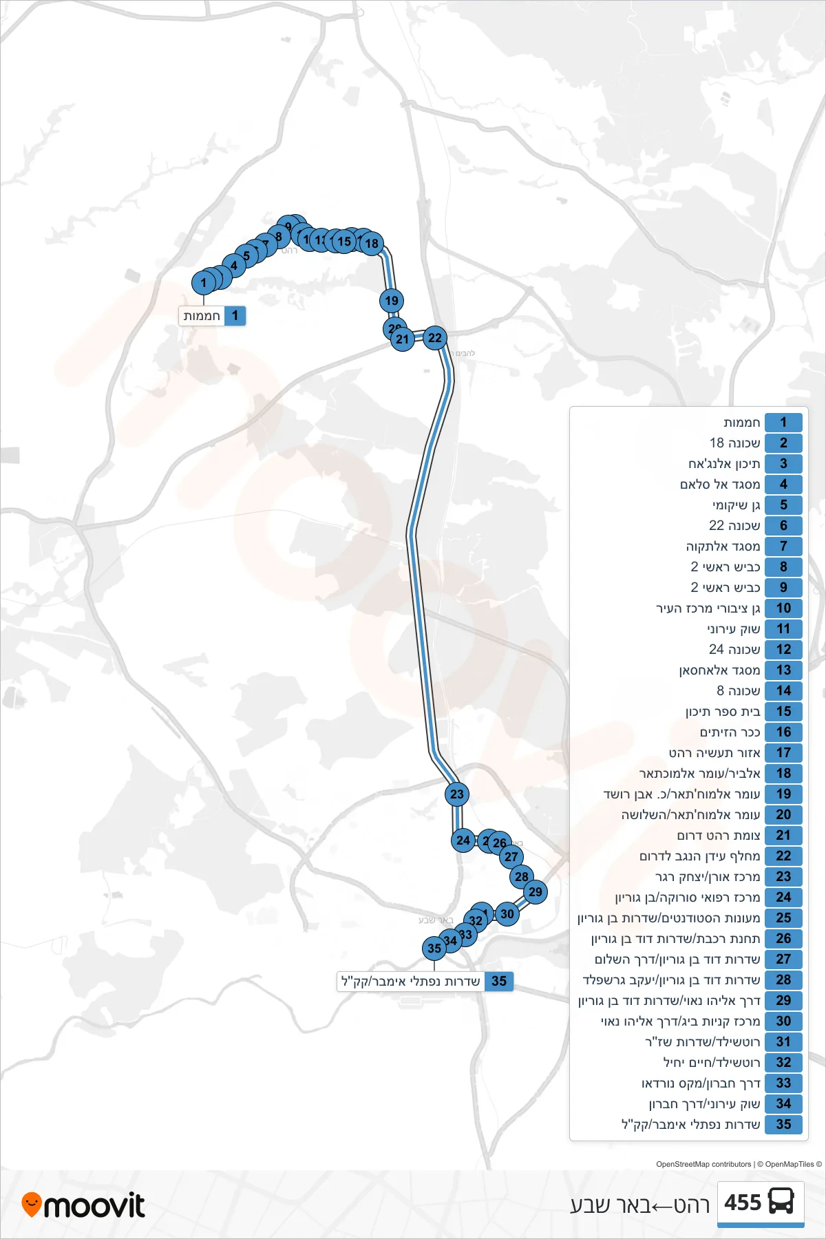
Stops list (455 - Rahat→Beer Sheva)
- Greenhouses
- Neighborhood 18
- Al-Najah High School
- Al Salam Mosque
- Rehabilitation Garden
- Neighborhood 22
- Al-Taqwa Mosque
- Main Road 2
- Main Road 2
- City Center Public Garden
- City Market
- Neighborhood 24
- Al-Ahsan Mosque
- Neighborhood 8
- High School
- Olive Square
- Rahat Industrial Zone
- Al-Bir/Omar Al-Mukhtar
- Omar Al-Mukhtar/Ibn Rushd
- Omar Al-Mukhtar/HaShlosha
- Rahat South Junction
- Idan HaNegev Interchange South
- Oren Center/Yitzhak Rager
- Soroka Medical Center/Ben Gurion
- Student Dorms/Ben Gurion Boulevard
- Train Station/David Ben Gurion Boulevard
- David Ben Gurion Boulevard/Peace Road
- David Ben Gurion Boulevard/Yaakov Gershfeld
- Eliyahu Nave Road/Ben Gurion Boulevard
- Big Shopping Center/Eliyahu Nave Road
- Rothschild/Shazar Boulevard
- Rothschild/Chaim Yechiel
- Hebron Road/Max Nordau
- City Market/Hebron Road
- Naftali Imber Boulevard/KKL