
455 Bus Route Map
View the 455 route map and see all 455 stops along the route. The map of 455 shows where the bus travels and the location of each stop, making it easy to understand the entire route at a glance.
Explore RVK Regionalverkehr Köln GmbH NL Berg.Gladb. routes on the map and see where RVK Regionalverkehr Köln GmbH NL Berg.Gladb. bus services operate. Use the 455 map to find bus stops and see how the 455 connects different areas along its trip.
All 455 stops on the map are displayed in route order, helping you follow the 455 bus from the first stop to the last.
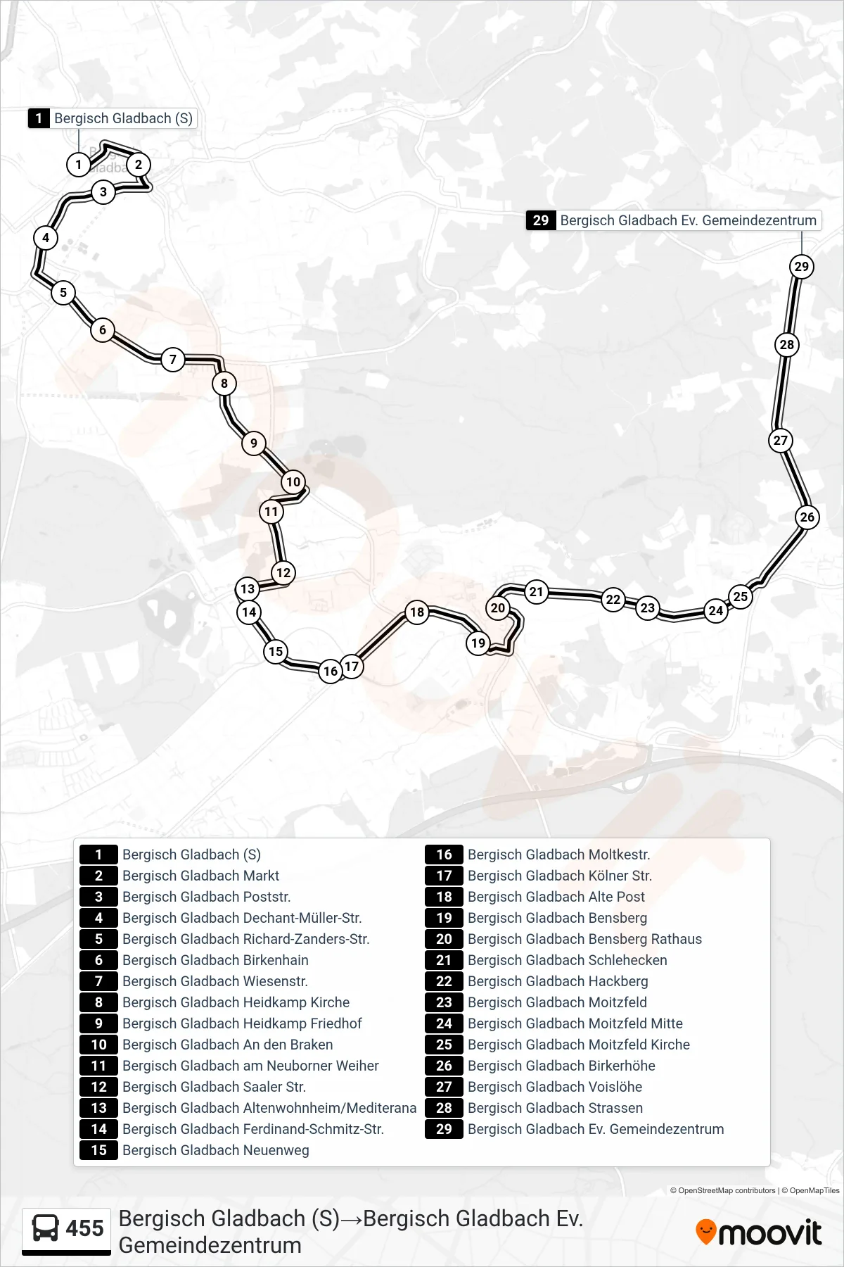

Stops list (455 - Bergisch Gladbach (S)→Bergisch Gladbach Ev. Gemeindezentrum)
- Bergisch Gladbach (S)
- Bergisch Gladbach Markt
- Bergisch Gladbach Poststr.
- Bergisch Gladbach Dechant-Müller-Str.
- Bergisch Gladbach Richard-Zanders-Str.
- Bergisch Gladbach Birkenhain
- Bergisch Gladbach Wiesenstr.
- Bergisch Gladbach Heidkamp Kirche
- Bergisch Gladbach Heidkamp Friedhof
- Bergisch Gladbach An den Braken
- Bergisch Gladbach am Neuborner Weiher
- Bergisch Gladbach Saaler Str.
- Bergisch Gladbach Altenwohnheim/Mediterana
- Bergisch Gladbach Ferdinand-Schmitz-Str.
- Bergisch Gladbach Neuenweg
- Bergisch Gladbach Moltkestr.
- Bergisch Gladbach Kölner Str.
- Bergisch Gladbach Alte Post
- Bergisch Gladbach Bensberg
- Bergisch Gladbach Bensberg Rathaus
- Bergisch Gladbach Schlehecken
- Bergisch Gladbach Hackberg
- Bergisch Gladbach Moitzfeld
- Bergisch Gladbach Moitzfeld Mitte
- Bergisch Gladbach Moitzfeld Kirche
- Bergisch Gladbach Birkerhöhe
- Bergisch Gladbach Voislöhe
- Bergisch Gladbach Strassen
- Bergisch Gladbach Ev. Gemeindezentrum
Change direction
- Route Map - 455 - Bergisch Gladbach An Der Zinkhütte→Bergisch Gladbach (S)
- Route Map - 455 - Bergisch Gladbach (S)→Bergisch Gladbach Ball
- Route Map - 455 - Bergisch Gladbach Johanniterstr.→Bergisch Gladbach Bensberg
- Route Map - 455 - Bergisch Gladbach (S)→Bergisch Gladbach Johanniterstr.
- Route Map - 455 - Bergisch Gladbach Ev. Gemeindezentrum→Bergisch Gladbach (S)
- Route Map - 455 - Bergisch Gladbach Moitzfeld Kirche→Bergisch Gladbach (S)
- Route Map - 455 - Bergisch Gladbach Bensberg→Bergisch Gladbach (S)
- Route Map - 455 - Bergisch Gladbach Johanniterstr.→Bergisch Gladbach (S)
- Route Map - 455 - Bergisch Gladbach (S)→Bergisch Gladbach Bensberg
- Route Map - 455 - Bergisch Gladbach (S)→Bergisch Gladbach Martin-Luther-Str.
- Route Map - 455 - Bergisch Gladbach Bensberg→Bergisch Gladbach Moitzfeld Kirche