
457 Bus Route Map
View the 457 route map and see all 457 stops along the route. The map of 457 shows where the bus travels and the location of each stop, making it easy to understand the entire route at a glance.
Explore Kavim routes on the map and see where Kavim bus services operate. Use the 457 map to find bus stops and see how the 457 connects different areas along its trip.
All 457 stops on the map are displayed in route order, helping you follow the 457 bus from the first stop to the last.
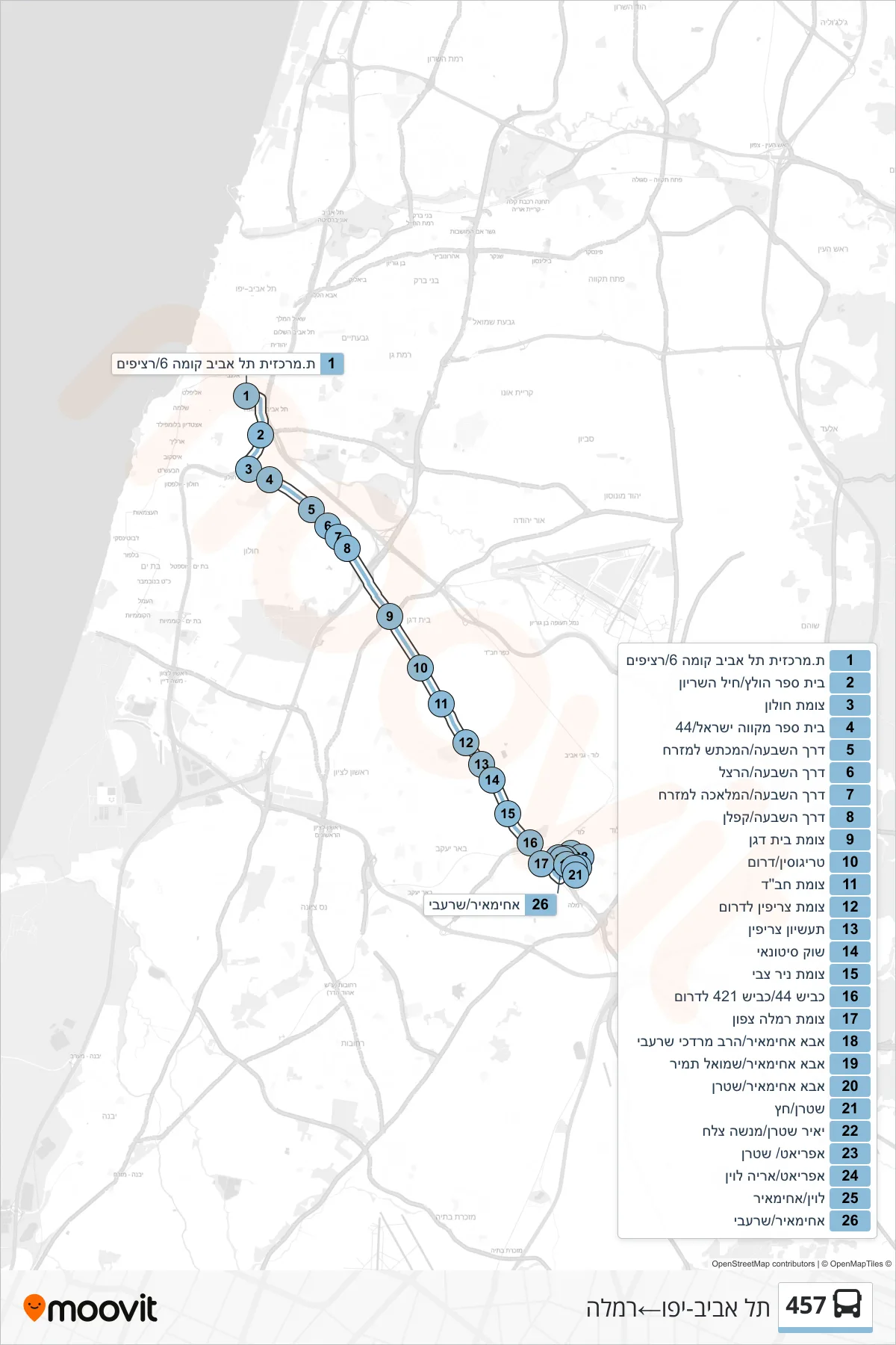

Stops list (457 - Tel Aviv-Yafo→Ramla)
- Tel Aviv Central Station Level 6/Platforms
- Holtz School/Armored Corps
- Holon Junction
- Mikveh Israel School/44
- HaShiva Road/HaMachtesh East
- Hashiva Road/Herzl
- HaShiva Road/HaMelacha East
- Derech HaShiva/Kaplan
- Beit Dagan Junction
- Trigosin/South
- Chabad Junction
- Tzrifin Junction South
- Tzrifin Industrial Zone
- Wholesale Market
- Nir Zvi Junction
- Highway 44/Highway 421 South
- Ramla North Junction
- Abba Ahimeir/Rabbi Mordechai Sharabi
- Abba Ahimeir/Shmuel Tamir
- Abba Ahimeir/Stern
- Stern/Hetz
- Yair Stern/Menashe Tzelach
- Afriat/Stern
- Afriat/Aryeh Levin
- Levin/Achimaier
- Achimayr/Sharabi