
46 Bus Route Map
View the 46 route map and see all 46 stops along the route. The map of 46 shows where the bus travels and the location of each stop, making it easy to understand the entire route at a glance.
Explore TriMet routes on the map and see where TriMet bus services operate. Use the 46 map to find bus stops and see how the 46 connects different areas along its trip.
All 46 stops on the map are displayed in route order, helping you follow the 46 bus from the first stop to the last.
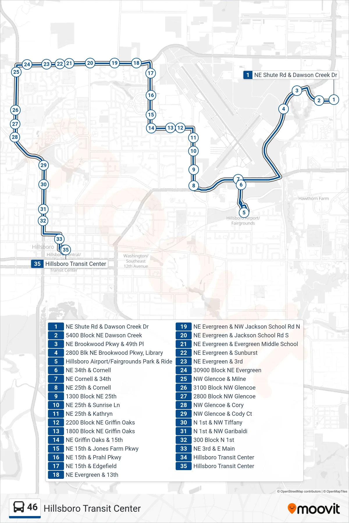
Stops list (46 - Hillsboro Transit Center)
- NE Shute Rd & Dawson Creek Dr
- 5400 Block NE Dawson Creek
- NE Brookwood Pkwy & 49th Pl
- 2800 Blk NE Brookwood Pkwy, Library
- Hillsboro Airport/Fairgrounds Park & Ride
- NE 34th & Cornell
- NE Cornell & 34th
- NE 25th & Cornell
- 1300 Block NE 25th
- NE 25th & Sunrise Ln
- NE 25th & Kathryn
- 2200 Block NE Griffin Oaks
- 1800 Block NE Griffin Oaks
- NE Griffin Oaks & 15th
- NE 15th & Jones Farm Pkwy
- NE 15th & Prahl Pkwy
- NE 15th & Edgefield
- NE Evergreen & 13th
- NE Evergreen & NW Jackson School Rd N
- NE Evergreen & Jackson School Rd S
- NE Evergreen & Evergreen Middle School
- NE Evergreen & Sunburst
- NE Evergreen & 3rd
- 30900 Block NE Evergreen
- NW Glencoe & Milne
- 3100 Block NW Glencoe
- 2800 Block NW Glencoe
- NW Glencoe & Cory
- NW Glencoe & Cody Ct
- N 1st & NW Tiffany
- N 1st & NW Garibaldi
- 300 Block N 1st
- NE 3rd & E Main
- Hillsboro Transit Center
- Hillsboro Transit Center