
46 Bus Route Map
View the 46 route map and see all 46 stops along the route. The map of 46 shows where the bus travels and the location of each stop, making it easy to understand the entire route at a glance.
Explore Süddeutsche Verkehrslinien (SVL) routes on the map and see where Süddeutsche Verkehrslinien (SVL) bus services operate. Use the 46 map to find bus stops and see how the 46 connects different areas along its trip.
All 46 stops on the map are displayed in route order, helping you follow the 46 bus from the first stop to the last.
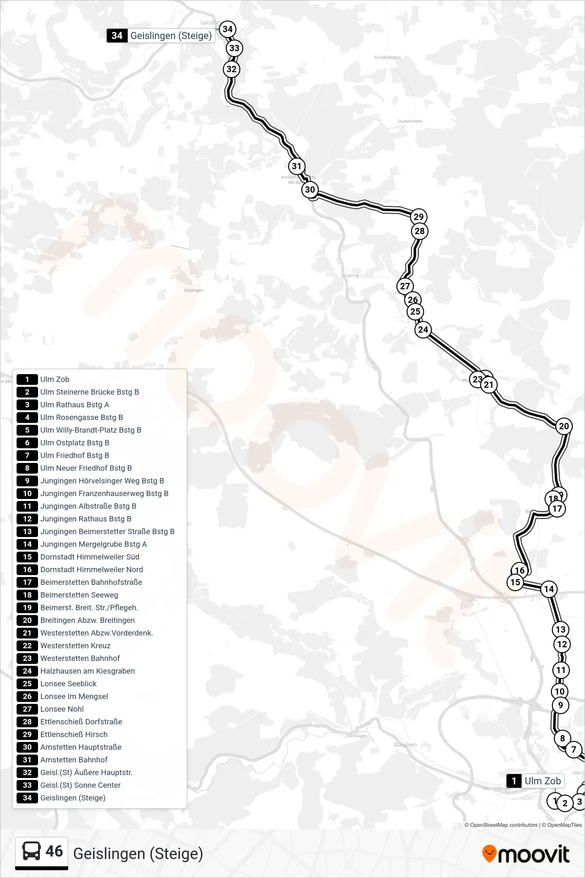
Stops list (46 - Geislingen (Steige))
- Ulm Zob
- Ulm Steinerne Brücke Bstg B
- Ulm Rathaus Bstg A
- Ulm Rosengasse Bstg B
- Ulm Willy-Brandt-Platz Bstg B
- Ulm Ostplatz Bstg B
- Ulm Friedhof Bstg B
- Ulm Neuer Friedhof Bstg B
- Jungingen Hörvelsinger Weg Bstg B
- Jungingen Franzenhauserweg Bstg B
- Jungingen Albstraße Bstg B
- Jungingen Rathaus Bstg B
- Jungingen Beimerstetter Straße Bstg B
- Jungingen Mergelgrube Bstg A
- Dornstadt Himmelweiler Süd
- Dornstadt Himmelweiler Nord
- Beimerstetten Bahnhofstraße
- Beimerstetten Seeweg
- Beimerst. Breit. Str./Pflegeh.
- Breitingen Abzw. Breitingen
- Westerstetten Abzw.Vorderdenk.
- Westerstetten Kreuz
- Westerstetten Bahnhof
- Halzhausen am Kiesgraben
- Lonsee Seeblick
- Lonsee Im Mengsel
- Lonsee Nohl
- Ettlenschieß Dorfstraße
- Ettlenschieß Hirsch
- Amstetten Hauptstraße
- Amstetten Bahnhof
- Geisl.(St) Äußere Hauptstr.
- Geisl.(St) Sonne Center
- Geislingen (Steige)
Change direction
- Route Map - 46 - Beimerstetten Seeweg
- Route Map - 46 - Lonsee Im Mengsel
- Route Map - 46 - Lonsee Im Mengsel
- Route Map - 46 - Beimerstetten Bahnhofstraße
- Route Map - 46 - Bernstadt Feuerwehrgerätehaus
- Route Map - 46 - Westerstetten Abzw.Vorderdenk.
- Route Map - 46 - Amstetten Bahnhof
- Route Map - 46 - Reutti Ortsmitte
- Route Map - 46 - Ulm Zob
- Route Map - 46 - Westerstetten Bahnhof