
461 Bus Route Map
View the 461 route map and see all 461 stops along the route. The map of 461 shows where the bus travels and the location of each stop, making it easy to understand the entire route at a glance.
Explore Würzburger Straßenbahn routes on the map and see where Würzburger Straßenbahn bus services operate. Use the 461 map to find bus stops and see how the 461 connects different areas along its trip.
All 461 stops on the map are displayed in route order, helping you follow the 461 bus from the first stop to the last.
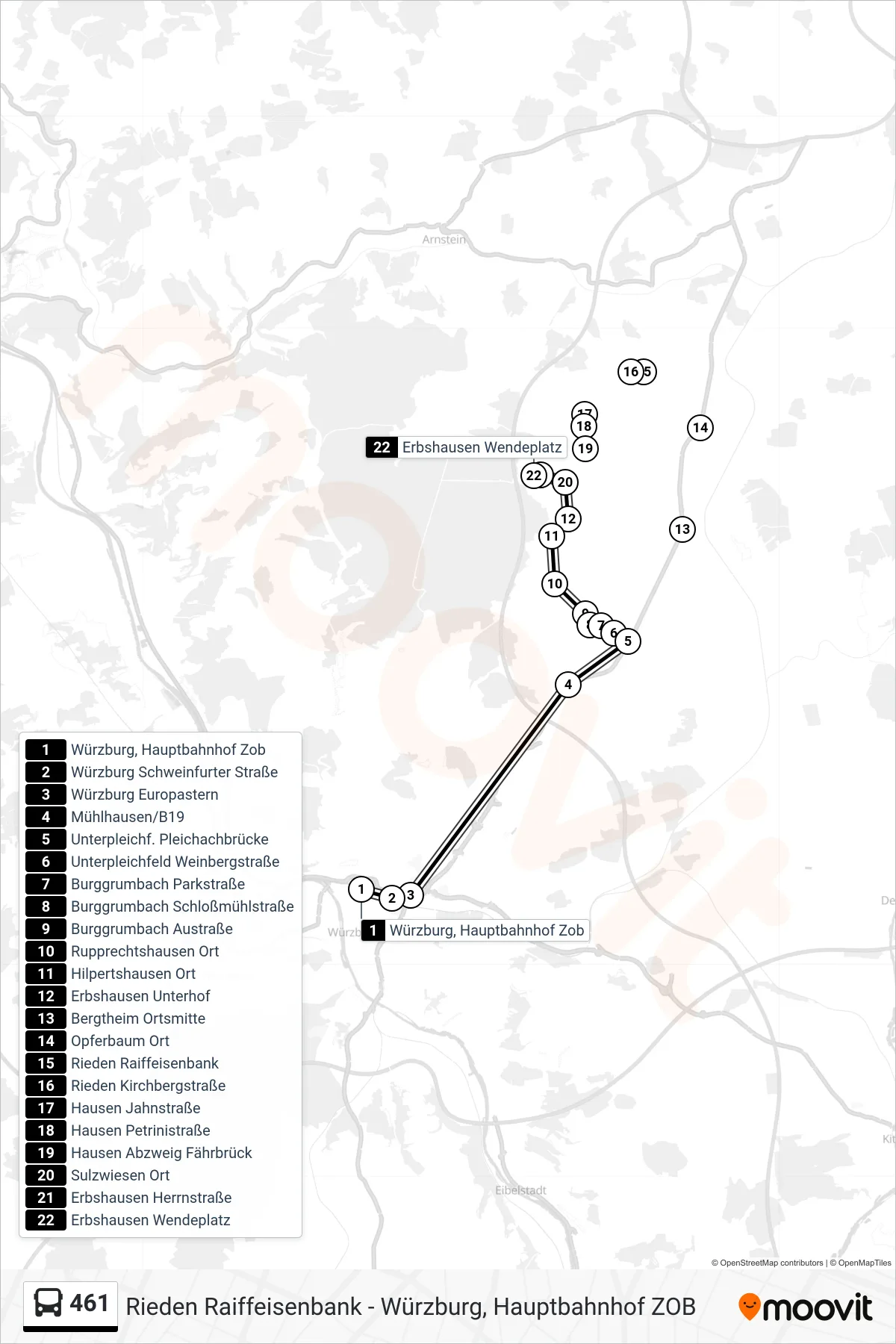
Stops list (461 - Erbshausen Wendeplatz)
- Würzburg, Hauptbahnhof Zob
- Würzburg Schweinfurter Straße
- Würzburg Europastern
- Mühlhausen/B19
- Unterpleichf. Pleichachbrücke
- Unterpleichfeld Weinbergstraße
- Burggrumbach Parkstraße
- Burggrumbach Schloßmühlstraße
- Burggrumbach Austraße
- Rupprechtshausen Ort
- Hilpertshausen Ort
- Erbshausen Unterhof
- Bergtheim Ortsmitte
- Opferbaum Ort
- Rieden Raiffeisenbank
- Rieden Kirchbergstraße
- Hausen Jahnstraße
- Hausen Petrinistraße
- Hausen Abzweig Fährbrück
- Sulzwiesen Ort
- Erbshausen Herrnstraße
- Erbshausen Wendeplatz
Change direction
- Route Map - 461 - Bergtheim Ortsmitte
- Route Map - 461 - Unterpleichf. Pleichachbrücke
- Route Map - 461 - Würzburg Frauenlandplatz
- Route Map - 461 - Würzburg, Hauptbahnhof Zob
- Route Map - 461 - Würzburg, Hauptbahnhof Zob
- Route Map - 461 - Opferbaum Ort
- Route Map - 461 - Bergtheim
- Route Map - 461 - Bergtheim
- Route Map - 461 - Rieden Raiffeisenbank