
463 Bus Route Map
View the 463 route map and see all 463 stops along the route. The map of 463 shows where the bus travels and the location of each stop, making it easy to understand the entire route at a glance.
Explore ww mobility GmbH routes on the map and see where ww mobility GmbH bus services operate. Use the 463 map to find bus stops and see how the 463 connects different areas along its trip.
All 463 stops on the map are displayed in route order, helping you follow the 463 bus from the first stop to the last.
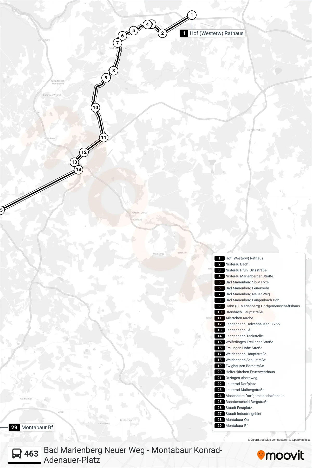
Stops list (463 - Montabaur Bf)
- Hof (Westerw) Rathaus
- Nisterau Bach
- Nisterau Pfuhl Ortsstraße
- Nisterau Marienberger Straße
- Bad Marienberg Sb-Märkte
- Bad Marienberg Feuerwehr
- Bad Marienberg Neuer Weg
- Bad Marienberg Langenbach Dgh
- Hahn (B. Marienberg) Dorfgemeinschaftshaus
- Dreisbach Hauptstraße
- Ailertchen Kirche
- Langenhahn Hölzenhausen B 255
- Langenhahn Bf
- Langenhahn Tankstelle
- Wölferlingen Freilinger Straße
- Freilingen Hohe Straße
- Weidenhahn Hauptstraße
- Weidenhahn Schulstraße
- Ewighausen Bornstraße
- Helferskirchen Feuerwehrhaus
- Ötzingen Ahornweg
- Leuterod Dorfplatz
- Leuterod Malbergstraße
- Moschheim Dorfgemeinschaftshaus
- Bannberscheid Bergstraße
- Staudt Festplatz
- Staudt Industriegebiet
- Montabaur Obi
- Montabaur Bf
Change direction
- Route Map - 463 - Montabaur Konrad-Adenauer-Platz
- Route Map - 463 - Montabaur Schulzentrum
- Route Map - 463 - Quirnbach Hammelberghalle
- Route Map - 463 - Wölferlingen Freilinger Straße
- Route Map - 463 - Bad Marienberg ZOB
- Route Map - 463 - Helferskirchen Feuerwehrhaus
- Route Map - 463 - Hof (Westerw) Rathaus
- Route Map - 463 - Bad Marienberg Neuer Weg