
469 Bus Route Map
View the 469 route map and see all 469 stops along the route. The map of 469 shows where the bus travels and the location of each stop, making it easy to understand the entire route at a glance.
Explore Metropoline routes on the map and see where Metropoline bus services operate. Use the 469 map to find bus stops and see how the 469 connects different areas along its trip.
All 469 stops on the map are displayed in route order, helping you follow the 469 bus from the first stop to the last.
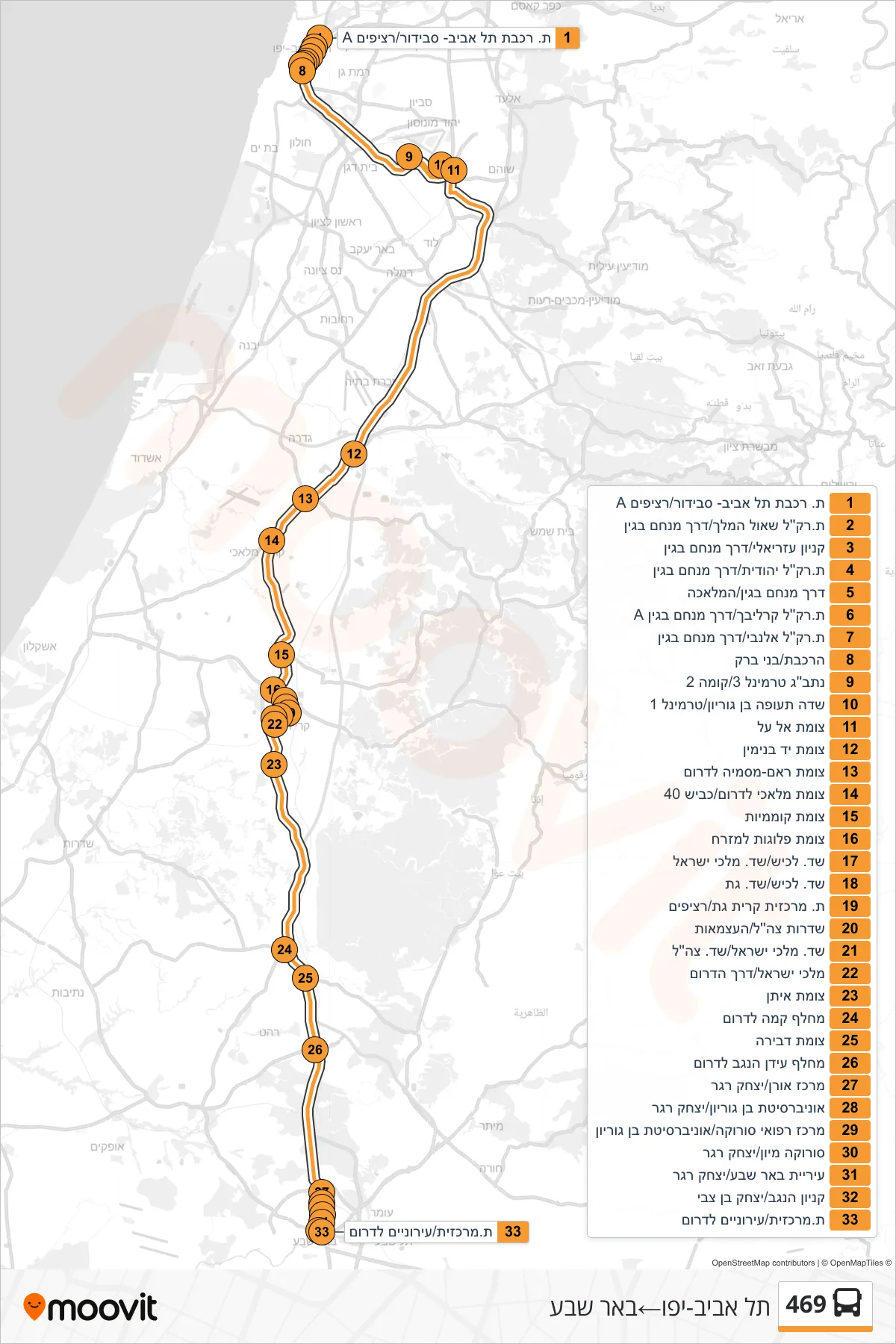
Stops list (469 - Tel Aviv-Yafo→Beer Sheva)
- Tel Aviv Savidor Station/Platform A
- Shaul HaMelech Light Rail Station/Menachem Begin Road
- Azrieli Mall/Menachem Begin Road
- Yehudit Light Rail Station/Menachem Begin Road
- Menachem Begin Road/HaMelacha
- Karalibakh Light Rail Station/Menachem Begin Road A
- Allenby Light Rail Station/Menachem Begin Road
- HaRakevet/Bnei Brak
- Ben Gurion Airport Terminal 3/Level 2
- Ben Gurion Airport/Terminal 1
- Al Al Junction
- Yad Binyamin Junction
- Ram-Masmiya Junction Southbound
- Malachi South Junction/Road 40
- Komemiyut Junction
- Plugot Junction East
- Lachish Blvd/Kings of Israel Blvd
- Lachish Blvd/Gat Blvd
- Kiryat Gat Central Station/Platforms
- IDF Boulevard/Ha'Atzmaut
- Kings of Israel Blvd/IDF Blvd
- Malchei Israel/Derech HaDarom
- Eitan Junction
- Kama Interchange South
- Dvira Junction
- Idan HaNegev Interchange South
- Oren Center/Yitzhak Rager
- Ben Gurion University/Yitzhak Rager
- Soroka Medical Center/Ben Gurion University
- Soroka Emergency/Yitzhak Rager
- Beer Sheva City Hall/Yitzhak Rager
- Kenyon HaNegev/Yitzhak Ben Zvi
- Central Station/Southbound Urban