
47 Bus Route Map
View the 47 route map and see all 47 stops along the route. The map of 47 shows where the bus travels and the location of each stop, making it easy to understand the entire route at a glance.
Explore MBTA routes on the map and see where MBTA bus services operate. Use the 47 map to find bus stops and see how the 47 connects different areas along its trip.
All 47 stops on the map are displayed in route order, helping you follow the 47 bus from the first stop to the last.
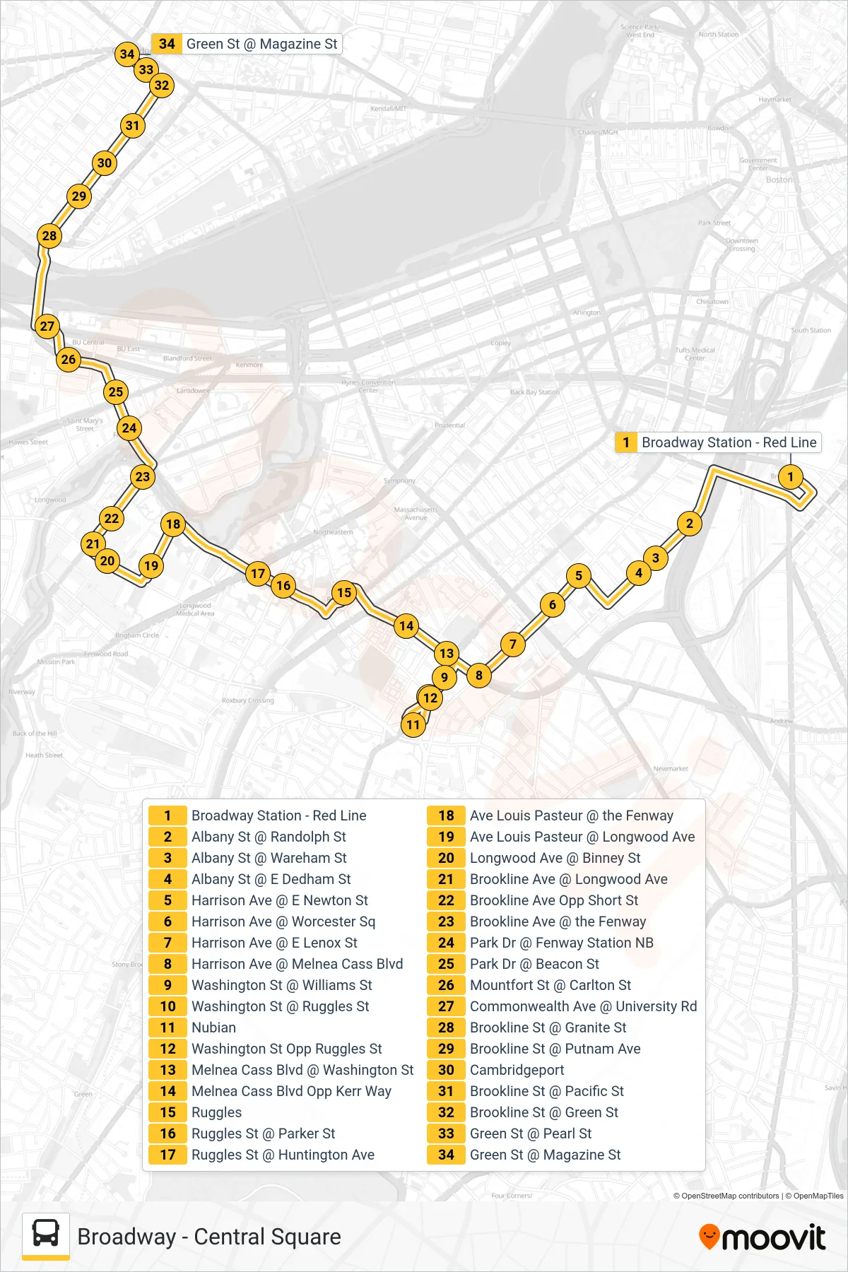
Stops list (47 - Central Square)
- Broadway Station - Red Line
- Albany St @ Randolph St
- Albany St @ Wareham St
- Albany St @ E Dedham St
- Harrison Ave @ E Newton St
- Harrison Ave @ Worcester Sq
- Harrison Ave @ E Lenox St
- Harrison Ave @ Melnea Cass Blvd
- Washington St @ Williams St
- Washington St @ Ruggles St
- Nubian
- Washington St Opp Ruggles St
- Melnea Cass Blvd @ Washington St
- Melnea Cass Blvd Opp Kerr Way
- Ruggles
- Ruggles St @ Parker St
- Ruggles St @ Huntington Ave
- Ave Louis Pasteur @ the Fenway
- Ave Louis Pasteur @ Longwood Ave
- Longwood Ave @ Binney St
- Brookline Ave @ Longwood Ave
- Brookline Ave Opp Short St
- Brookline Ave @ the Fenway
- Park Dr @ Fenway Station NB
- Park Dr @ Beacon St
- Mountfort St @ Carlton St
- Commonwealth Ave @ University Rd
- Brookline St @ Granite St
- Brookline St @ Putnam Ave
- Cambridgeport
- Brookline St @ Pacific St
- Brookline St @ Green St
- Green St @ Pearl St
- Green St @ Magazine St