
471 Bus Route Map
View the 471 route map and see all 471 stops along the route. The map of 471 shows where the bus travels and the location of each stop, making it easy to understand the entire route at a glance.
Explore PACE routes on the map and see where PACE bus services operate. Use the 471 map to find bus stops and see how the 471 connects different areas along its trip.
All 471 stops on the map are displayed in route order, helping you follow the 471 bus from the first stop to the last.
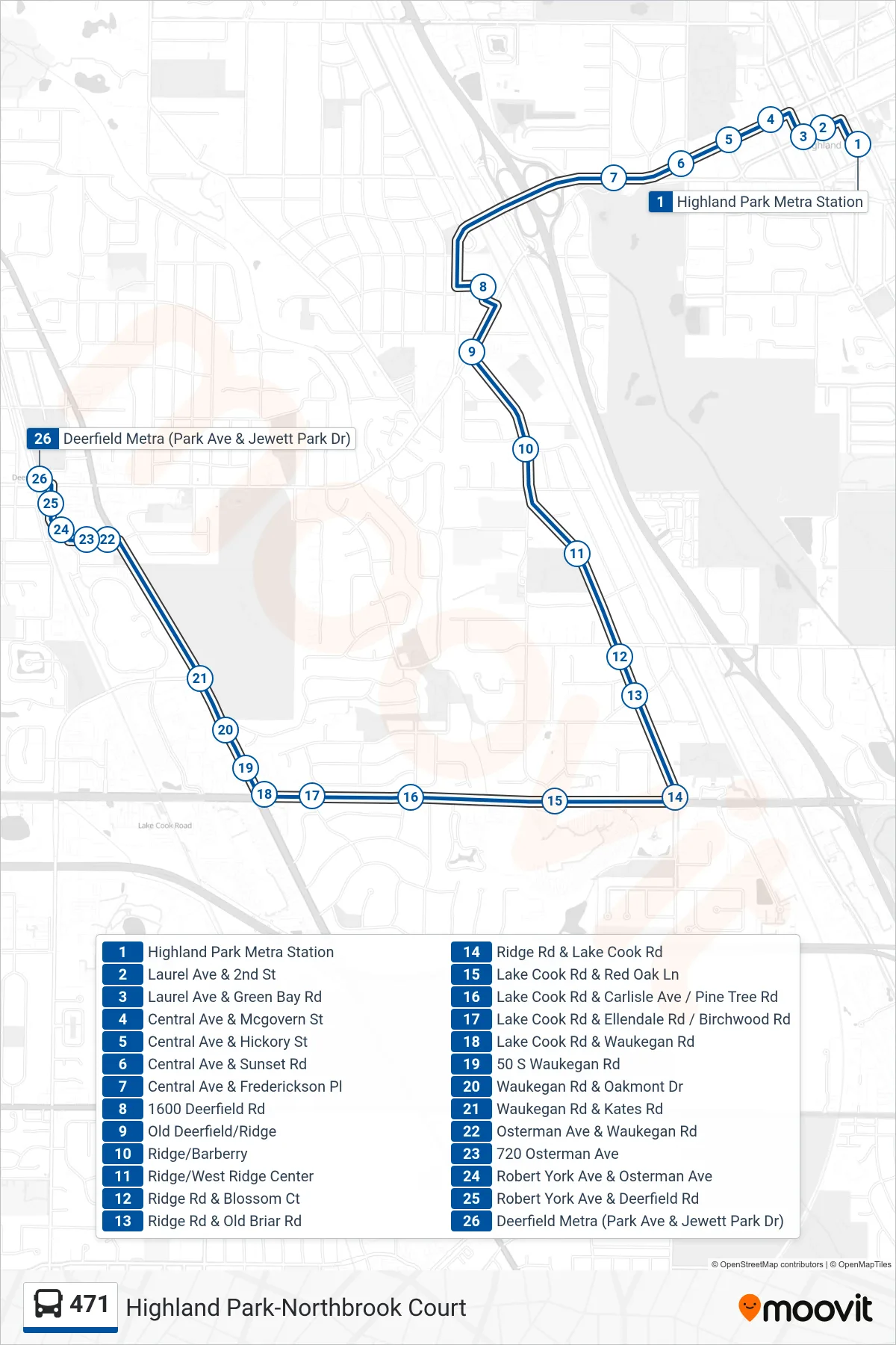
Stops list (471 - Deerfield Metra (Park Ave & Jewett Park Dr))
- Highland Park Metra Station
- Laurel Ave & 2nd St
- Laurel Ave & Green Bay Rd
- Central Ave & Mcgovern St
- Central Ave & Hickory St
- Central Ave & Sunset Rd
- Central Ave & Frederickson Pl
- 1600 Deerfield Rd
- Old Deerfield/Ridge
- Ridge/Barberry
- Ridge/West Ridge Center
- Ridge Rd & Blossom Ct
- Ridge Rd & Old Briar Rd
- Ridge Rd & Lake Cook Rd
- Lake Cook Rd & Red Oak Ln
- Lake Cook Rd & Carlisle Ave / Pine Tree Rd
- Lake Cook Rd & Ellendale Rd / Birchwood Rd
- Lake Cook Rd & Waukegan Rd
- 50 S Waukegan Rd
- Waukegan Rd & Oakmont Dr
- Waukegan Rd & Kates Rd
- Osterman Ave & Waukegan Rd
- 720 Osterman Ave
- Robert York Ave & Osterman Ave
- Robert York Ave & Deerfield Rd
- Deerfield Metra (Park Ave & Jewett Park Dr)