
48 Bus Route Map
View the 48 route map and see all 48 stops along the route. The map of 48 shows where the bus travels and the location of each stop, making it easy to understand the entire route at a glance.
Explore Regional Transportation District routes on the map and see where Regional Transportation District bus services operate. Use the 48 map to find bus stops and see how the 48 connects different areas along its trip.
All 48 stops on the map are displayed in route order, helping you follow the 48 bus from the first stop to the last.
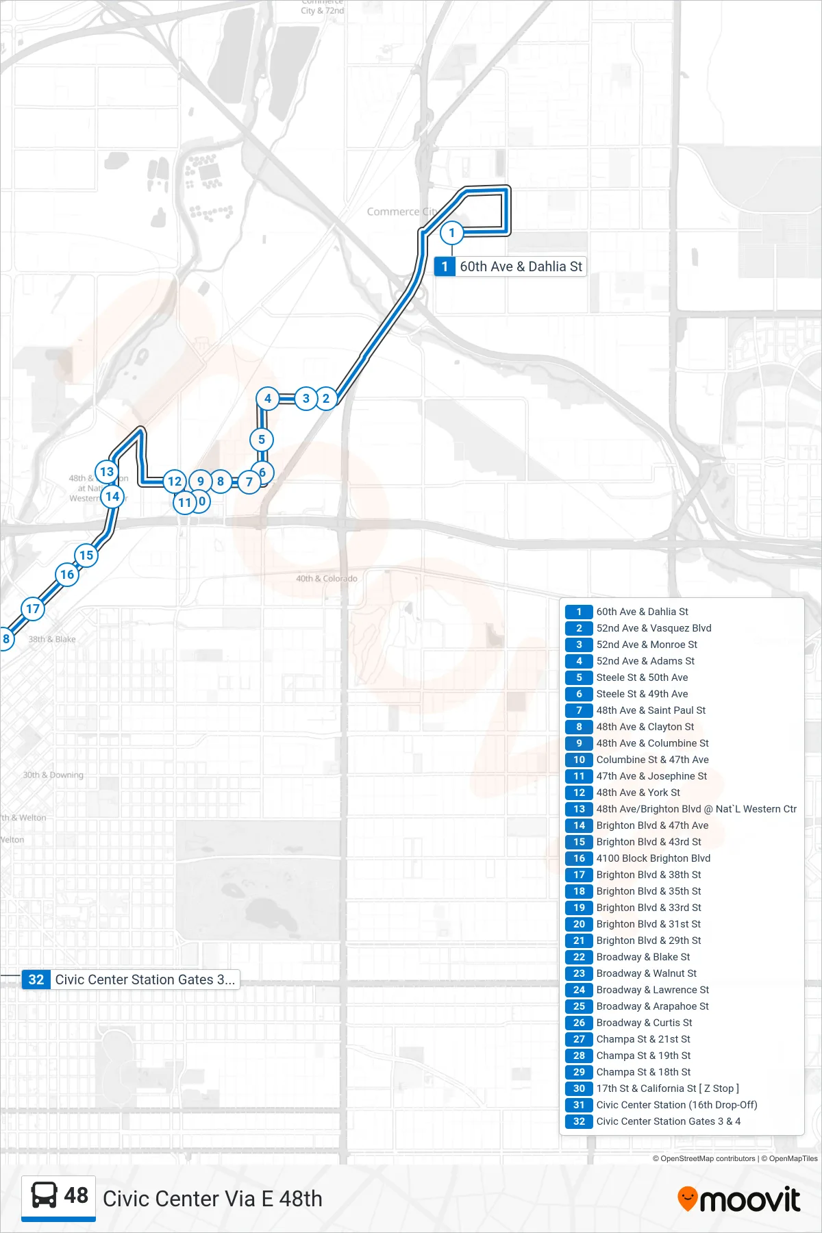
Stops list (48 - Civic Center Via E 48th)
- 60th Ave & Dahlia St
- 52nd Ave & Vasquez Blvd
- 52nd Ave & Monroe St
- 52nd Ave & Adams St
- Steele St & 50th Ave
- Steele St & 49th Ave
- 48th Ave & Saint Paul St
- 48th Ave & Clayton St
- 48th Ave & Columbine St
- Columbine St & 47th Ave
- 47th Ave & Josephine St
- 48th Ave & York St
- 48th Ave/Brighton Blvd @ Nat`L Western Ctr
- Brighton Blvd & 47th Ave
- Brighton Blvd & 43rd St
- 4100 Block Brighton Blvd
- Brighton Blvd & 38th St
- Brighton Blvd & 35th St
- Brighton Blvd & 33rd St
- Brighton Blvd & 31st St
- Brighton Blvd & 29th St
- Broadway & Blake St
- Broadway & Walnut St
- Broadway & Lawrence St
- Broadway & Arapahoe St
- Broadway & Curtis St
- Champa St & 21st St
- Champa St & 19th St
- Champa St & 18th St
- 17th St & California St [ Z Stop ]
- Civic Center Station (16th Drop-Off)
- Civic Center Station Gates 3 & 4